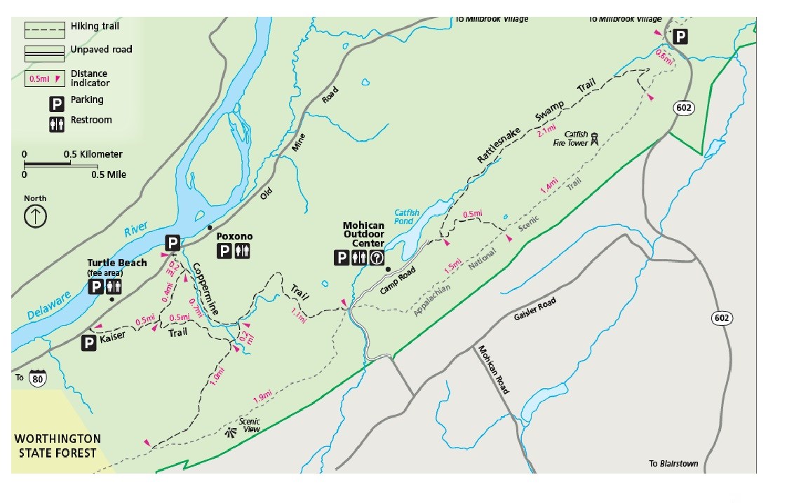
NPS Map Length: 2.0 miles, one-way Following an old roadbed through mixed hardwood forest, the Kaiser Trail climbs gradually up toward the ridgeline, leveling out just before joining the Appalachian National Scenic Trail. Spurs that lead to the Coppermine Trail are found at the quarter mile and three-quarter mile marks (indicated with blue blazes);the first is 0.6 mile long, and the second is 0.2 mile long. Kaiser Trail terminates at the Appalachian Trail, about two miles south of Mohican Outdoor Center. Extend the hike by heading south on the Appalachian Trail for a number of spectacular overlooks of the valleys below. To create a loop for the return trip, head north along the Appalachian Trail. Descend from the ridge back to Old Mine Road via the Coppermine Trail that interests the Appalachian Trail 1.9 miles from the Kaiser and Appalachian trails intersection. |
Last updated: August 17, 2021
