|
Hikers on the Low Pass route will explore some of Dick Proenneke's stomping grounds in the high country above Upper Twin Lake. With four million undeveloped, wild acres to explore there are countless places go for adventure, solitude, and recreation in Lake Clark. Part of the purpose of the park is to allow for individual, personal exploration of wilderness; therefore, the only maintained trails are the Tanalian Trails near Port Alsworth. This page only describes the general terrain in the high country above Twin Lakes; it does not describe in detail the exact route you should walk. Instead, we encourage you to use the information provided to plan your own unique trip. This off-trail route can be expanded, linked with other routes, or simply used to get an idea of the terrain. Adventurers in Lake Clark will need to rely upon way-finding, map-reading, and trailless hiking skills to navigate, or hire a guide who can help. 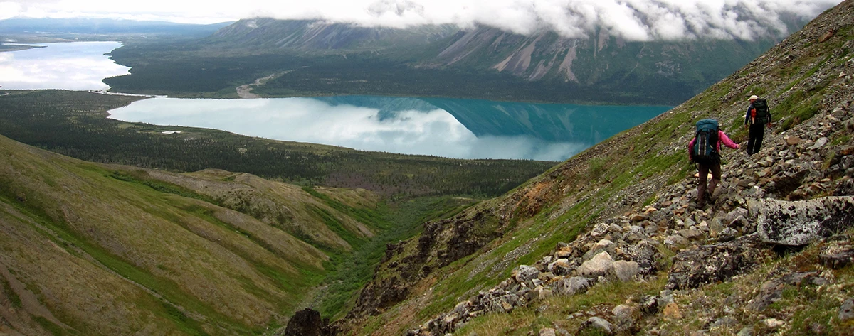
Photo by A. Lindholm MapsUSGS 1:63 360 series topographic Lake Clark C3 AccessFly in and out of Upper Twin Lake. A float or amphibious plane is required in order to land on Upper Twin Lake in the summer, as it does not have beaches suitable for a wheeled plane to land. Planes operating on wheels or skis may land on the lake in the winter if ice conditions are suitable. Time1-3 days DifficultyTrail-less hiking around brushy lake shore, then climbing into alpine terrain closer to the pass. HighlightsSpectacular views of mountains and lakes. HazardsUse caution when sidehilling steep scree fields. Be alert to wildlife when hiking through brush. Campsites and Food StorageThere are many places to camp in the Low Pass area; however, you will need to store your food and toiletry items in approved bear resistant canisters during this trip due to the lack of trees to hang food where suitable camping is available. Canisters can be rented for free at the park visitor center in Port Alsworth. You should also cook at least 100 yards away from your camp to avoid an association made by bears between your camp and your food. Please follow leave no trace ethics and park rules and regulations when choosing campsites, storing food, and building campfires. Route DescriptionRoute begins from the Proenneke site and follows the lake shore west for about 3 miles. You should be able to discern which drainage will lead to Low Pass because it's the most significant one in the vicinity allowing you to head south from the lake. From the lake shore, select a route that appears least brushy. You may be able to string together a series of meadows to avoid much of the brush. You can stay on the left side of the creek and follow the tundra ridge to the pass. This route crosses a couple steep scree slopes. Alternatively, you can drop into the creek bottom and head up to the pass. Low Pass is very gentle and is surrounded by sweeping alpine tundra. There are many side drainages and ridges to explore. Heading east can lead you over a pass into the Hope Creek valley (see Hope Creek route description). 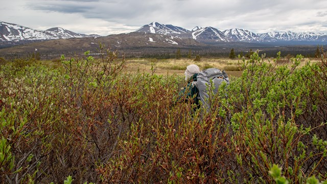
Backpacking in Alaska
Get acquainted with what makes backpacking in Alaska unique and familiarize yourself with these backcountry tips before you plan your trip. 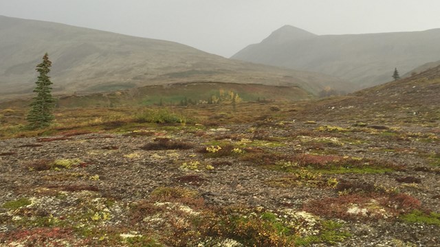
Low Pass Route Photos
Images taken along the Low Pass Route. |
Last updated: March 22, 2021