Getting to Zion Zion National Park is located in southwest Utah and covers nearly 150,000 acres. Travellers can reach the park via personal vehicle or public transportation, like the SunTran bus system.
Zion Canyon, the park's most visited destination, is found next to the town of Springdale, Utah. This canyon is where popular hikes such as Angels Landing or the Narrows begin. During the shuttle season, visitors can navigate Zion Canyon and Springdale using the free shuttles. Outside of shuttle season, visitors can use personal vehicles to travel the canyon. Kolob Canyons is found in the northwest area of Zion National Park, just south of Cedar City, Utah. Kolob Terrace Road is located just west of Zion Canyon, north of the town of Virgin, Utah. These locations can be reached using personal vehicles. To reach Zion Canyon, Kolob Canyons, or Kolob Terrace Road, use your navigation app of choice or follow the directions below. Remember that all visitors must pay the park fee or use a valid pass to enter the park. Zion CanyonTo reach Zion Canyon from the south, travel to Springdale, Utah. The park's South Entrance and Pedestrian Entrance are located on the north end of town. To reach Zion Canyon from the east, travel to Mt. Carmel Junction, Utah. Then, drive west on State Road 9. The park's East Entrance is located 13 miles west of Mt. Carmel Junction. If you are travelling to/from the park's east side, make sure your vehicle is not too big to traverse the highway. Vehicles that are too big will have to take an alternate route to the park's South Entrance:
Other LocationsKolob Canyons Visitor Center and scenic drive is located at Exit 40 on Interstate 15. This is 40 miles from Zion Canyon and 17 miles south of Cedar City. Kolob Terrace Road begins in the town of Virgin, Utah. The start of this road is located 13.5 miles west from the Zion Canyon Visitor Center. International AirportsHarry Reid International Airport (LAS) is located in Las Vegas, Nevada, 170 miles away. Regional AirportsSt. George Regional Airport (SGU) is located in St. George, Utah, 49 miles away. This airport offers flights from Salt Lake City, Utah and Denver, Colorado. Parking for Zion Canyon Zion Canyon has limited parking space, and spots fill up quickly. When spaces inside the park are full, visitors can park in Springdale and ride the shuttle instead. Check the tabs below for parking options. Vehicles parked outside of designated spaces are subject to citation and/or towing.
The Zion Canyon Visitor Center has Zion's largest parking lot, featuring over 350 parking spaces and more than a dozen accessible parking spots. Stop 1 of the Zion Canyon Shuttle System is located just north of this parking lot.
Parking is free and available on a first-come, first-served basis. Visitors just have to pay the park entrance fee in order to reach the parking lot.
Located across from the Zion Canyon Visitor Center, this parking lot is designed for large vehicles and motorcycles. Stop 1 of the Zion Canyon Shuttle System is near this parking lot.
There are over 20 parking spaces for large vehicles (such as RVs, trucks with trailers, and buses). There are also 22 spaces for motorcycles. Normal size cars are not allowed to park in this location. Parking is free and available on a first-come, first-served basis. Visitors just have to pay the park entrance fee in order to reach the parking lot.
The Human History Museum has 51 parking spaces, including 4 accessible parking spaces. Stop 2 of the Zion Canyon Shuttle System is located on the west side of this parking lot.
Parking is free and available on a first-come, first-served basis. Visitors just have to pay the park entrance fee in order to reach the parking lot.
Parking at the Nature Center is limited due to ongoing construction at the South Campground. There are currently 16 parking spaces, including one accessible parking spot. This parking lot is meant for visitors to the Nature Center and its picnic areas. The shuttle does not stop at this location.
Parking is free and available on a first-come, first-served basis. Visitors just have to pay the park entrance fee in order to reach the parking lot.
Visitors may park in designated pullouts along the Zion-Mt. Carmel Highway within park boundaries, as space allows. Many of these pullouts are only large enough for normal size cars. Make sure to follow all posted signs. Do not park outside of designated areas, such as on vegetation, walking paths, or in shuttle stops. Violators may be cited or towed.
Be aware that many of these spots are a long distance from shuttle stops or restrooms. Be prepared to walk to a shuttle stop in order to access the canyon. Parking is free and available on a first-come, first-served basis. Visitors just have to pay the park entrance fee.
Springdale, the town just outside Zion's entrance, offers parking for a fee. Parking is available on streets and in parking lots throughout town. There is also designated parking for large vehicles (such as RVs or trucks with trailers). A free shuttle runs during the summer season, allowing visitors to park and ride to the Pedestrian Entrance.
SunTran is a bus service based in St. George. SunTran's Zion Route connects St. George, Washington, Hurricane, La Verkin, Virgin, and Springdale, allowing visitors to park in any of those communities and ride to Zion National Park. Check the SunTran website for details. Remember to park legally and responsibly in these communities. Parking regulations are strictly enforced, especially during the summer season. Be sure to follow all posted signs. Parking in Other LocationsKolob Canyons, Kolob Terrace Road, and the park's east side offer designated parking at trailheads and points of interest. Kolob Canyons and the east side both have paved parking areas. Kolob Terrace Road typically has dirt or gravel lots for its trailheads. Parking is limited - make backup plans and arrive early if possible. 
Large VehiclesLarge vehicles are not permitted to drive the Zion-Mt. Carmel Highway between Canyon Junction and the park’s East Entrance. Vehicles that exceed size limits will have to reroute through Springdale. Visit our large vehicles page to learn more about size limits and alternative routes. 
Shuttle Schedule & Information
Learn about the free shuttle service in Zion Canyon and the neighboring town of Springdale. 
Large Vehicle Information
Learn about vehicle size limits on the Zion-Mt. Carmel Highway. 
Traffic & Travel Tips
Make the most out of your trip by learning how to avoid crowds and traffic. 
NPS Map Mailing AddressZion National Park Zion Canyon Visitor Center coordinates (near Springdale)Kolob Canyons Visitor Center coordinates (near New Harmony)
Plan Your Visit
Make your ideal visit a reality! Explore fun activities, places to stay, and trip-planning advice. 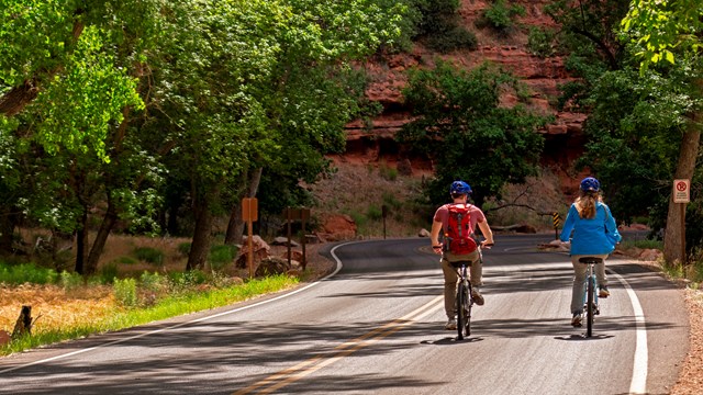
Biking
The Pa'rus Trail and Zion Canyon Scenic Drive are accessible to bicycles. |
Last updated: June 6, 2026