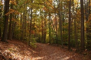
Bicycle Roads

There are over 12 miles of paved roads and 9.2 miles of gravel roads that are open for cycling within the park. We suggest that you check the park alerts and conditions updates for any possible road closures while planning your visit.

 
Scenic Drive in fall
Scenic Drive

NPS photo

Scenic Drive

Rating: Moderate to Difficult

This paved road has its beginning at the Pine Grove Picnic Area and the first two miles of this road is recommended for experienced cyclists only, due to several steep grades and blind curves. The entire distance of Scenic Drive is 11.3 miles (18.2 km) while the scenic loop is 7.3 miles (11.7 km) and is accessible from all of the parking lots along the loop as well as the parking lot at the Picnic Area. Between Parking Lot H and I, you will find two miles (3.2 km) of steep terrain and hills that will provide a good workout for the experienced cyclist.

 
Burma Road rounding the curve in fall
Burma Road

NPS photo

Burma Road

Rating: Difficult

This crushed rock road is located off the north side of Scenic Drive about halfway between Parking Lots E and F, across from Taylor Farm Road. This is a nice gentle descent down to the bridge crossing the North Fork of Quantico Creek which is followed by the climbs and descends to the gate at the Park Boundary. You will have ridden 1.4 miles (2.3 km) and now one must turn around and retrace your ride back to Scenic Drive. Burma Road is a fabulous workout for a cyclist. Total distance out and back is 2.8 miles (4.5 km).

 
Biker on Lake One road
Lake One Road

NPS photo

Lake One Road

Rating: Easy to Moderate

This crushed rock road is adjacent to Parking Lot E and has one hill. Riders should use caution when descending this hill due to erosion and loose gravel. There is a lake at the end of the road, which is a great place to picnic. Total distance out and back is 1.5 miles (2.4 km).

 
Liming Lane in fall
Liming Lane

NPS photo

Liming Lane

Rating: Moderate

This crushed rock road is just west of Scenic Drive Parking Lot I and has a mostly upward grade out to a gate at the park boundary. Halfway along this road, in a clearing on the left, is an old stone building which was built by the CCC for storage and is still used by the park today. The Liming Cemetery site can also be found near the gate at the parks boundary. One may access the cemetery site by a small grassy road that leads through a clearing, and then down a steep hill into a mature forest. The cemetery is just beyond this forest. Total distance out and back is 2.6 miles (4.2 km).

 
Mawavi Road bicycle trail
Mawavi Road

NPS photo

Mawavi Road

Rating: Easy to Moderate

This crushed rock road is adjacent to Parking Lot G and is a wonderful shaded ride to the gate at Cabin Camp 2 (permit campers only). One has to turn around at the gate and retrace your path to the parking lot. There are two hills on this road, one of which will give you a good workout. Total distance out and back is 1.0 mile (1.6 km).

 
North Orenda Road trail sign and metal gate
North Orenda Road

NPS photo

North Orenda Road

Rating: Easy to Moderate

This crushed rock road is located at the south end of Parking Lot D and is mostly a gentle descent downhill to the South Fork of Quantico Creek. The Lewis and Johnson Cemetery is located on the left side of the road approximately one-half mile in, and is marked by a small metal gate. North Orenda Road meets South Orenda Road at the bridge crossing the creek. There is one small hill on this road. Total distance out and back is 2.4 miles (3.8 km).

 
Old Blacktop road on a rainy day
Old Blacktop Road

NPS photo

Old Blacktop Road

Rating: Easy to Moderate

This crushed rock road is accessible from Parking Lot F or the Turkey Run Education Center (TREC) parking lot. This road has two medium hills and can be used as a shortcut around Scenic Drive to cut out the 2.0 miles (3.2 km) of steep terrain and hills between Parking Lots H and I. Total one-way distance is 1.5 miles (2.4 km).

 
Pyrite Mine trail on a fall day
Pyrite Mine Road

NPS photo

Pyrite Mine Road

Rating: Moderate to Difficult

This crushed rock road is found on the north side of Parking Lot D and next to North Orenda Road. The road provides a gentle descent for approximately 1.0 mile (1.5 km) and then a quick decent for 0.2 miles (0.3 km) ending at a bridge. Once across the bridge, follow the road to the left and go to the end of the road to see the remains of the Pyrite Mine Commissary on the right. At the boardwalk, park your bike and take the short walk to the mine observation deck under a stand of pine trees. There are benches here that you may use to rest up for the climb back up that hill. Total distance out and back is 2.6 miles (4.2 km).

 
South Orenda Road trail sign
South Orenda Road

NPS photo

South Orenda Road

Rating: Easy to Moderate

This dirt and crushed rock road begins at the parking lot at the Pine Grove Picnic Area. Please walk your bike down the Piedmont Forest Trail to the overlook to start this ride. One medium hill leads down to the bridge crossing the South Fork of Quantico Creek.

Caution: If you are an experienced mountain cyclist, you may try the loose gravel connecter from the northwest end of the parking lot to South Orenda Road; however, this is an extremely steep descent and it is recommended that you walk your bike down this descent. Total distance out and back is 1.1 miles (1.7 km).

 
Taylor Farm Road
Taylor Farm Road

NPS photo

Taylor Farm Road

Rating: Moderate to Difficult

This mostly crushed rock road is on the south side of Scenic Drive across from Burma Road. The first portion of the road from Scenic Drive to Old Black Top Road has two moderate hills which will bring your heart rate up a bit and then once you cross over Old Black Top Road enroute to the farm site, there is one downhill and a steep climb up to the farm. Taylor Farm Road is closed to bicyclist at that point and you must retrace your path back to Old Black Top Road or Scenic Drive. Total distance out and back is 3.0 miles (4.8 km).

 
West Gate Road
West Gate Road

NPS photo

West Gate Road

Rating: Easy

This crushed rock and dirt road is located at the northwestern edge of the park at the Oak Ridge Campground parking lot. This fire trail has one small hill. Total distance out and back 1.2 miles (1.9 km).

Last updated: October 11, 2020

Park footer

Contact Info

Mailing Address:

18100 Park Headquarters Road
Triangle, VA 22172

Phone:

703-221-7181

Contact Us