



News Release
News Release Date: September 22, 2026
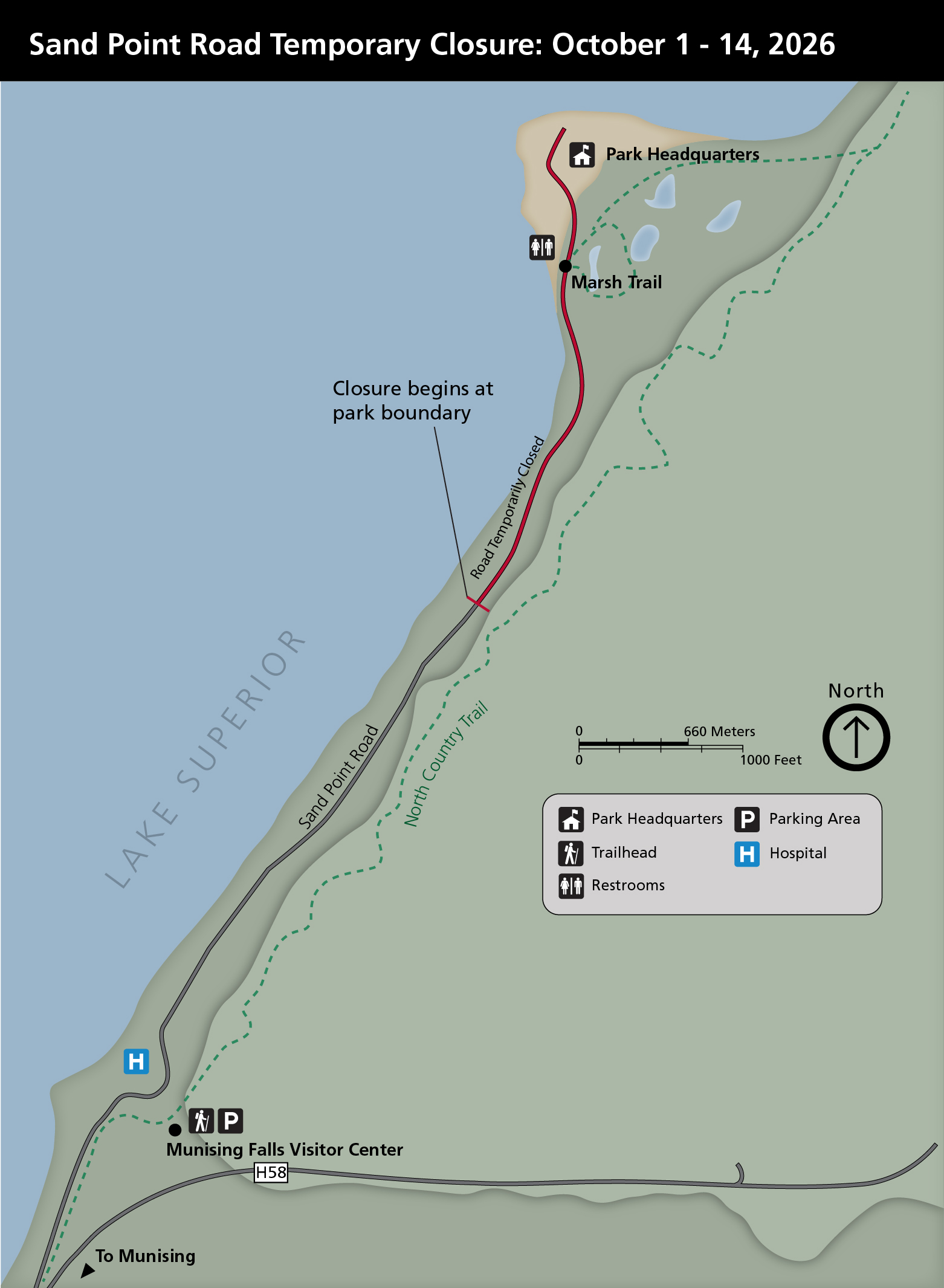
During this time, the Sand Point Marsh Trail, Sand Point Beach, and Pictured Rocks National Lakeshore Headquarters will be inaccessible via Sand Point Road. Access to Munising Memorial Hospital, the Munising Falls Visitor Center, or private residences on Sand Point Road will not be impacted by this closure. Backpackers should park at Munising Falls Visitor Center and confirm pickup location with their shuttle service.
“The Sand Point wetland is a vital ecosystem within the park,” said David Horne, Pictured Rocks National Lakeshore superintendent. “Improving connectivity with Lake Superior is critical to maintaining its ecological health. We also recognize the importance of access to Sand Point and are committed to completing the work as quickly as possible.”
The culvert replacement project, funded by the Great Lakes Restoration Initiative, will improve hydrologic connectivity between the Sand Point Wetland and Lake Superior within Pictured Rocks National Lakeshore.
Additional information regarding Pictured Rocks National Lakeshore can be found at www.nps.gov/piro or on Facebook @PicturedRocksNL and lnstagram @picturedrocksnps.
Last updated: September 22, 2026