![]()
Cover Page
MENU
![]() Heart Mountain
Heart Mountain
|
| |
Confinement and Ethnicity: An Overview of World War II Japanese American Relocation Sites by J. Burton, M. Farrell, F. Lord, and R. Lord |

|
|
| |
Chapter 6 (continued)
Heart Mountain Relocation Center
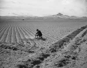 Figure 6.9. Farm field at Heart Mountain. (Hikaru Iwasaki photograph, Bancroft Library, University of California, Berkeley) |
Water for farming came from canals, most already in place from the Bureau of Reclamation's (BOR) Heart Mountain Reclamation Project. Evacuees, however, did construct 1 mile of canal, and used 850 tons of bentonite to waterproof some of the existing canal sections that leaked (Mackey 1998). A little over 1,000 acres were cleared for farming. Fields were located adjacent to the south and east of the central area, including across (east of) the highway. Other fields were located to the north and along both sides of the highway from the central area to 3-1/2 miles south (Figures 6.8 and 6.9).
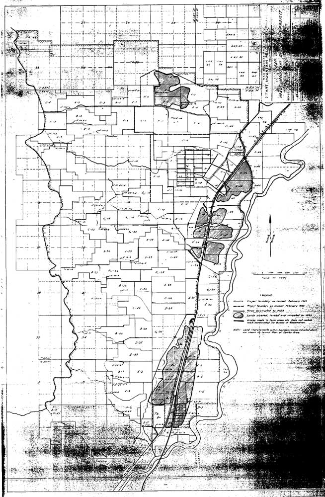 Figure 6.8. Farm fields at the Heart Mountain Relocation Center. (National Archives) (click image for larger size (~156K) ) |
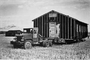 Figure 6.10. Transporting barracks from Heart Mountain. (Big Horn Basin Project Photography Collection, John Taggart Hinckley Library, Northwest College) |
There have been several recent studies of the relocation center, which provide information on the past history and current condition. In 1983 Michael Gorman of the Wyoming Recreation Commission reviewed the history of the camp and completed a National Register nomination for the hospital complex, which is located on BOR land. The parcel was listed on the National Register of Historic Places in 1985. In 1986 real estate appraiser George Page developed salvage estimates for two of the wood frame buildings in the staff housing area. His assessment provides information about construction details and the condition of the buildings at that time, which suffered from neglect and vandalism (Page 1986).
For a pipeline project, Welch et al. (1988) recorded features in the warehouse area, and noted extensive disturbance from fields and other agricultural activities. Additional features and artifacts of the hospital and administration complexes were recorded as part of a cultural resources inventory by Penny et al. (1990), who recommended that the National Register district be expanded to include the entire BOR parcel. Rose (1992) prepared a condition assessment of the four standing buildings for the BOR, and Larson et al. (1995) presented a paper at the Society for Historical Archaeology meetings which outlined the history of the center and its research potential.

 Top
Top
Last Modified: Fri, Sep 1 2000 07:08:48 pm PDT
http://www.cr.nps.gov/history/online_books/anthropology74/ce6b.htm
![]()