![]()
Cover Page
MENU
![]() Gila River
Gila River
|
| |
Confinement and Ethnicity: An Overview of World War II Japanese American Relocation Sites by J. Burton, M. Farrell, F. Lord, and R. Lord |

|
|
| |
Chapter 4 (continued)
Gila River Relocation Center
The larger of the two camps at the Gila River Relocation Center, Butte Camp, covered 790 acres at the base of Sacaton Butte 3-1/2 miles west of Canal Camp (Figure 4.9). At Butte Camp east-west streets were numbered, 1st on the south to 14th on the north; north-south streets were lettered "A" Street on the east to "G" Street on the west. The main entrance to the camp was along the east side, at 9th street. The blocks were numbered from 28 to 81, beginning at the southeast corner and wrapping west, then east, row by row to the north. There were two narrow east-west firebreaks, one just south of 9th Street and one between 4th and 5th Streets.
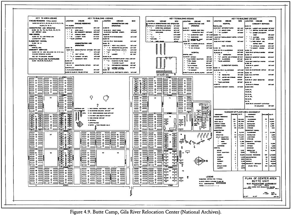 Figure 4.9. Butte Camp, Gila River Relocation Center. (National Archives) (click image for larger size (~150K) ) |
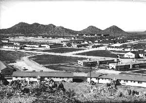 Figure 4.10. Staff housing at Butte Camp. (National Archives photograph) |
The warehouse area (Blocks 67 and 68) included 22 warehouses, two of which were built by evacuees. North of the warehouse blocks, in areas designated Blocks 77 and 78, were two carpenter shops, a warehouse, a planer shed, a plumbing and electrical shop, an ice house, and a 37-by-108-foot machine shop, the latter two buildings built by evacuees.
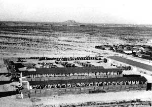 Figure 4.11. Camouflage net factory at Butte Camp. (National Archives photograph) |
The Butte Camp hospital, which served both Butte and Canal Camp, was located north of the administration area. In addition to the hospital's 18 interconnected buildings, there was a dental clinic in Block 73 and a convalescent hostel in Block 74.
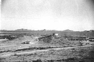 Figure 4.12. Water tank and outdoor stage at Butte Camp. (National Archives photograph) |
The WRA map lists 627 evacuee residential buildings, 46 of which were used as schools, 6 for churches, and 29 for other community services. All of Block 41 was an elementary school. Block 42 was used for community services including offices, churches, a shoe repair shop, a sewing shop, a laundry and dry cleaning, a barber shop, a beauty shop, a canteen, a store, and a "diet kitchen." Four buildings in Block 42 were used for staff apartments. Block 43 was used for a high school. To the north of Block 43 the evacuees built an auditorium and three classroom buildings for science, home economics, and vocational arts (shop/crafts).
Vacant blocks (35, 37, 38, 50, 53, 62, and 71) were used for athletic fields, playgrounds, and other facilities. Butte Camp also featured what has been called the WRA's finest baseball diamond (Hansen 1997). Designed by professional baseball player Kenichi Zenimura it included dugouts, bleachers, and other features and could accommodate up to 6,000 spectators.

 Top
Top
Last Modified: Fri, Sep 1 2000 07:08:48 pm PDT
http://www.cr.nps.gov/history/online_books/anthropology74/ce4b.htm
![]()