![]()
Cover Page
MENU
![]() Poston
Poston
|
| |
Confinement and Ethnicity: An Overview of World War II Japanese American Relocation Sites by J. Burton, M. Farrell, F. Lord, and R. Lord |

|
|
| |
Chapter 10 (continued)
Poston Relocation Center
Three and a half miles south of Poston I, Poston II included an administration area, staff housing, a garage area, warehouses, and a net factory, as well as evacuee residential blocks (Figures 10.17 and 10.18). The camp was bisected by a north-south canal, which fed a large swimming pool in the center of the camp. Block numbers were consecutive, beginning with 201 to distinguish the numbers from those of Poston I.
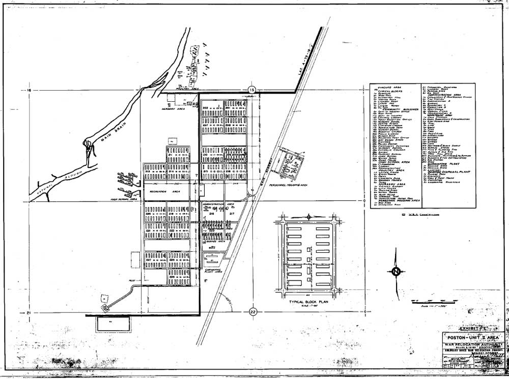
Figure 10.17. Poston II central area.
(National Archives)
(click image for larger size (~92K) )
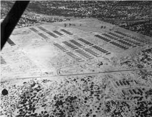 Figure 10.18. Aerial view of Poston II construction. (Fred Clark photograph, Bancroft Library, University of California, Berkeley) |
The warehouse area, south of the administration area in Block 223, included 20 buildings. The garage area, south of the warehouse area, included a gasoline station and an evacuee-built shed. Farther south still was the net factory, with two weaving sheds and a latrine.
On either side of 7th street were the 18 evacuee residential blocks, in groups of three or four separated by fire breaks. One of the blocks served as the elementary school. The high school, west of the residential area, was constructed by the evacuees of adobe. It included an office, library, and 10 classroom buildings. The fire break to the east of the high school served as the recreation area and athletic fields.
A chicken farm, with 15 laying houses, two brooder houses, four storage buildings, two sheds, and a privy (all evacuee-built), was located north of the evacuee residences. A farm nursery was located northwest of Block 202; the nursery included a lath house, a victory garden, and a packing shed, all built by evacuees. Between the nursery and Block 202 were a pump house, water tower, and storage tank.
The sewage treatment plant for Poston II was located southwest of the residences. It included a pump house, clarifier, digester, sludge beds, and sewage lagoon.

 Top
Top
Last Modified: Fri, Sep 1 2000 07:08:48 pm PDT
http://www.cr.nps.gov/history/online_books/anthropology74/ce10c.htm
![]()