
NPS Photo 
NPS Photo Carbon RiverCarbon River is in the park’s northwest corner and receives high amounts of rainfall. The climate and plant communities found here resemble that of a temperate rainforest. Carbon is reached via the Carbon River Road, off State Route 165. Visitors to the Carbon River area should be prepared to navigate around road and trail washouts and expect to encounter hazards including downed trees, snow, and changing weather conditions. Part of the Carbon River Road was washed out by the 2006 flood and is closed to vehicles past the Carbon River park entrance; this 5 mile section is now referred to as the Carbon River Trail. Bicycle and pedestrian traffic are permitted on the Carbon River Trail. Mowich LakeSet in a glacial basin surrounded by fragile wildflower meadows, Mowich Lake is the largest and deepest lake in Mount Rainier National Park. The lake is open for fishing and non-motorized boating. The area is generally open mid-July to mid-October. Mowich is reached via State Route 165. The road is unpaved after the first three miles and is rough with potholes and washboard sections. Check the road status prior to visiting the Carbon & Mowich area. ParkingCarbon RiverCarbon River Ranger Station
Carbon River Entrance Area
MowichMowich Lake
Paul Peak Trailhead
Public BuildingsCarbon River Ranger Station The ranger station is located on the Carbon River Road, 2.5 miles (4km) before the park boundary. There is an accessible parking space near the entrance to the building. There is a short gravel path that leads from the paved parking area into the building. Park information, wilderness camping, and climbing permits are available inside at the information desk. There are souvenirs and educational items for sale in a small alcove. There are no restrooms in the ranger station. RestroomsThe restrooms in the Carbon/Mowich area are all vault toilets without sinks or running water. There is hand sanitizer available in the restrooms. Carbon RiverCarbon River Entrance Area Restrooms are accessed via a paved path from the parking lot.
MowichMowich Lake Restrooms are accessed from the parking lot, via a gently sloping gravel and rock road.
Paul Peak Trailhead and Picnic Area Restrooms are accessed from the gravel parking lot, via a flat gravel path.

NPS Photo Water Fountains and Refill StationsThere is no drinking water available in Carbon or Mowich. Wifi and Cell ServiceThere is no wifi or cell service available in Carbon or Mowich. LodgingThere is no lodging available in Carbon or Mowich. DiningThere is no dining available in Carbon or Mowich. Picnic AreasCarbonThere are several picnic tables at the Carbon River Entrance. MowichMowich Lake Campground Picnic Area There are several picnic tables at the edge of the campground that are available for people who are not camping. The path to the picnic tables from the parking lot is sloping, uneven gravel. There is an accessible picnic table to the right of the vault toilets.
Paul Peak Trailhead Picnic Area
CampingCarbonThe Ipsut Creek Campground is located 5 miles (8 km) from the Carbon River Entrance, via the Carbon River Trail, a former road that is closed to vehicles. The road is rough, with areas of gravel, tree roots, potholes and bumps.
MowichThe Mowich Lake Campground is located 6 miles (9.5 km) from the Mowich Lake Entrance and is reached from the parking area via a gently sloping gravel path:
ViewpointsCarbon River Entrance There are views of the river just before the parking lot at the Carbon River Entrance. There are many views closer to the river along the Carbon River Trail. Mowich Lake There are glimpses of the lake along the road in the mile before reaching the parking lot. The best unobstructed view of the lake is just before the parking lot; it is a nice spot for photos of the small ‘peninsula’ that juts out into the lake. TrailsCarbon River Entrance The Rainforest Nature Trail is a 0.3 mile (0.5km) former loop trail on old boardwalk. Sections of boardwalk are broken or sparse. The loop no longer connects on the far side. Mowich Lake Most of the trails to the lake from the road or the parking lot are steep at the beginning, with several stairs. There are narrow and rocky sections with roots on the ground. The flattest route to reach the lake is a section of the Lake Shore Trail which begins in the campground in between sites 19 and 20. It is hard-packed gravel and slopes downward at the start, which is narrow. The trail then widens, sloping upward and then becoming mostly flat as it leads to the lake edge. Things to Do
Winter at Carbon and MowichThe Carbon River area remains open through winter. The Mowich Lake area is closed for winter, usually from mid-October to mid-July. NPS Mobile AppThe NPS App is accessible and includes alt text for images. Mount Rainier National Park does not have cell service in many areas; download the NPS App prior to coming to the park. Features available include:
Area Maps:

Explore other areas of Mount Rainier National Park: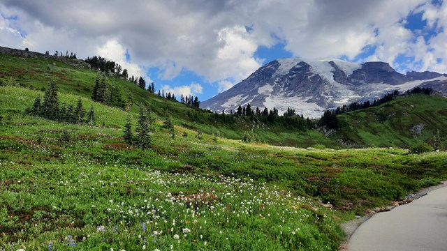
Accessibility at Paradise
Learn more about accessibility in the Paradise area. 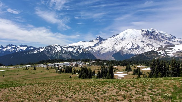
Accessibility at Sunrise
Learn more about accessibility at the Sunrise and White River areas. 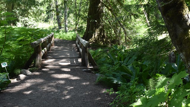
Accessibility at Longmire
Learn more about accessibility at Longmire and Cougar Rock. 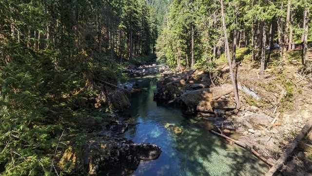
Accessibility at Ohanapecosh
Learn more about accessibility in the Ohanapecosh area. 
Accessibility at Mount Rainier
Learn more about accessibility at Mount Rainier National Park. |
Last updated: April 29, 2025