
Glacier Bay plays to the rhythm of the tides.
At low tide, little creatures in the intertidal pools and along rocky beaches are exposed to sun and sky, and they seal themselves tightly to keep from drying out. Meanwhile, the seafood buffet is open once again, a feast for beachgoing bears and shorebirds. As the waterline steadily creeps up, the intertidal zone comes back to life. Mussels, snails, sea stars, and limpets are back to business under the surface of the bay. Humans exploring Glacier Bay benefit from understanding the tides and working in harmony with them. Whether boating or kayaking in the bay, tides can make a trip safe and enjoyable—or difficult and hazardous. What Causes Tides?Tides are caused by the gravitational pull of the moon, and to a lesser degree, the sun.Because the moon takes 24 hours and 50 minutes to revolve around the earth, the full tidal “day” is slightly longer than a normal, 24-hour day. For the sake of simplicity, we think of tides as occurring every six hours. There are typically two high tides and two low tides each day. Tides occur about 50 minutes later each day, and the height of the tide varies, depending on the phase of the moon and the relative position of the sun. During the new or full moon or at certain times of the year, highs and lows are more extreme, with a larger tidal swing. This is why it’s important to check the tides while planning a boating or kayaking trip and keep tide tables on hand. Tides in Glacier BayGlacier Bay has a tidal swing of up to 25 feet, making awareness of tides crucial to boaters and kayakers. The six hours approaching the high tide constitute a period of flood, as water flows into Glacier Bay and its smaller inlets. After high tide is a period of ebb, when water flows back out of the bay, reaching low tide about six hours later.During times of peak flow, bottlenecked areas can create strong currents and rough water, especially in Sitakaday Narrows (in the lower bay) and at the mouths of narrow inlets. Those operating smaller watercraft, including kayaks, find it safer and easier to travel during slack tide or in the same direction as the tidal current. 
Slack Tide, Peak Flow, and the Rule of TwelfthsThere are approximately six hours between high tide and low tide. Water flows at different rates at different points in the cycle, creating periods of slack tide and periods of peak flow.The tide cycle can be broken down by hour, utilizing the “Rule of Twelfths”. The hour before and the hour after each high or low tide is considered slack tide. Water flow is very minimal, and currents will be at their weakest. This is usually the safest time for kayakers to make a large open-water crossing or to approach the mouth of a narrow inlet. The highest volume of water flows in the middle part of the cycle between high and low tide. About half of the flow occurs during these two hours, creating the strongest currents in the cycle. Peak flow can be a more hazardous time for kayakers, especially in bottlenecked areas such as Sitakaday Narrows (in the lower bay), where currents can reach 7 knots. Traveling against the current during peak flow can be slow and difficult, while traveling in the same direction can be quite helpful. Harmony with the TidesWhen exiting the water, kayakers should take care to haul their kayaks a safe distance up the beach to ensure the kayak will not be carried away. When camping overnight, haul kayaks well above the high tide line and tie off to a rock or tree.High tide often reaches just below the line of beach grass, but an above-average high can saturate the grass as well. Areas with moss and trees, above the line of grass, are good places to set up camp and store kayaks overnight. Keep Leave No Trace principles in mind when selecting a campsite. Boaters should consider the change in tide when anchoring, and may want to time their travel to go with the tidal current, rather than against it.
Visit our keyboard shortcuts docs for details
Learn about tides and currents. Knowing these conditions is a matter of critical safety when traveling the remote waters of Glacier Bay. Boaters can utilize tidal and water current knowledge to aid their boating experience throughout the Bay. 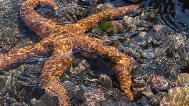
Tide Pools
The Intertidal Life of Bartlett Cove 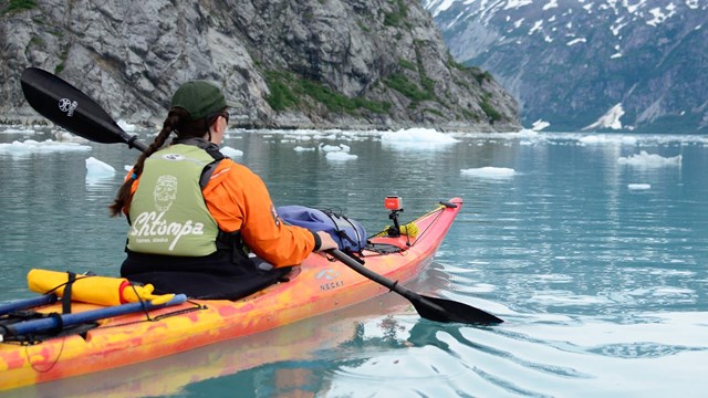
Kayaking
Learn more about kayaking in Glacier Bay 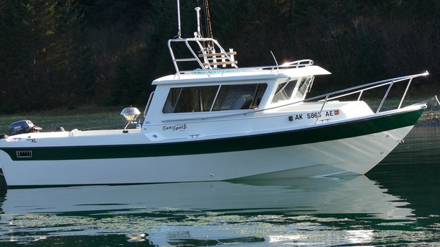
Boating in Glacier Bay
Explore the park by private vessel. |
Last updated: July 5, 2022