
NPS Glacier Bay National Park and Preserve Glacier Bay Park brochure map (3.3MB Jpg)

The Fairweather 
NOAA Chart of Glacier Bay 
Map of park areas subject to boating restrictions, speed limits, or other regulations designed to protect wildlife and provide for a range of visitor experiences. Intended for visitors boating, camping, or kayaking in Glacier Bay's waters and on its coastlines. 
Camper Drop-off Locations 
Close-up of the lodge, showing main lodge, room layout and connecting boardwalks. NOTE: This map is only available via the Glacier Bay Lodge, a commercial concessioner of Glacier Bay National Park and Preserve. Find a link on the page above for a map showing the lodge property and room numbers. 
Bartlett Cove Trails 
Schematic diagram of the Bartlett Cove Dock showing no-anchor zones and slips available to the public. (1.7mb Jpeg file) 
Diagram of Bartlett Cove campground showing individual and group campsites, fire ring, warming hut, food caches, etc. (1mb pdf file). 
Click here for a detailed map of the campground itself with individual campgrounds marked. Also note locations of food caches, the warming shelter, a fire pit, and more. 
A detailed map showing the Gustavus boundary with the park. Includes GPS coordinates. 
Commercial Fishing 
Cruise Ship Routes 
Tour Boat Routes ")
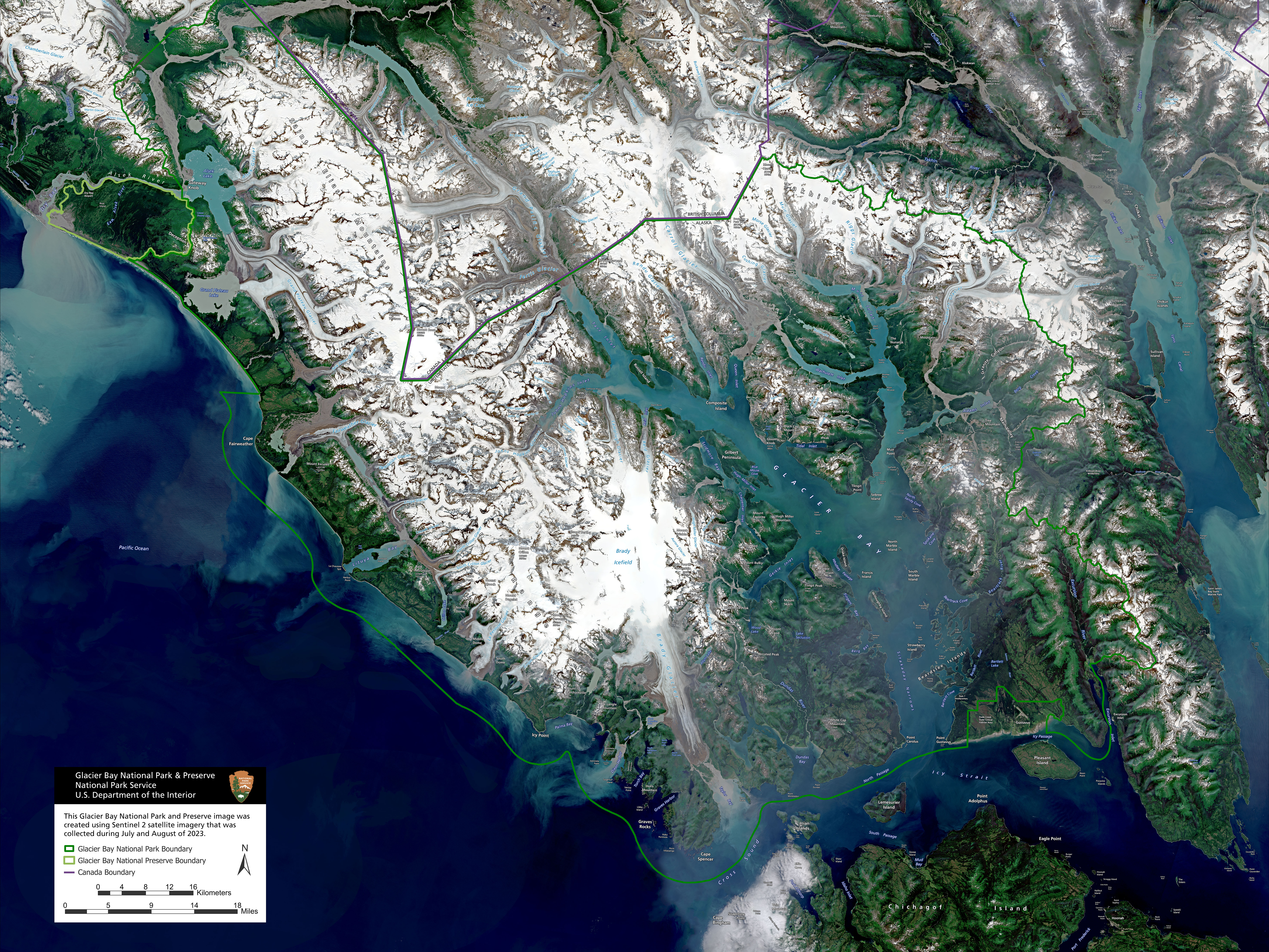
Utilizing satellite imagery from Sentinel-2 data, this image shows a rare cloud-free view of Glacier Bay from July/August 2023. If printed at 300 dpi, this image is approximately 18 x 24 inches in size. Click to download/open 10 mb jpeg file. |
Last updated: May 30, 2025