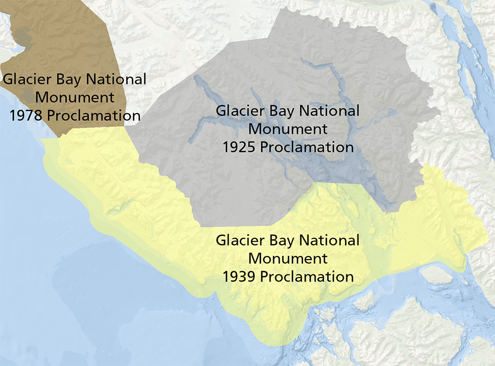
Glacier Bay has had three primary boundary additions in 1925, 1939, and 1978.
This expansion included the Beardslee Islands just north of Bartlett Cove, which have been a favorite location for exploration for generations. Glacier Bay was named by Lester Anthony Beardslee in 1880 while he was commander of the Department of Alaska. He is the namesake of the Beardslee Islands, as well as Lester Island. Lagoon Island in Bartlett Cove was once also called Anthony Island. One of the first charts of the bay in 1882, basically only alluded to a navigational challenge on the east side of the bay by drawing what looks like a bunch of dried beans in the water and noting “unsurveyed.”
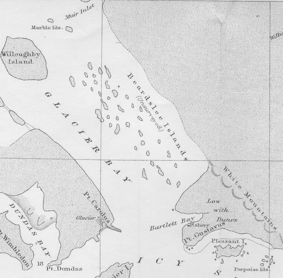 The 1882 chart is the first more detailed chart of the bay; however, it is far from a navigation worthy product by modern standards. Compare the Beardslee Islands in this chart to subsequent versions.
By the 1899 Glacier Bay chart, the Beardslee Islands are taking on a more recognizable form. If you’ve ever visited Secret Bay (the water between the words Beardslee and Islands), you can see that access into the area was more open in this survey. Glacier Bay has undergone enormous isostatic or glacial rebound since the end of the Little Ice Age, so islands have been rising up and out of the water.
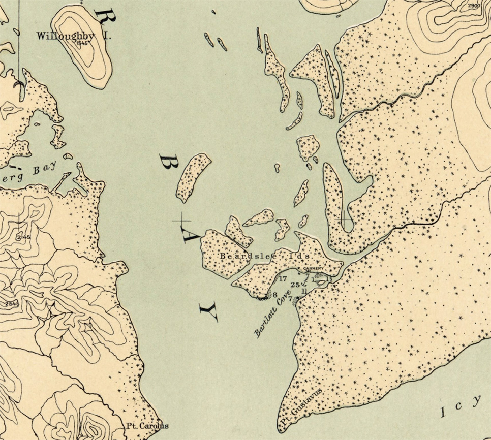
By 1899, the International Boundary Tribunal surveys were complete, as well as early glaciology and survey work by Reid. Chart No. 3095 is more recognizable in form.
In 1925, the first Proclamation was made creating Glacier Bay National Monument in the upper glacial area. When William Skinner Cooper made his 1929 trip with stops near the Beardslees, his field map was a cut up and rebound for folding copy of the 1916 US Coast and Geodetic Survey chart #8306. Icy Strait now has soundings (depth of water) recorded, but still little indication on what the water depths were in Glacier Bay. There is a caution that “the navigation of Glacier Bay is not considered safe without the aid of local knowledge. Glacial ice is always present.”
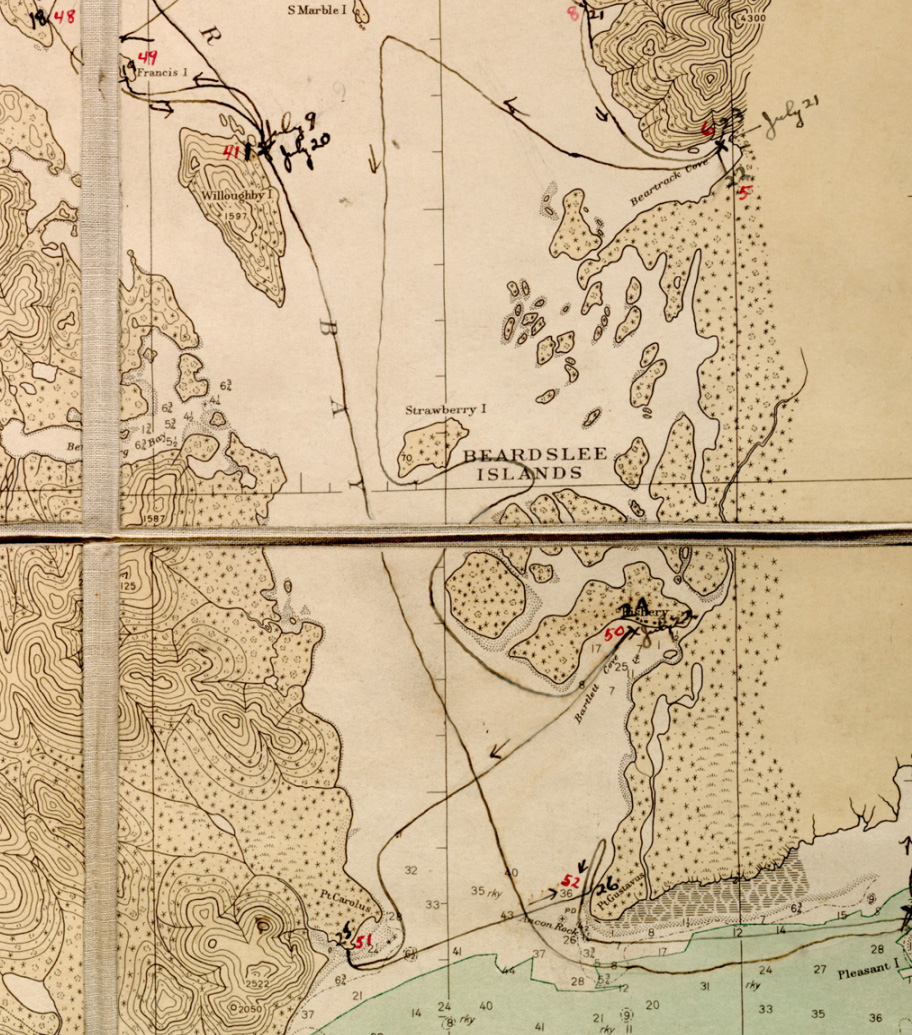
William Cooper’s field stations and route for his 1929 trip are marked on this U.S. Coast and Geodetic Survey 1916 chart No. 8306.
Then in June-Oct 1939, the year that Glacier Bay National Monument was expanded, the first hydrographic survey of the Beardslee Islands was conducted by the US Coast and Geodetic Survey.
The report from that survey shows them testing their fathometer; trying to decide on names like Hutchins Bay vs. Hutchins Basin and Johnson Cove vs Willoughby Cove; the grounding of one of the survey’s launches that “struck rock and bent propeller” thus having “the day ended in so unorthodox a manner;” another reference to a tender unable to make forward progress against the currents between Strawberry and Young Islands; icebergs in the Beardslees; one fox farm already abandoned, but the other occupied by one man; and them placing many survey monuments, like Anchor, Goat, Lawn, and Spider.
During those five months, they produced the first hydrographic survey. From the smooth sheet, we can for the first time see the islands in their true shape, orientation, and location.
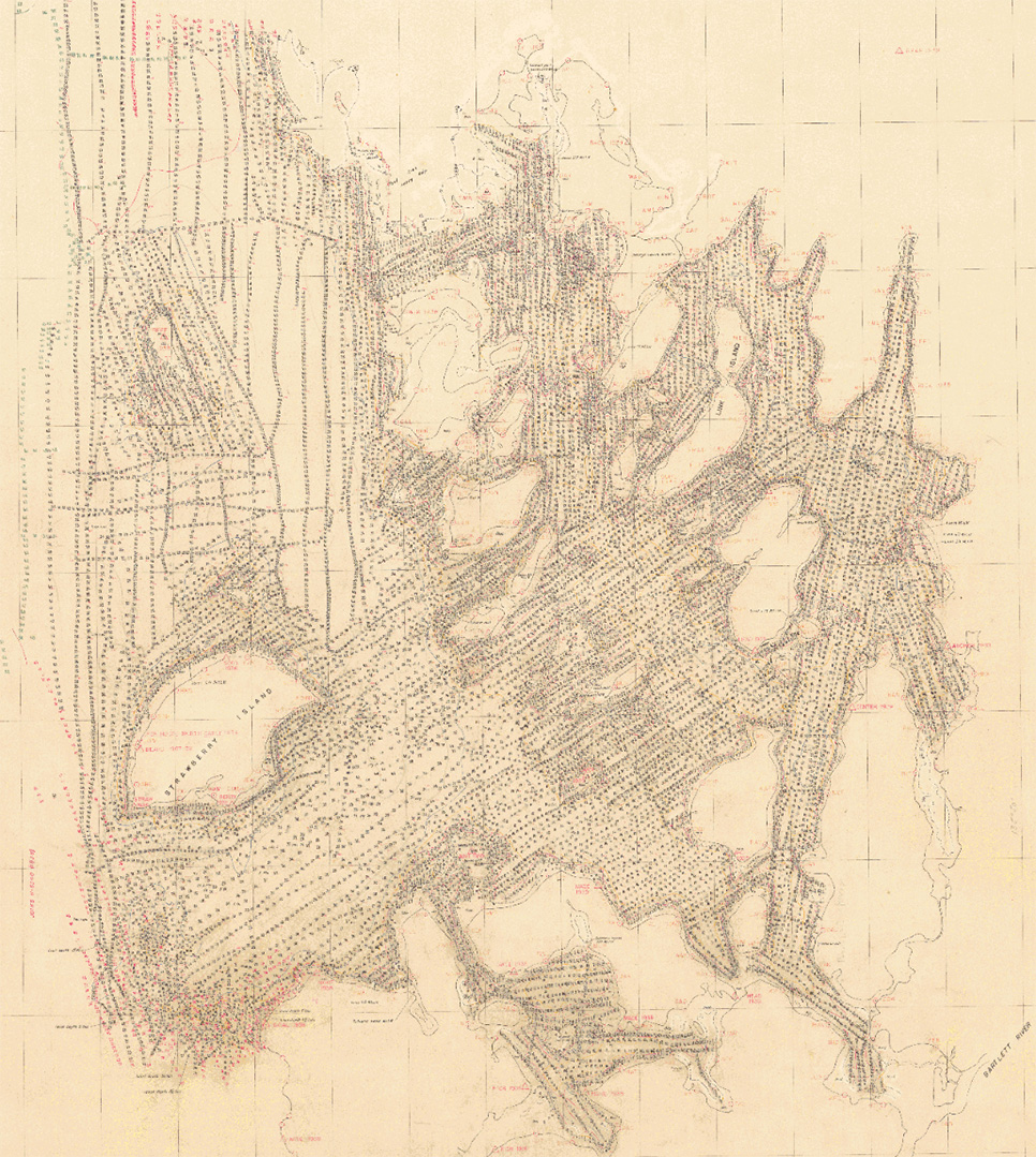
The Smooth Sheet of the first Beardslee Island survey in 1939.
As we zoom in, we see all the dark marks are the water depths. Additionally, on shore, we can see all the survey monuments (triangles) and intermediate survey locations (circles) that were used in triangulation. Remember this was many decades before Global Positioning Systems (GPS).
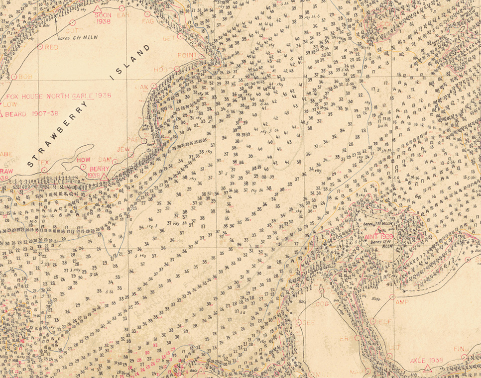
A close-up of the 1939 Smooth Sheet showing the soundings/depths and survey locations on shore.
For the last 82 years, that survey has been the prevailing dataset for Glacier Bay’s chart No. 17318 for the Beardslee Islands, although resurveys of the Beardslee Entrance area were done in 1979 and 2001.
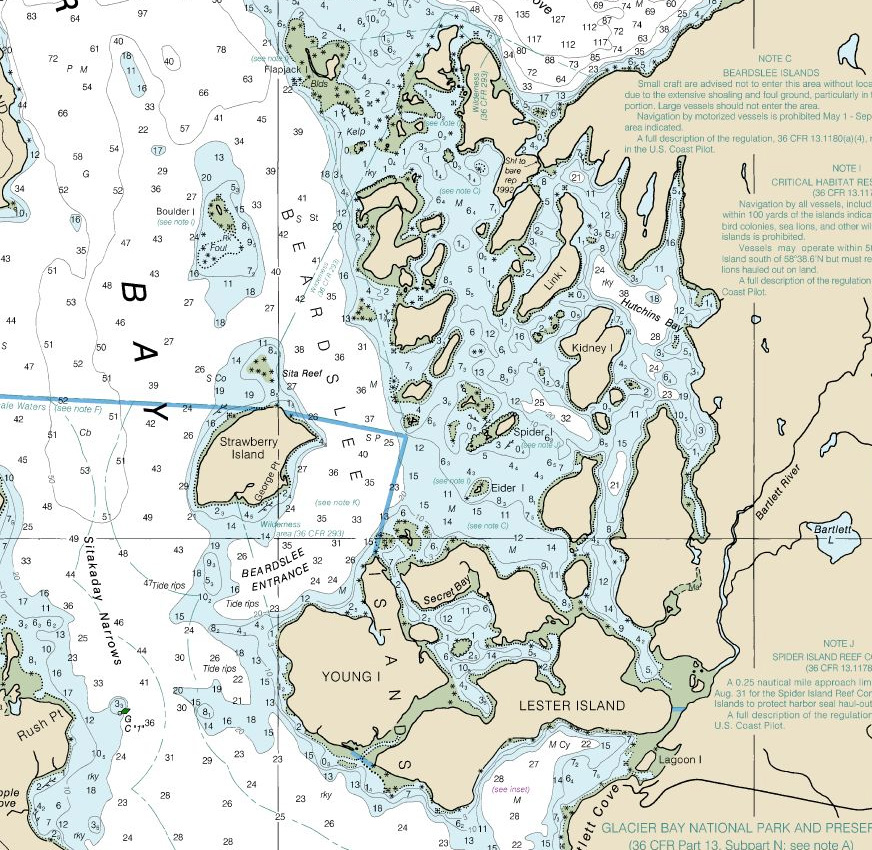
A contemporary raster nautical chart of the Beardslee Islands still uses the same data as collected in 1939.
Then, in March 2021, the ship NOAA Rainier arrived to redo what took five months in 1939. The Rainier’s launches crisscrossed the Beardslee Islands with their tracks shown in blue.
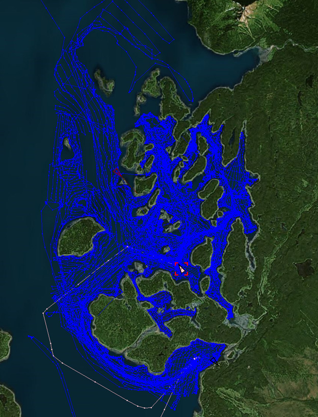
During March 2021, the NOAA Ship Rainier came to resurvey the Beardslee Islands. The Rainier’s launches crisscrossed the area collecting multibeam sonar.
Using modern multi-beam data collection, their preliminary results show the bathymetry of the Beardslee Islands like never before with the fuchsia color being the shallowest and the blue areas deepest.
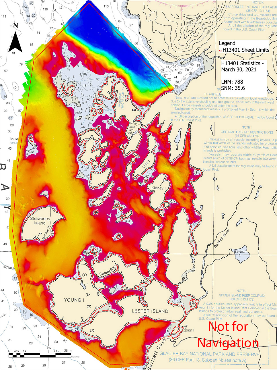
From the March 2021 survey, a draft view of the bathymetry data collected by NOAA Ship Rainier in Glacier Bay, Alaska. This data will be submitted to NOAA's Office of Coast Survey for review and application to the nautical chart.
So, 82 years after being added to the National Park Service, the Beardslee Islands have a brand new survey for the safer enjoyment for future generations! We look forward to comparing the data collected in these two surveys to determine rates of change. Thank you NOAA Rainier and NOAA Fairweather (who surveyed other parts of Glacier Bay last fall) for continued successful surveys and partnership.
