How fast is the land rising, and how do scientists measure the rate?
Project Dates

Ongoing since 2006
Did You Know?
Glacier Bay and the surrounding area show the fastest rates of isostatic uplift on the planet. Uplift of about 5.5 meters has taken place in Glacier Bay since the retreat of glacial ice beginning about 250 years ago. Uplift should continue for several hundred more years.
Introduction

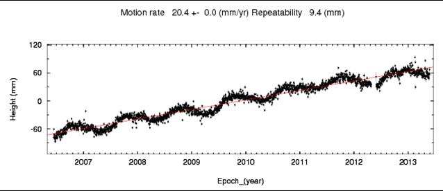
When the crushing weight of glacier ice is removed from an area, the land rises in a process known as isostatic uplift or rebound. Glacier Bay is one of the best locations in the world for scientists to study this phenomenon. Over the last 15 years, researchers have measured isostatic uplift in Glacier Bay using several different techniques including GPS, tree-ring dating of raised shorelines, and tide gauge data. GPS measurements are continuing, both to refine estimates of the uplift rates and to measure changes in the uplift rates over time.
The investigators are also measuring changes in gravity. The attraction of gravity varies over the surface of the earth with latitude, elevation, and subsurface geology. In an area of dynamic uplift like Glacier Bay, it also changes with time. The change is very small but measurable by sensitive instruments called gravimeters.
Gravity change in Glacier Bay comes from two sources. First, as the land uplifts, the ground surface moves farther away from the earth’s center, resulting in a reduction of gravitational acceleration. Second, as the surface uplifts, some mantle material at depth flows in to fill the void. This causes an increase in gravitational acceleration, partially counteracting the effect of uplift.
Isostatic rebound produces significant stresses on the earth’s crust that can affect seismicity and tectonics. It also impacts park ecosystems by causing changes in shorelines, hydrologic patterns, erosion, and sedimentation.
Methods

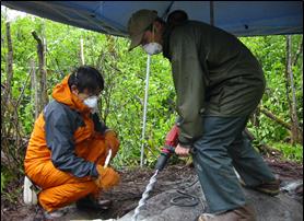
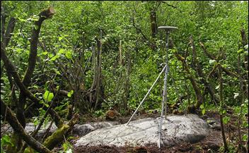
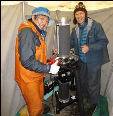
Continuous GPS sites at Dry Bay, Queen Inlet, and Blue Mouse Cove have been recording data since 2006. Absolute gravity is measured with gravimeters set up for a few days each year at Bartlett Cove (the old generator shed) and Russell Island. Russell Island was chosen because it is near the area overlain by the thickest ice at the height of the Little Ice Age, and thus is near the center of current uplift.
The researchers tested various glacial rebound models against the uplift observations to determine whether factors other than isostatic rebound, such as tectonism, could be major contributors to uplift.
In past work, the researchers have also calculated relative sea-level changes from tide gauge measurements and raised shoreline studies.
Findings

This research project has measured the world’s fastest present-day isostatic uplift. Uplift of 32 mm/year has been measured in upper Glacier Bay. The observed uplift pattern spans an area of over 105 km2, centered on the coastal mountains along the Gulf of Alaska. Regional uplift began 230-250 years ago and is primarily associated with post-Little Ice Age de-glaciation.
The researchers calculated that an ice volume of about 3450 km3 was lost above sea level during the post-Little Ice Age collapse, comparable in volume to Lake Huron, and equivalent to a rise in global sea level of about 1 cm. An additional 250 k3 of below-sea level glacier ice was lost.
Learn More
Check out the Geophysical Institute website at www.gi.alaska.edu/research/seismo
Last updated: September 13, 2016
