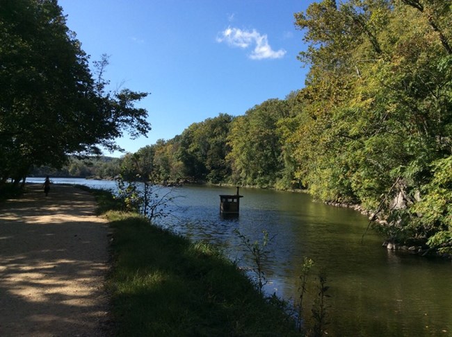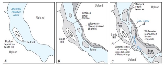
NPS / Nanette Nyce Here at Widewater (MM13) is an abandoned channel of the ancestral Potomac River. The sides of rivers and streams erode at varying rates. If one side erodes more quickly than the other, a meander (or curve) will form. This can create a curvy, snaky river or stream bed. However, during a high water event, sometimes a channel or bypass is cut through, and the meander is abandoned. The shapes of rivers change over time. The builders of the C&O Canal decided to use an ancient, abandoned channel of the Potomac for this portion of the Canal. It saved them the trouble of digging. At 400 feet wide, it is much wider than most sections, which averaged 50-80 feet. The Widewater and other basins served as tying off spots for canal boats, as well as an opportunity to alleviate congestion of boat traffic. However, a stone wall needed to be built on the river side to support the towpath and retain the water in the Canal. 
Image courtesy of United States Geological Survey B - Narrower ancestral Potomac, the deeply incised channel where Widewater would eventually be located. C - Present-day features with the Potomac incised into Mather Gorge and Widewater channel separated from the Potomac River by a terrace. It was incorporated by the builders of the C&O Canal to avoid digging a channel in this location. (Information courtesty of USGS Professional Paper 1691) Discussion Questions: How do landscapes change over time? What changes have you seen? Are these changes caused by natural events, or the result of human influence? |
Last updated: September 6, 2023
