NPS 
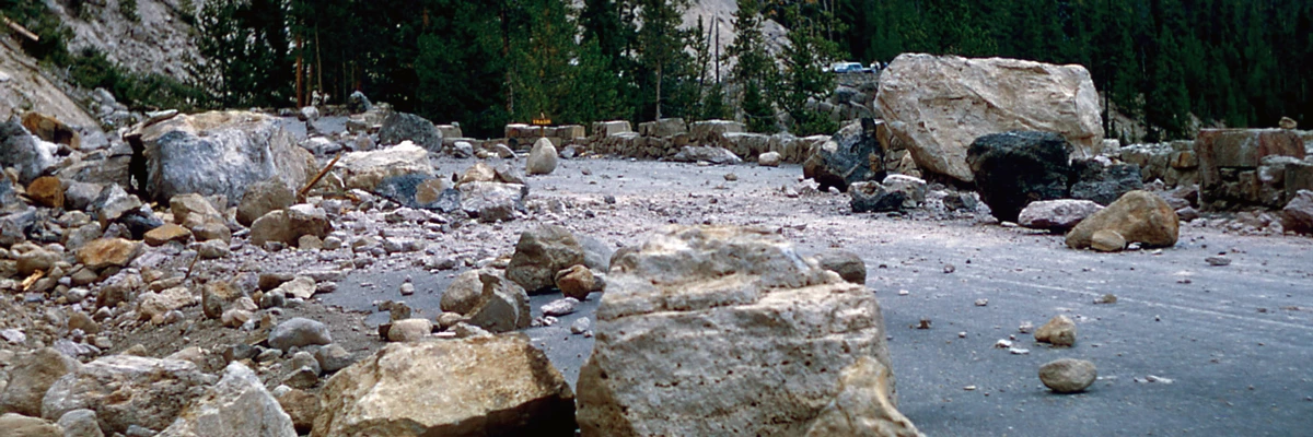
NPS map. Earthquake data provided courtesy of University of Utah Seismograph Stations Network. Yellowstone is one of the most seismically active areas in the United States. Approximately 700 to 3,000 earthquakes occur each year in the Yellowstone area; most are not felt. They result from the extensive network of faults associated with the volcano and surrounding tectonic features. Yellowstone earthquakes tend to occur in swarms—close together in time and space. This phenomenon is related to transport of volcanic fluids along the many small fractures in the shallow rocks over the magma, a pattern that has been noted in volcanos around the world. Earthquakes occur along fractures in the crust where stress from crustal plate movement and volcanic activity build to a significant level. The rock along these faults becomes so strained that eventually it slips or breaks. Energy is then released as shock waves (seismic waves) that reverberate throughout the surrounding rock. Once a seismic wave reaches the surface of the Earth, it may be felt. Surface waves affect the ground, which can roll, crack open, or be vertically and/or laterally displaced. Structures are susceptible to earthquake damage because the ground motion is dominantly horizontal. In Yellowstone, earthquakes help to maintain hydrothermal activity by keeping the “plumbing” system open. Without periodic disturbance from relatively small earthquakes, the small fractures and conduits that supply hot water to geysers and hot springs might be sealed by mineral deposition. Some earthquakes generate changes in Yellowstone’s hydrothermal systems. For example, the 1959 Hebgen Lake (7.3 M) and 1983 Borah Peak (6.9 M) earthquakes caused measurable changes in Old Faithful Geyser and other hydrothermal features. Yellowstone commonly experiences “earthquake swarms”—a series of earthquakes over a short period of time in a localized area. The largest swarm occurred in 1985, with more than 3,000 earthquakes recorded during three months on the northwest side of the park. Hundreds of quakes were recorded during swarms in 2009 near Lake Village and 2010 between Old Faithful area and West Yellowstone. Scientists posit these swarms are due to shifting and changing pressures in the Earth’s crust that are caused by migration of hydrothermal fluids, a natural occurrence of volcanoes. Earthquakes help us to map and to understand the sub-surface geology around and beneath Yellowstone. The energy from earthquakes travels through hard and molten rock at different rates. Scientists can “see” the subsurface and make images of the magma chamber and the caldera by “reading” the seismic waves emitted during earthquakes. An extensive geological monitoring system is in place to aid in that interpretation. On June 16, at 6:48 pm Mountain Daylight Time, the largest earthquake of 2017 occurred. The magnitude 4.36 quake was located about nine miles northnorthwest of West Yellowstone, Montana. The earthquake was reported felt in the towns of Gardiner and West Yellowstone, Montana. It was the largest quake since the 4.8 M that occurred on March 30, 2014. This earthquake was part of an energetic swarm in the same area. The Maple Creek Swarm began on June 12, 2017, and persisted until October. A cluster of more than 2,475 earthquakes was recorded in the area six miles north of West Yellowstone, Montana, and on the west side of the park. Earthquake sequences like these are common and account for roughly 50% of the total seismicity in the Yellowstone region. In November 2017, the University of Utah, in collaboration with the University of Texas El Paso and Yellowstone National Park, installed 290 nodal seismometers in and around the Upper Geyser Basin in a continuation of a study that started in 2015. The temporary deployment, which lasted several days, was intended to record seismic signals from the various thermal features. The 2017 study focused on Geyser Hill, to identify the underground root of thermal features there and to see if they originate from a common reservoir or if they have distinct sources. Similar work in 2015 focused on the plumbing system of Old Faithful. External Resources
ResourcesFarrell, J., R. B. Smith, S. Husen, and T. Diehl. 2014. Tomography from 26 years of seismicity revealing that the spatial extent of the Yellowstone crustal magma reservoir extends well beyond the Yellowstone caldera. Geophysical Research Letter 41. doi:10.1002/2014GL059588. Farrell, J. M., R.B. Smith and S. Husen. 2009. Earthquake swarm identification and b-value mapping of the Yellowstone volcanic-tectonic system. Journal of Volcanology and Geothermal Research. 188:260–276 Huang, H.H., F. C. Lin, B. Schmidt, J. Farrell, R. B. Smith and V.C. Tsai. 2015. The Yellowstone magmatic system from the upper crust to the mantle plume. Science Express. published online 23 April 2015 [DOI:10.1126/science. aaa5648]. Smith, R.B., M. Jordan, B. Steinberger, C. Puskas, J. Farrell, G.P. Waite, S. Husen, W. Chang and R. O’Connell, 2009, Geodynamics of the Yellowstone hotspot and mantle plume: Seismic and GPS imaging, kinematics, and mantle flow. Journal of Volcanology and Geothermal Research. 188:26–56. Smith, R.B. and J. Farrell, 2016, The Yellowstone hotspot: Volcano and Earthquake Properties, Geologic Hazards and the Yellowstone GeoEcosystem. In Abstracts of the 13th Biennial Scientific Conference Greater Yellowstone Ecosystem.p. 56. Wu, S.-M., Ward, K. M., Farrell, J., Lin, F.-C., Karplus, M., & Smith, R. B. (2017). Anatomy of Old Faithful from subsurface seismic imaging of the Yellowstone Upper Geyser Basin. Geophysical Research Letters, 44, 10,240– 10,247. https://doi.org/10.1002/2017GL075255. 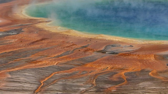
Hydrothermal Systems
Yellowstone's hydrothermal systems are the visible expression of the immense Yellowstone volcano. 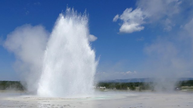
Hydrothermal Features
More than 10,000 hydrothermal features are found here, of which more than 500 are geysers. 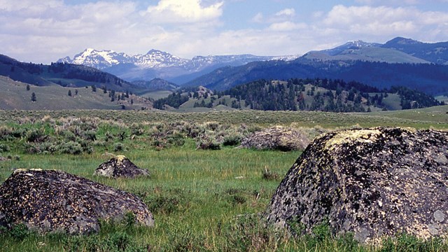
Geology
A volcano, geysers and other thermal features, earthquakes, and glaciers shape Yellowstone's landscape. |
Last updated: August 7, 2025