Last updated: July 11, 2024
Article
NPS Geodiversity Atlas—Olympic National Park, Washington
Geodiversity refers to the full variety of natural geologic (rocks, minerals, sediments, fossils, landforms, and physical processes) and soil resources and processes that occur in the park. A product of the Geologic Resources Inventory, the NPS Geodiversity Atlas delivers information in support of education, Geoconservation, and integrated management of living (biotic) and non-living (abiotic) components of the ecosystem.

Introduction
Olympic National Park is located along the Pacific coast approximately 72 km (45 mi) west of Seattle in Clallam, Grays Harbor, Jefferson, and Mason Counties, northwestern Washington. Originally authorized as Mount Olympus National Monument on March 2, 1909, the park unit was re-named and re-designated on June 29, 1938. The national park encompasses about 373,383 hectares (922,650 acres) containing glacier-capped mountains, deep valleys, meadows, lakes, old-growth forest, temperate rain forest, and more than 113 km (70 mi) of Pacific coastal beach. Olympic National Park hosts a rich biodiversity of more than 1,000 plant species, hundreds of bird species, and 70 species of mammals including the native Olympic marmot and herds of Roosevelt elk. Hundreds of archeological sites within OLYM record more than 12,000 years of human occupation, and historic sites reveal a 200-year history of exploration, homesteading, and community development in the Pacific Northwest. The significant natural resources of Olympic National Park are internationally recognized, as the park was designated an International Biosphere Reserve in 1976 and World Heritage Site in 1981.
Geologic Setting
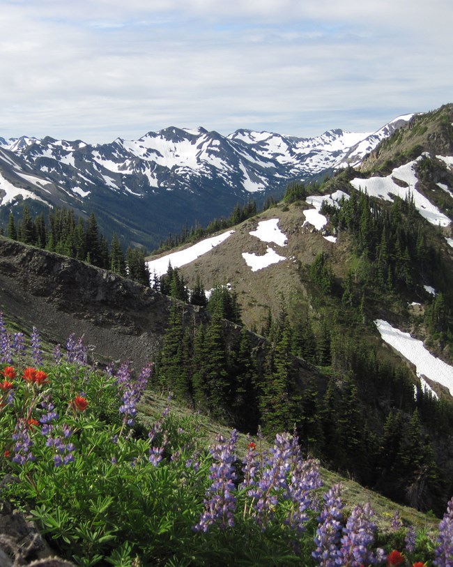
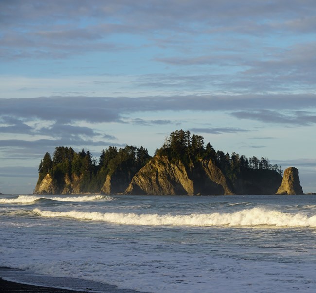
The geology of Olympic National Park predominantly consists of igneous and sedimentary rocks that were formed in the last 60 million years since the Paleocene. Many of the geologic formations within Olympic that form the prominent mountain peaks were originally deposited offshore as an accretionary prism and were then uplifted, folded, and eroded into the landscape seen today. Tectonic convergence between the Juan de Fuca and North American Plates during the Eocene (~34 Ma) has slowly accreted foreign masses of rock to the western coast of North America. As the denser Juan de Fuca Plate continues to subduct beneath the North American Plate, sedimentary packages on top of the Juan de Fuca Plate are scraped off and juxtaposed against the western margin of North America. Continuous subduction over millions of years have folded, thrusted, and uplifted the rock assemblages into the mountain peaks of Olympic. Hurricane Ridge is a good example, consisting of ancient seafloor rocks that now stand approximately 1,830 m (6,000 ft) above sea level. Besides the continuously rising mountains, other notable geologic features in Olympic include the jagged sea stacks along the scenic coast (composed of the Hoh rock assemblage), coastal cliffs, glacially carved lakes such as Lake Crescent, and glacial features such as U-shaped valleys, erratics, and scree fields.
Regional Geology
Olympic National Park is a part of the Pacific Border Physiographic Province and shares its geologic history and some characteristic geologic formations with a region that extends well beyond park boundaries.
- Scoping summaries are records of scoping meetings where NPS staff and local geologists determined the park’s geologic mapping plan and what content should be included in the report.
- Digital geologic maps include files for viewing in GIS software, a guide to using the data, and a document with ancillary map information. Newer products also include data viewable in Google Earth and online map services.
- Reports use the maps to discuss the park’s setting and significance, notable geologic features and processes, geologic resource management issues, and geologic history.
- Posters are a static view of the GIS data in PDF format. Newer posters include aerial imagery or shaded relief and other park information. They are also included with the reports.
- Projects list basic information about the program and all products available for a park.
Source: NPS DataStore Saved Search 3038. To search for additional information, visit the NPS DataStore.
A NPS Soil Resources Inventory project has been started for Olympic National Park and can be found on the NPS Data Store.
Source: NPS DataStore Saved Search 3085. To search for additional information, visit the NPS DataStore.

Related Links
Related Articles
Olympic National ParkNational Park Service Geodiversity Atlas
The servicewide Geodiversity Atlas provides information on geoheritage and geodiversity resources and values within the National Park System. This information supports science-based geoconservation and interpretation in the NPS, as well as STEM education in schools, museums, and field camps. The NPS Geologic Resources Division and many parks work with National and International geoconservation communities to ensure that NPS abiotic resources are managed using the highest standards and best practices available.
