Last updated: June 14, 2024
Article
NPS Geodiversity Atlas—Cuyahoga Valley National Park, Ohio
Geodiversity refers to the full variety of natural geologic (rocks, minerals, sediments, fossils, landforms, and physical processes) and soil resources and processes that occur in the park. A product of the Geologic Resources Inventory, the NPS Geodiversity Atlas delivers information in support of education, Geoconservation, and integrated management of living (biotic) and non-living (abiotic) components of the ecosystem.

Introduction
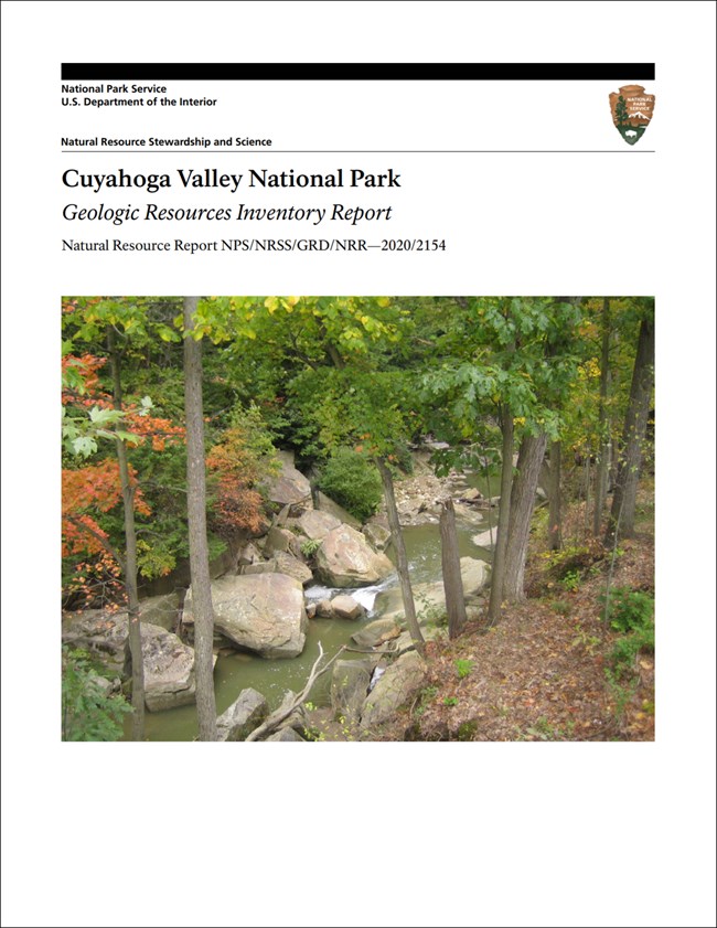
The Cuyahoga River slices through the plateau country of northeastern Ohio as an unexpected crevasse flanked by rolling uplands. Although there are other contenders, one could refer to it as the vegetated Grand Canyon of the east with its lush forests and meadows obscuring the rugged topography. Near vertical cliffs of sandstone and conglomerate frame an ancient valley that was filled with glacial deposits during the last major Ice Age. Now, a young river system is cutting through these deposits. The park’s bedrock records a geologic history of more than 380 million years, beginning when much of Ohio was flooded by a shallow sea. The sea transgressed and regressed many times, depositing the mix of clays, silts, sands, and gravels that compose the park’s stack of bedrock. Ancient rivers cut down through the rock layers for millennia prior to the glaciations of the Pleistocene more than 10,000 years ago. During these glaciations, vast continental glaciers advanced southward from Canada and covered the landscape with ice. These advances blocked and rerouted the old river systems. Resistant bedrock just south of the park area impeded glacial advance. This setting caused the glaciers to leave a complex record of deposits on the local landscape. The ancient river courses were filled with sediment and modern channels are still cutting through glacial deposits. Earth surface processes continue to modify the Cuyahoga Valley landscape. Geology and geologic processes affect nearly every facet of the natural environment of the park as well as its long and rich human history.
Geologic Features and Processes
The following geologic features and processes are found within the park:
-
fluvial features and processes
-
glacial features
-
bedrock exposures
-
ancient sedimentary features
-
bedrock caves
- lacustrine features and wetlands
Geoconservation
Those varied geologic features and processes also create a multitude of resource management issues for park staff, including:
-
flooding
-
management of fluvial processes and flooding
-
groundwater availability
-
geologic hazards
-
abandoned mineral lands and disturbed lands
-
paleontological resource inventory, monitoring, and protection
Learn more about NPS programs for geologic resource management on these websites: [Geoconservation Programs] [Geohazards] [Fossil Stewardship] [Cave Resources Stewardship]
Regional Geology
Cuyahoga Valley National Park is a part of the Appalachian Plateaus Physiographic Province and shares its geologic history and some characteristic geologic formations with a region that extends well beyond park boundaries.

- Scoping summaries are records of scoping meetings where NPS staff and local geologists determined the park’s geologic mapping plan and what content should be included in the report.
- Digital geologic maps include files for viewing in GIS software, a guide to using the data, and a document with ancillary map information. Newer products also include data viewable in Google Earth and online map services.
- Reports use the maps to discuss the park’s setting and significance, notable geologic features and processes, geologic resource management issues, and geologic history.
- Posters are a static view of the GIS data in PDF format. Newer posters include aerial imagery or shaded relief and other park information. They are also included with the reports.
- Projects list basic information about the program and all products available for a park.
Source: NPS DataStore Saved Search 2801. To search for additional information, visit the NPS DataStore.
A NPS Soil Resources Inventory project has been completed for Cuyahoga Valley National Park and can be found on the NPS Data Store.
Source: NPS DataStore Saved Search 2833. To search for additional information, visit the NPS DataStore.
GRI Geology Image Gallery

Related Links
Related Articles
Cuyahoga Valley National Park
National Park Service Geodiversity Atlas
The servicewide Geodiversity Atlas provides information on geoheritage and geodiversity resources and values within the National Park System. This information supports science-based geoconservation and interpretation in the NPS, as well as STEM education in schools, museums, and field camps. The NPS Geologic Resources Division and many parks work with National and International geoconservation communities to ensure that NPS abiotic resources are managed using the highest standards and best practices available.
