Last updated: June 3, 2021
Article
Stratotype Inventory—Yosemite National Park, California

NPS photo.
Introduction
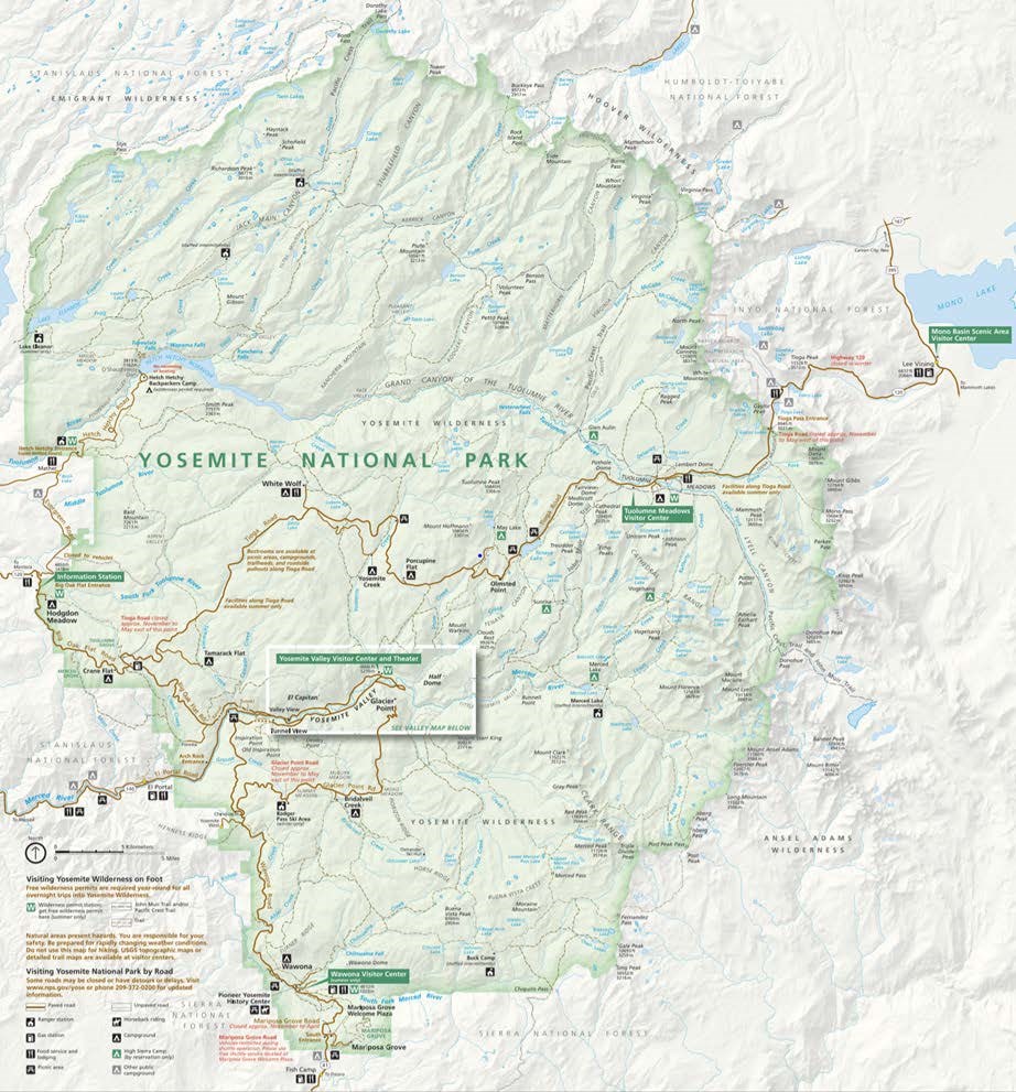
Yosemite National Park (YOSE) is located in the heart of the Sierra Nevada in Madera, Mariposa, and Tuolumne counties, California (Figure 17). Established as a national park on October 1, 1890, the park encompasses 308,106 hectares (761,347.5 acres) of land consisting of granitic peaks and domes that rise high above broad meadows (Anderson 2017). YOSE is home to groves of giant sequoias, mountains, lakes, U-shaped valleys, and some of the tallest waterfalls found in the United States. The scenic landscape of Yosemite Valley is decorated with world-renowned geologic features that include Half Dome, El Capitan, Sentinel Rock, and the cliffs of Yosemite Valley. The lofty mountain peaks of Mount Lyell, Mount Dana, and Kuna Peak are the highest in YOSE with elevations that exceed 3,960 m (13,000 ft) above sea level. YOSE was designated a World Heritage Site on October 31, 1984.

NPS image.
Significance and Geologic Resource Values
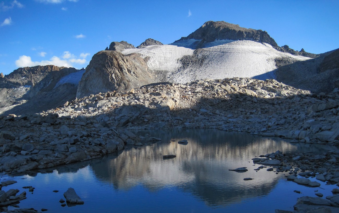
The geology of YOSE is dominated by igneous rocks that form many of the park’s iconic features. These plutonic igneous rocks form much of the Sierra Nevada Batholith and represent multiple episodes of magma intrusion and solidification in the vicinity of YOSE (Figures 18, 19a and 19b; Graham 2012). A majority of the granitoid rocks in YOSE are between 105 and 85 million years old, and record a complex history of pluton emplacement associated with subduction-zone volcanism that took place during the Mesozoic Era from 220 to 85 million years ago (Bateman 1992; Graham 2012). The oldest sedimentary rocks in YOSE are Paleozoic in age. They have been metamorphosed and form linear, northwest-trending outcrop belts along the western and eastern borders of YOSE (Huber 1989; Huber et al. 1989; Bateman 1992). During the Cenozoic, the Sierra Nevada Batholith was uplifted and tilted to the southwest, allowing streams and ice age glaciers to carve the dense, hard plutonic rocks into the inspiring landscape seen today in YOSE. Glacial features of YOSE originated from multiple episodes of glaciation and include cirque basins, alpine lakes, towering waterfalls, U-shaped and hanging valleys, polished granitic domes, glacial erratics, and glacial moraines. Pleistocene glaciers first impacted the region about 1.5 million years ago, and the most recent major episode of glaciation (Tioga glaciation) began ~26,000 years ago (Graham 2012; Glazner and Stock 2010).

NPS image.


Stratotypes in Yosemite National Park
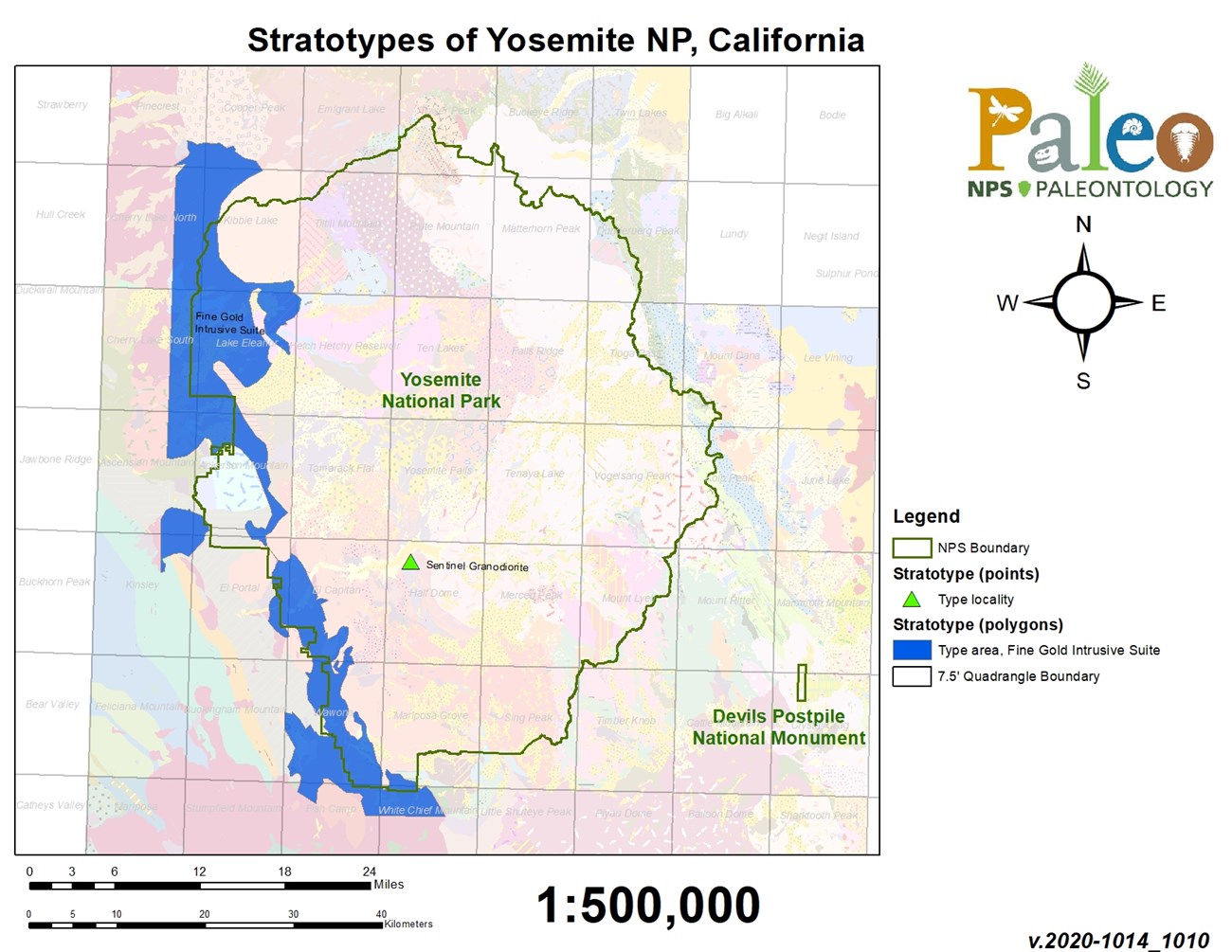
YOSE contains two stratotype occurrences: one type locality and one type area (Table 2; Figure 20). The oldest stratotype of the park pertains to the Early Cretaceous Fine Gold Intrusive Suite, the oldest formally named intrusive suite in the western Sierra Nevada, dated between 123–105 million years old (Bateman 1992). The Fine Gold Intrusive suite was named after exposures along Fine Gold Creek and consists of several igneous units including, from oldest to youngest:
- Granodiorite of Hazel Green Ranch
- Tonalite of Poopenaut Valley
- Tonalite of Blue Canyon
- Tonalite of Oakhurst
- Bass Lake Tonalite
- Granite of Hogan Mountain
- Granodiorite of Sawmill Mountain
- Granodiorite of Crane Flat
- Granodiorite of Arch Rock
- an unnamed alaskite unit
Bateman (1988, 1992) states that the type area is the Ward Mountain–Bass Lake area (Figure 20). A portion of the intrusive suite type area is located along the western boundary of YOSE. The suite is characterized by granitoid bodies containing a low presence of alkali feldspar and 87Sr/86Sr (strontium isotope) ratios indicative of source magmas containing substantial amounts of crustal material (Bateman 1992).
| Unit Name (map symbol) | Reference | Stratotype Location | Age |
|---|
Geologic Time Scale
Location Map

NPS image.
The Upper Cretaceous Sentinel Granodiorite was originally named by Calkins (1930) after the world-renowned monolith Sentinel Rock in YOSE. Bateman and Chappell (1979) would later designate Sentinel Rock the type locality (Figures 20 and 21). The unit occurs as a narrow ~2 km (1.25 mi)-wide, north–south trending band south of Yosemite Valley, but its distribution widens north of the valley into the region near Bald Mountain. The granodiorite is characterized as being equigranular, containing well-formed crystals of hornblende and biotite and abundant wedge-shaped crystals of sphene (Figure 22; Bateman 1992).
In addition to the designated stratotypes located within YOSE boundaries, a list of stratotypes located within 48 km (30 mi) of park boundaries is included here for reference. These nearby stratotypes include:
- Jurassic
- Mariposa Formation (type area)
- Cretaceous
- Bass Lake Tonalite (type locality)
- Ward Mountain Trondhjemite (type locality)
- Shaver Intrusive Suite (type area)
- Miocene
- Eureka Valley Tuff (type locality)
- Table Mountain Latite (type locality)
- Miocene–Pliocene
- Disaster Peak Formation (type locality)
Photos

NPS image by Greg Stock.

Photos courtesy of Allen Glazner (UNC) and Greg Stock (NPS).
Type Section Inventory Report—Sierra Nevada Inventory & Monitoring Network

The information on this page is excerpted from a report covering three parks within the Sierra Nevada Inventory and Monitoring Network (SIEN):
The full Network report is available in digital format from the Sierra Nevada Inventory and Monitoring Network and Natural Resource Publications Management websites. To receive this report in a format optimized for screen readers, please email irma@nps.gov.
Please cite this publication as:
- Henderson T, Santucci VL, Connors T, Tweet JS. 2021. National Park Service geologic type section inventory: Sierra Nevada Inventory & Monitoring Network. Natural Resource Report. NPS/SIEN/NRR—2021/2219. National Park Service. Fort Collins, Colorado. https://irma.nps.gov/DataStore/Reference/Profile/2284063
Leave No Trace—Protect Type Sections for Science

Many type sections and paleontological sites are vunerable to damage from careless visitation and over-use. Be sure to practice Leave No Trace princples whenever you are in the outdoors. Of particular importance at geoheritage sites is to:
-
Travel and camp on durable surfaces, and
-
Leave what you find.
If you see signs of vandalism or someone acting inappropriately during your visit to a park site, please contact a ranger at the park or make a report through NPS Investigative Services.
Related Links
- Yosemite National Park, California—[Geodiversity Atlas] [Park Home] [NPSHistory.com]
- Geologic Time Scale
- America's Geoheritage
- NPS Paleontological Resource Inventory
- NPS Geologic Resources Inventory
- NPS Geodiversity Atlas
