Last updated: November 25, 2025
Article
SECN Highlights October 2024

NPS photo
Ocean Acidification at TIMU and CUIS
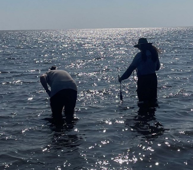
SECN's Mallorie Davis and Elena Kelly Assist Park Staff with Monitoring Project
Carbon dioxide (CO2) emissions have grown dramatically since the Industrial Age. Since the ocean absorbs roughly one-third of atmospheric CO2, oceanic CO2 levels have increased as well. Through a series of chemical reactions, seawater lowers in pH (i.e., becomes more acidic) and retains fewer carbonate ions. These conditions stress many aquatic organisms and impair the ability of organisms such as oysters, corals, and sea urchins to build and maintain their calcium carbonate body structures. The National Oceanic and Atmospheric Administration (NOAA) conducts the Ocean Acidification Monitoring Program to track ocean acidification and its impacts on marine species and ecosystems. The National Park Service (NPS) collaborates with NOAA to conduct near-shore sampling that compliments NOAA’s off-shore sampling missions.
Recently, park staff at Timucuan Ecological and Historic Preserve (TIMU) and Cumberland Island National Seashore (CUIS), along with assistance from SECN Scientist in Parks intern Elena Kelly and Biological Technician Mallorie Davis, participated in ocean acidification monitoring efforts. The TIMU and SECN staff conducted their biannual collection of six water samples from estuarine locations across the preserve. The CUIS and SECN staff collected five samples from the island, including three samples off docks and two accessed from the beach. The monitoring team also recorded water quality parameters such as temperature and dissolved oxygen using a multiparameter sonde at the time of collection. Once the samples were collected, highly toxic mercury chloride (HgCl2) was added to the samples to halt any biological activity from altering the carbon distributions. Samples have been shipped to NOAA who will analyze “the big four” parameters–pH, partial pressure of CO2 (pCO2), total alkalinity (TA), dissolved inorganic carbon (DIC)–from the near-shore samples and examine how they compare to nearby open-ocean conditions.
Ocean acidification already poses a significant threat to these delicate estuarine and marine ecosystems. As emissions and CO2 levels continue to climb, the problem of ocean acidification will only worsen. By participating in NOAA’s Ocean Acidification Monitoring Program, the NPS gains vital insight into the current state of its coastal parks. The NPS can use the data to track ocean acidification across time and even project future trends.

NPS photo
NPS photo / SECN staff
Forbes Boyle Returns to Detail as SECN Program Manager
Network Botanist to Handle Operations Through November
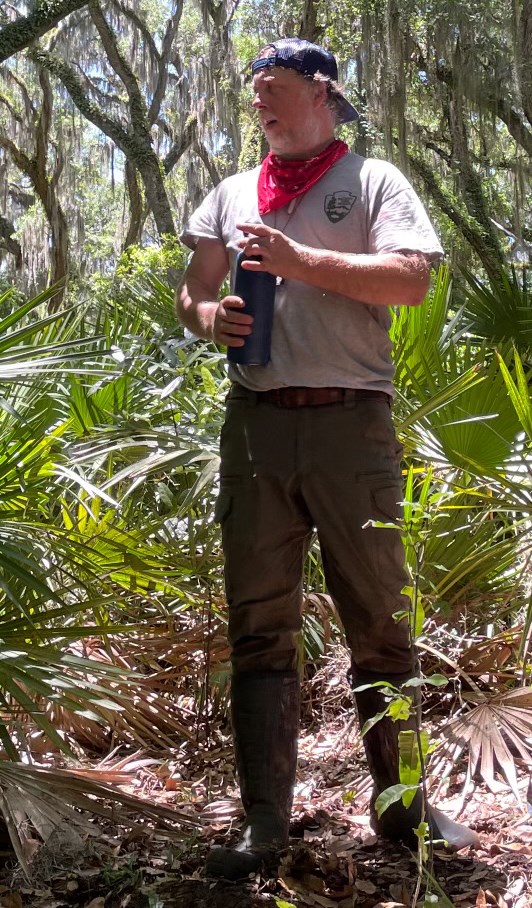
Forbes Boyle (SECN Botanist) resumed his 120-day temporary promotion detail as Program Manager on September 8 continuing through the end of November. During the first “half” of his detail (February–March), Forbes kept the Southeast Coast I&M Network ship afloat while Brian Gregory (former SECN Program Manager) was in recovery-mode following surgery. Gregory started his new role as Regional I&M Program Manager for the Southeast Region in September. Forbes joined the NPS in the fall of 2018, after seven years of service as Botanist with the Southeast Region Inventory and Monitoring Branch of the U.S. Fish and Wildlife Service. In his current SECN role, Forbes oversees the “Terrestrial Vegetation Monitoring Protocol Implementation Plan” which he helped published in his first year with the network. Forbes holds a PhD and MS in Forest Resources from Clemson University, and a BS in Wildlife Biology from the University of Vermont. During his Post-Doctoral Appointment at the University of North Carolina (Chapel Hill) from 2006–2011, Forbes served as the Project Manager for the multi-agency Carolina Vegetation Survey. Between now and the end of November, Forbes will provide support and leadership for FY24 Annual Reports closeout, development of FY25 Workplans, and organizing the Fall 2024 SECN Steering Committee Meeting.
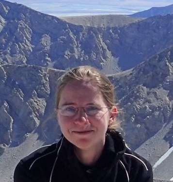
Photo submitted
Myra Joins the SECN as Wildlife Intern
Working toward MS in Forestry and Natural Resources at UGA
Myra Kincaid is a new Cooperative Ecosystem Studies Unit CESU intern joining Wildlife Biologist Michael Parrish in the Landbird and Vocal Anuran Community Monitoring Program. She will assist Michael with field work, classifying landbird calls from recordings, and data entry. She is affiliated with the University of Georgia where she is pursuing a Master of Science in Forestry and Natural Resources. Myra has worked as a field technician for both the New York Breeding Bird Atlas III and the North Carolina Breeding Bird Atlas. She completed a Bachelor's of Biology at the University of North Georgia, where she conducted a point-count project to map the bird population on campus. Myra grew up in North Georgia and is a long-time outdoor enthusiast whose interests include hiking, backpacking, foraging, canoeing and birding. In 2019 she completed a four and a half month thru-hike of the 2.650-mile Pacific Crest Trail. In 2021, she completed a 16-year section hike of the 2,200 mile Appalachian Trail. She is excited to join the Southeast Coastal network and facilitate the monitoring of birds and frogs in the parks. Welcome aboard Myra!
SECN Data Management Hopping in September!
Data packages for Vegetation, Water Quality and Vocal Anurans Published
-
The network’s first open-data package has been published for the Forest Vegetation Monitoring protocol, and includes all data collected under the current Protocol Implementation Plan through the end of 2023: Terrestrial Vegetation Monitoring in National Parks of the Southeast Coast Network, 2019-2023 Data Package.
-
Water Quality Parkwide Assessment data packages are now published with accompanying maps and supplemental materials.
-
An updated cumulative data package has been published for vocal anurans: Southeast Coast Network Anuran Monitoring in the Southeastern United States, 2024 cumulative data package

Photos submitted
Meet Me in Montana
Stephen Studies Stream Restoration with Acclaimed Hydrologist Dave Rosgen
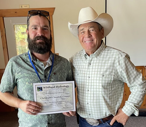
Physical Scientist and protocol lead for SECN’s Wadeable Stream Habitat Monitoring program Stephen Cooper attended a week-long stream restoration course in Ennis, Montana last month. The training was presented by Wildland Hydrology, a consulting firm started by Dave Rosgen (Professional Hydrologist [P.H.], Ph.D.). Rosgen received his training under the renowned fluvial geomorphologist Dr. Luna Leopold, son of the renowned naturalist Aldo Leopold. Rosgen has more than 50 years of experience in surveying stream conditions in various landscape types in Europe, North and South America, and even New Zealand. He is the creator of the Rosgen Stream Classification System (Rosgen 1994) and the “Natural Channel Design” method of stream restoration. Called “River Morphology & Applications," this was the Level II of IV courses offered. Stephen completed Level I “Applied Fluvial Geomorphology” back in 2022.
He is the embodiment of the old-school field scientist. Give him a measuring tape, stadia rod, ruler, and rite-in-the-rain notepad and he’ll get every bit of data he needs...He’s surveyed more streams over his 50-plus years then most of us have thought about. And at age 82, he’s still learning, investigating, and introducing new concepts. I’ve been unbelievably lucky to have been able to learn from his experience."
Image credit: Photo submitted
"My biggest takeaway from the course is that in any given fluvial setting or landscape, there is a natural progression in a stream’s form," said Stephen. "Stream restoration efforts should only ever serve to speed up that natural progression. It’s imperative to determine the natural tendency of the river and always work WITH the river to achieve biological and geomorphic function and stability, not AGAINST the river. We can’t force a restoration design that doesn’t agree with the stream’s natural tendencies." He added that they learned how to determine those natural tendencies, and it’s a lot of work but it’s crucial to have this information. Stephen was also appreciative of the opportunity to learn under Rosgen.
"He is the embodiment of the old-school field scientist," Stephen said. "Give him a measuring tape, stadia rod, ruler, and rite-in-the-rain notepad and he’ll get every bit of data he needs. His attention to detail is extreme and he is very picky about collecting data the right way and not introducing bias. He’s surveyed more streams over his 50-plus years then most of us have thought about. And at age 82, he’s still learning, investigating, and introducing new concepts. I’ve been unbelievably lucky to have been able to learn from his experience."
NPS photo
On the Fire Line
Katie Dagastino served as a REAF on the Lava Fire in Idaho
"The relentless roar of flames, the suffocating smoke, and the unrelenting heat."
Hydrologic Technician Katie Dagastino, who recently completed a 14-day REAF (resource advisor, fireline) assignment on the Lava Fire near the Boise National Forest in Idaho, said those are the daily realities faced by firefighters on the front lines.
"From early morning briefings to late nights sleeping in camp, fire crews navigated a landscape transformed by the fire," said Katie, who served as a liaison between the home unit and the incident management team. "My role was to protect sensitive ecosystems and minimize the fire's impact on local communities."
NPS photo
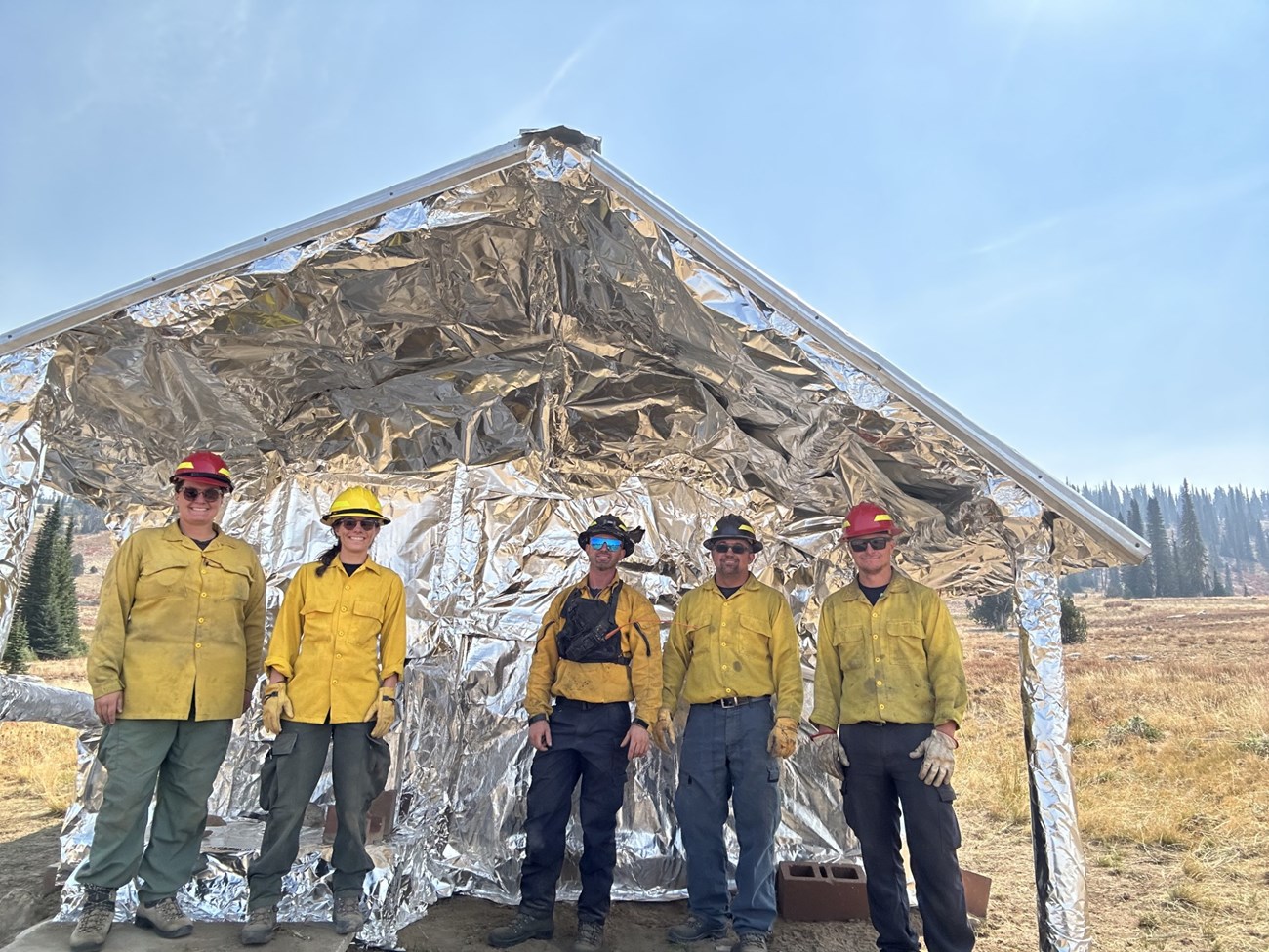
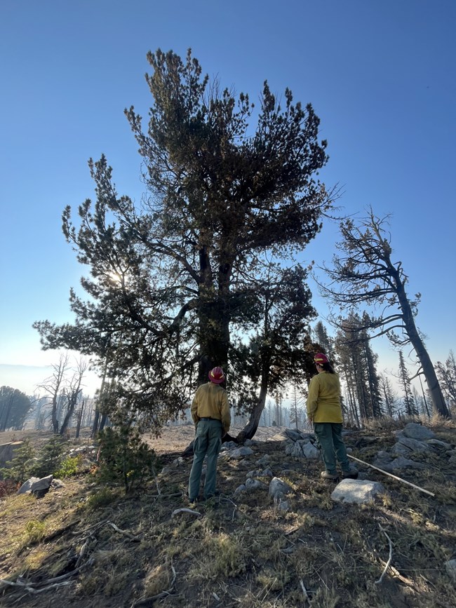
"However, preserving ancient whitebark pine trees, estimated to be 1,500-2,000 years old, was equally critical," she added. "These trees, some of which were resistant to blister rust, a disease threatening the species, were carefully limbed and protected with handlines. Historic cabins wrapped in fire-resistant fabric also required vigilant attention." As a REAF, she was tasked with personally assessing these resources.
"I walked the handlines and dozer lines, precisely mapped the area, and flagged hazardous areas and snags of concern before sending in crews to repair them," she said. "I also measured the hose-lay, accounted for pumps sometimes threatened by fire activity, and mitigated stream degradation caused by suppression activities."
Katie said the assignment thrust her into a completely new environment, demanding fast paced adaptation and familiarity. But beyond the physical challenges, the most impactful part of the experience was the human connection.
"Ashley, a wilderness ranger from Minnesota, quickly acclimated me to my division and shared countless stories of fighting fires in Oregon on a hand crew," said Katie. "I met Pickle, a dozer operator with decades of firefighting experience, who shared stories of major fires across the nation. His presence on the fire for over a month was a testament to his dedication. And there was Tate, a talented excavator operator, who managed to see his family he had been away from for most of the fire season, by meeting up with them in a nearby town for occasional dinners. Finally, there was Anna, who works in fire when she is not guiding people down the Pigeon River. She spent hours feeding downed trees into her chipper with her team in terrible weather conditions."
According to a September 29 report from the U.S Forest Service's Fire Incident website, InciWeb the Incident Information System (wildfire.gov), the nearly 98,000-acre Lava Fire was 72% contained. Despite the immense challenges, Katie said the assignment was incredibly rewarding.
"Being surrounded by individuals from across the country, united by a common objective, was an empowering experience. I can't wait to go out again to serve our public lands."

NPS photo
Recent Publications
The Southeast Coast Network recently published the following reports:
Terrestrial
- Terrestrial Vegetation Monitoring at Canaveral National Seashore: 2022 Data Summary-Version 1.1. Available at: DataStore - Terrestrial vegetation monitoring at Canaveral National Seashore: 2022 data summary—version 1.1 (nps.gov)
- SOP 1.1.02 Uploading Points to GPS Units-Version 2.1. Available at: DataStore - Standard Operating Procedure 1.1.02 Uploading Points to GPS Units—Version 2.1 (nps.gov)
- SOP 1.4.01 Programming and Maintenance of Automated Recording Devices for Vocal Anuran and Landbird Monitoring—Version 2.1. Available at: DataStore - Standard Operating Procedure 1.4.01 Programming and Maintenance of Automated Recording Devices for Vocal Anuran and Landbird Monitoring—Version 2.1 (nps.gov)
- SOP 1.4.22 Deployment and Retrieval of Automated Recording Devices for Vocal Anuran and Landbird Monitoring—Version 3.1. Available at: DataStore - Standard Operating Procedure 1.4.22 Deployment and Retrieval of Automated Recording Devices for Vocal Anuran and Landbird Monitoring—Version 3.1 (nps.gov)
- SOP 1.4.24 Inventory, Maintenance, and Testing of Rechargeable ARD Batteries—Version 1.3. Available at: DataStore - Standard Operating Procedure 1.4.24 Inventory, Maintenance, and Testing of Rechargeable ARD Batteries—Version 1.3 (nps.gov)
- SOP 1.4.31 Navigation to Southeast Coast Network Sampling Locations for Landbird and Vocal Anuran Monitoring—Version 3.1. Available at: DataStore - Standard Operating Procedure 1.4.31 Navigation to Southeast Coast Network Sampling Locations for Landbird and Vocal Anuran Monitoring—Version 3.1 (nps.gov)
- SOP 1.4.32 Classification of Landbird Vocalization Recordings—Version 1.1. Available at: DataStore - Standard Operating Procedure 1.4.32 Classification of Landbird Vocalization Recordings—Version 1.1 (nps.gov)
- SOP 1.4.33 Classification of Anuran Vocalization Recordings—Version 1.1. Available at: DataStore - Standard Operating Procedure 1.4.33 Classification of Anuran Vocalization Recordings—Version 1.1 (nps.gov)
- SOP 3.1.01 Reporting of On-Duty Injury, Illness, Near Misses, Hazards and Exposure—Version 6.0. Available at: DataStore - Standard Operating Procedure 3.1.01 Reporting of On-Duty Injury, Illness, Near Misses, Hazards and Exposure—Version 6.0 (nps.gov)
- SOP 3.1.07 Communicating Field Operations with SECN Parks—Version 3.2. Available at: DataStore - Standard Operating Procedure 3.1.07 Communicating Field Operations with SECN Parks—Version 3.2 (nps.gov)
Aquatic
- Assessment of Estuarine Water Quality at Cumberland Island National Seashore: 2022 Data Summary (Web Article):Assessment of Estuarine Water Quality at Cumberland Island National Seashore: 2022 Data Summary (U.S. National Park Service) (nps.gov)
- Assessment of Estuarine Water Quality at Fort Matanzas National Monument: 2022 Data Summary (Web Article): Assessment of Estuarine Water Quality at Fort Matanzas National Monument: 2022 Data Summary (U.S. National Park Service) (nps.gov)
- Assessment of Estuarine Water Quality at Fort Pulaski National Monument: 2022 Data Summary (Web Article): Assessment of Estuarine Water Quality at Fort Pulaski National Monument: 2023 Data Summary (U.S. National Park Service) (nps.gov)
- Assessment of Estuarine Water Quality at Timucuan Ecological and Historic Preserve: 2022 Data Summary (Web Article): Assessment of Estuarine Water Quality at Timucuan Ecological and Historic Preserve: 2023 Data Summary (U.S. National Park Service) (nps.gov)
Tags
- timucuan ecological and historic preserve
- cumberland island national seashore
- ocean acidification
- landbird community monitoring
- vocal anuran community monitoring
- terrestrial vegetation monitoring
- water-quality data monitoring
- fixed-station water quality monitoring
- park-wide assessments
- estuarine water quality
- wildland hydrology
- geomorphology
- wadeable stream habitat monitoring
- dave rosgen
- lava fire
- congaree national park
- canaveral national seashore
- fort matanzas national monument
- cape hatteras national seashore
- cape lookout national seashore
- fort pulaski national monument
- horseshoe bend national military park
- kennesaw mountain national battlefield park
- fort frederica national monument
- ocmulgee mounds national historical park
- moores creek national battlefield
- chattahoochee river national recreation area
- coastal wetlands monitoring
- coastal shoreline monitoring
- secn network highlights
