|
Explore some of Dick Proenneke's stomping grounds by walking the shoreline between Upper and Lower Twin Lakes. Details to help plan your trip are provided below. With four million undeveloped, wild acres to explore there are countless places go for adventure, solitude, and recreation in Lake Clark. Part of the purpose of the park is to allow for individual, personal exploration of wilderness; therefore, the only maintained trails are the Tanalian Trails near Port Alsworth. This page only describes the general terrain between Upper and Lower Twin Lakes; it does not describe in detail the exact route you should walk. Instead, we encourage you to use the information provided to plan your own unique trip. This off-trail route can be expanded, linked with other routes, or simply used to get an idea of the terrain. Adventurers in Lake Clark will need to rely upon way-finding, map-reading, and trailless hiking skills to navigate, or hire a guide who can help. 
NPS Photo MapsUSGS 1:63 360 series topographic Lake Clark C3 AccessFly into either Upper or Lower Twin Lake and get picked up at the other lake. A float or amphibious plane is required in order to land on these lakes in the summer, as neither have beaches suitable for a wheeled plane to land. Planes operating on wheels or skis may land on either lake in the winter if ice conditions are suitable. DistanceThe distance between the Proenneke Cabin on Upper Twin and the outlet of Lower Twin at the Chilikadrotna River is about 10 miles. TimeEight hours to two days, depending on how fast you hike, if you camp, and how much time you spend exploring or relaxing. DifficultyGentle to moderate. Expect uneven terrain and soft hiking surfaces, including loose gravel on the beaches. HighlightsScenic vistas, wildlife viewing opportunities, and good fishing exist all along the route. Dall's sheep are sometimes visible on the high mountain ridges. Brown bears and American black bears may be feeding on the berries in the tundra above the lakes or walking along the beach. HazardsLake Clark is bear country, and you may encounter brown bears or American black bears during your trip. Store your food properly and be sure you know how to stay safe in bear country.
RouteMany travelers enjoy either beginning or ending their trip at the Proenneke Cabin at Upper Twin and choose the outlet of Lower Twin at the Chilikadrotna River as their other destination. The south side of the lakes and rivers is the recommended side to hike on. No major obstacles will be encountered. Stay near the lakeshore and near the connecting river if possible as most heavier brush patches can be avoided this way. Hiking along the lake also allows better views. Camping and Food StorageMany flat, durable surfaces suitable for setting up camp exist along this route. Campers must store all food and toiletry items in approved bear resistant canisters if staying within two miles of Upper or Lower Twin Lake. Canisters can be rented for free at the park visitor center in Port Alsworth. The only exception is the Hope Creek campsite near the Proenneke cabin, which provides bear resistant food storage boxes on-site. You should also cook at least 100 yards away from your camp to avoid bears making an association between your camp and your food. Please follow leave no trace ethics and park rules and regulations when choosing campsites, storing food, and building campfires. Please note: camping within two miles of Upper or Lower Twin Lakes is limited to a total of 21 days between April 15 and September 30 unless camping at the Hope Creek campsite near Dick Proenneke's cabin in which case the limit is a total of 14 days between April 15 and September 30. There are no time restrictions October 1 - April 14. NotesRanger stations at Proenneke site and at the Lower Twin station are staffed during summer months for your convenience. 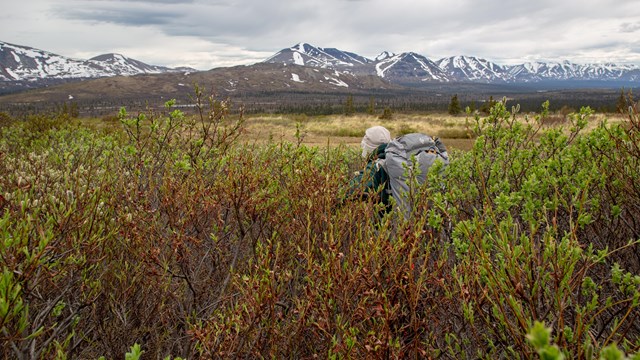
Backpacking in Alaska
Get acquainted with what makes backpacking in Alaska unique and familiarize yourself with these backcountry tips before you plan your trip. 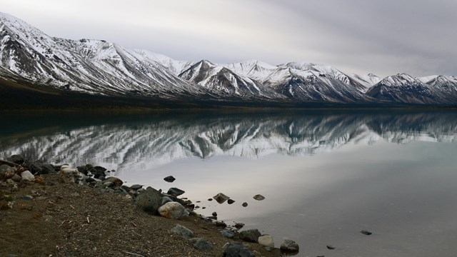
Upper to Lower Twin Lakes Route
Images taken along the Upper to Lower Twin Lakes Route. |
Last updated: December 18, 2018