An official website of the United States government
Here's how you know
Official websites use .gov A
.gov website belongs to an official government
organization in the United States.
Secure .gov websites use HTTPS A
lock (
) or https:// means you've safely connected to
the .gov website. Share sensitive information only on official,
secure websites.
View of the Henry Mountains in the distance, from the top of the Burr Trail Switchbacks.
NPS/ Chris Roundtree
Trip Planning and Safety
The spectacular Waterpocket District (or southern section) of Capitol Reef National Park is fairly remote and rugged, and open year-round. Most passenger cars, pickups, and vans can usually negotiate the roads without difficulty. However, road conditions can vary greatly depending on recent weather conditions. Check the weather forecast before your visit. Spring and summer rains and winter snows can sometimes leave roads slick, muddy, washed out, and impassable to the best high-clearance four-wheel drive vehicle. Many of the roads are unpaved, and are often rough, sandy, and corrugated. Check at the visitor center or call 435-425-3791 for current conditions. Press #1 for information, and then #4 for current road conditions. For weather conditions press #3.
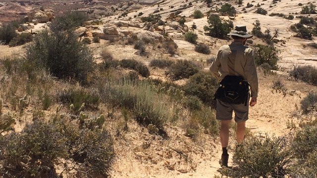
Vehicle and foot travel in the southern part of the park can be light to moderate, depending on the time of year, so be prepared for the unexpected. If you have problems, help may not arrive for hours or even days. Carry plenty of water, food, gas, adequate clothing, a shovel, and emergency supplies. Cell phone reception is usually poor to nonexistent. Cool or cold temperatures will accompany sudden summer storms or an unexpected night out in the backcountry. Daytime temperatures in the summer may top 100 °F (37.8°C) and winter highs may stay below freezing, so dress and plan accordingly. Your safety is your responsibility.
Your safety is your responsibility. Ask about the latest weather conditions at the visitor center.
Loop-The-Fold Driving Tour
Most visitors to the southern part of the park drive the 124-mile (199 km) loop, or various sections of it. Drive time is generally 4-6 hours.
Start at the visitor center and follow Highway 24 east to the Notom-Bullfrog Road.
Turn right on the Notom-Bullfrog Road and drive south to the Burr Trail Road junction.
Turn right on the Burr Trail Road and drive west to Boulder, UT.
Turn right (north) on Highway 12 to Torrey.
Turn right (east) on Hwy 24 back to the visitor center.
Highways 24 and 12 and the first 15 miles (24.1 km) of the Notom-Bullfrog Road (from the junction with Highway 24) are paved.
The Burr Trail Road from the park boundary west to Boulder is also a paved road. There are also opportunities for hiking and backpacking along the drive. The primitive campground, Cedar Mesa, is off the Notom-Bullfrog Road.
Notom-Bullfrog/Burr Trail Road to Lake Powell (at Bullfrog Marina)
The Burr Trail Road south from the Burr Trail Road junction remains unpaved for another 3.3 miles (5.3 km) to the park boundary. From there it continues another 32.5 miles (52.3 km) to Bullfrog Marina at Glen Canyon National Recreation Area (NRA). The road to Lake Powell is paved from the park boundary south to the boundary of Glen Canyon NRA. The access road to Halls Creek Overlook is located along this section of road and is marked by signs. Halls Creek Overlook Road usually requires high clearance four-wheel drive. Within Glen Canyon NRA, there is a section of unpaved road at Bullfrog Creek Crossing. The road from Capitol Reef to Bullfrog is normally in good condition, with the exception of the Bullfrog Creek Crossing which is occasionally impassable due to deep water, cut banks, and mud.
Loop the Fold Distances - Clockwise
All distances are from the Capitol Reef Visitor Center (VC), traveling in a clockwise direction
VC to Hwy 24/Notom-Bullfrog Road.......................................................................9.0 miles (14.4 km)
VC to Cedar Mesa Campground..........................................................................30.1 miles (48.4 km)
VC to Notom-Bullfrog Road/Burr Trail Road junction...........................................41.4 miles (66.6 km)
VC to Upper Muley Twist Road junction...............................................................44.5 miles (71.6 km)
VC to west park boundary....................................................................................46.6 miles (75.0 km)
VC to Burr Trail Road/Hwy 12 junction (Boulder, UT)........................................76.9 miles (123.8 km)
VC to Hwy 12/24 junction (Torrey, UT)............................................................113.9 miles (183.3 km)
Total distance..................................................................................................123.7 miles (199.0 km)
Loop the Fold Distances - Counterclockwise
All distances are from the Capitol Reef Visitor Center (VC), traveling in a counterclockwise direction
VC to Hwy 12/24 junction (Torrey, UT)..................................................................9.8 miles (15.7 km)
VC to Hwy 12/Burr Trail junction (Boulder, UT)....................................................46.8 miles (75.2 km)
VC to west park boundary..................................................................................77.1 miles (124.0 km)
VC to Upper Muley Twist Road junction.............................................................79.2 miles (127.5 km)
VC to Burr Trail Road/Notom-Bullfrog Road junction.........................................82.3 miles (132.5 km)
VC to Cedar Mesa Campground........................................................................93.6 miles (150.6 km)
VC to Notom-Bullfrog Road/Hwy 24 junction....................................................114.7 miles (184.6 km)
Total distance..................................................................................................123.7 miles (199.0 km)
Heading north on the Notom-Bullfrog Road around sunset.
NPS/ Ann Huston
Geologic Features of the South District
“Looping the Fold” is one of the best ways to be immersed in the geology of Capitol Reef. The Notom-Bullfrog Road runs parallel to the eastern slope of the Waterpocket Fold, offering great views of the Golden Throne and other “muffin” or “biscuit”-shaped formations in the Navajo and Page sandstones. South of the Cedar Mesa Campground, the Notom-Bullfrog Road cuts through a section of bentonite clay (in the Morrison Formation), which can be treacherous when wet. When it is dry, notice the colorful shades of gray, blue, purple and red in the popcorn-textured slopes.
Farther south, the pale Navajo Sandstone contrasts sharply with the dark red chevrons of the Carmel Formation. Eventually, the Notom-Bullfrog Road enters Strike Valley, where dark gray cliffs of Mancos Shale form the eastern side of the valley, and the older sandstone layers are on the western side. At a T-intersection, the Burr Trail offers one of the few routes through the Waterpocket Fold. These steep, narrow switchbacks gain some 800 feet (244 m) in only one-half mile (0.8 km) as they cut through Page and Navajo sandstones, before arriving in the Kayenta Formation at the top.
Driving the Burr Trail from Capitol Reef through Grand Staircase-Escalante highlights red Wingate Sandstone. Once the Burr Trail intersects Scenic State Route 12, panoramic overlooks like Larb Hollow offer a bird’s eye view of the rugged terrain and Waterpocket Fold.
The fossilized oyster shells are around 100 million years old. Remember to leave fossils where they are so others can enjoy them.
NPS
Oyster Shell Reef
Along the Notom-Bullfrog Road, a dense oyster shell reef dominated by the oysters Exogyra and Pycnodonte represents another form of life from Capitol Reef’s distant past. These 100-million-year-old oysters reflect a time when a sea inundated this area and created the brackish marine conditions necessary to support this form of life. The shells of these oysters were ultimately concentrated in the beach deposit preserved as the Dakota Sandstone.
Fossils are irreplaceable, non-renewable resources. Excavating, removing, damaging, or otherwise defacing fossils or other paleontological resources within the park diminishes our legacy, and is strictly prohibited by federal law and is punishable by fine and/or imprisonment. If you are fortunate enough to find a fossil in the park, leave it untouched, take a photo, and share your exciting discovery with a park ranger. Keeping fossils where they are found will help preserve their scientific, educational, and interpretive value for present and future generations.
Strike Valley in Capitol Reef highlights the erosional processes of different rock layers.
NPS/ Jacob Frank
Strike Valley
Strike Valley in Capitol Reef is a prime example of the geologic feature for which it is named. Strike Valley is the product of rock layers eroding at different rates, depending on how soft or hard they are. Erosion-resistant rock layers form into ridges, or hogbacks, while the softer layers erode into valleys parallel to the ridges.
Strike Valley leads to the erosional edge of the Waterpocket Fold, where the crest is pale Navajo Sandstone, and the younger rock layers appear below. This is an effect of the “fold” and erosion. Below the Navajo, Page Sandstone contrasts with the dark red chevrons of the Carmel Formation. The Entrada Sandstone forms rounded, orange hills near the valley floor. The Curtis and Summerville layers are submerged, but soft, rounded hills of bentonite in the Morrison Formation appear. A ridge of Dakota Sandstone, resistant to erosion, also stands out from the valley floor. On the opposite side of the valley, the dramatic, dark gray Mancos Shale forms tall, velvety slopes, capped by the tan, cliff-forming Mesa Verde Formation.
The Strike Valley Overlook Trail (0.9 miles/ 1.4 km roundtrip) offers views of the valley with nearly 150 million years of geologic history visible. This trail is accessed from the Strike Valley Overlook road which is unmaintained and requires a high clearance 4 wheel drive vehicle. It is possible to park just off the Burr Trail road and hike to the Strike Valley Overlook for an easy 7 mile (11.3 km) roundtrip hike.
Glossary
Definitions provided by Thomas H. Morris, Scott M. Ritter, and Dallin P. Laycock
Bedding plane: A surface or parting between different sedimentary rock layers. A bedding plane indicates some change in the depositional environment. Often seen as a clear contrast (different colors, different textures) between rock layers.
Depositional environment: Sediment accumulations (deposits) in a variety of settings (environments) wherein they can be buried and lithified (turned to stone). These environments are usually places which have space to catch (accommodate) loose sediment. Examples include deltas, lakes, river valleys, continental shelves, etc.
Differential erosion: The erosional rate of different rocks varies due to their variable strengths. Weak and fractured rocks tend to erode faster, forming slopes and valleys. Stronger rocks tend to resist erosion and form cliffs.
Dip: The angle between horizonal and an inclined surface, such as a bedding plane. Dip direction is the compass direction (azimuth) of the maximum dip angle. Dip and dip direction are common field measurements taken by geologists to measure folds and faults.
Fold: A planar structure such as rock strata (rock layers) that has been deformed, bent, or curved. Often a product of compressional stress produced by plate tectonic forces. Fold types include anticlines, monoclines, synclines, etc.
Monocline: A fold in Earth’s crust, usually tectonically induced by compressional stresses, in which relatively horizontal strata are abruptly kinked, creating a steeply inclined flank.
Slopes: An inclined land surface of erosion (e.g. hillside). A slope has less dip than a ledge or cliff and can usually be negotiated by humans without ropes or climbing aids. Slopes are commonly formed by the erosion of relatively less resistant rock and/or loose sediment. Contrast with cliffs, which are formed by the erosion of stronger, more resistant rock units.
Strike: The compass bearing of a horizontal line that does not gain or loose elevation on an included surface such as a dipping bedding plane. Strike is perpendicular to dip direction.
Strike Valley: A valley eroded parallel to the strike of the strata. In an area with tilted strata, erosion will erode some rock units faster than others. These weaker units erode into valets between the layers of more resistant rock.
Waterpockets: Erosional surface depressions (pockets) that form on relatively flat lying rocks. Created commonly on sandstone surfaces as rainwater dissolves the cement between sand grains, allowing them to be blown away.
The Waterpocket Fold, the monocline protected within the park, is named for these eroded depressions in the sandstone.
NPS/Al Hendricks
Additional Capitol Reef Geology
The geologic story of Capitol Reef spans approximately 280 million years of Earth's history. The immense change over geologic time is represented in the nearly complete set of Mesozoic-era sedimentary rocks. The meeting of tectonic plates uplifted and folded the layers, and ongoing erosional forces have sculpted the land ever since. An overview of this story can be found on the geology page.
435-425-3791
Recorded park information available 24 hours a day. Phones are answered when staff is available. If no one answers, please leave a message, your call will be returned. Questions may also be sent to care_information@nps.gov.