Kayenta Formation

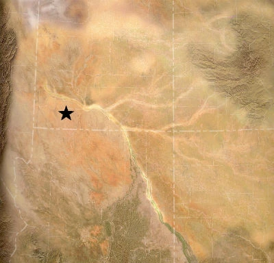
Kayenta paleoenvironment map 200 Ma
Depiction of the Colorado Plateau region during the deposition of the Kayenta Formation, in the Early Jurassic. Location of Zion National Park is starred.

Paleogeographic map courtesy of Ron Blakey, Colorado Plateau Geosystems, Inc.
 
Kayenta Formation outcrop
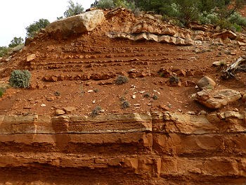
Outcrop of the Kayenta Formation along the Zion-Mt. Carmel Highway switchbacks

NPS photo/Adrienne Fitzgerald

Early Jurassic
~195-185 million years ago

The Kayenta Formation consists of layers of reddish-brown and pink sandstone, and varicolored mudstone and siltstone deposited in streams and rivers within an arid environment.
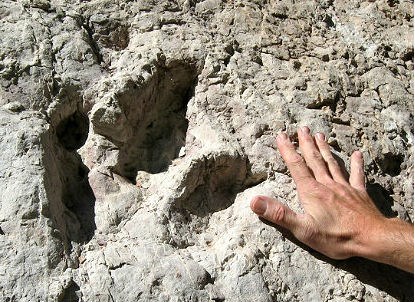
 
three-toed dinosaur track with human hand for scale
Large dinosaur track in the Kayenta Formation

NPS photo/Adrienne Fitzgerald

Similar to the environment of the underlying Moenave Formation, the Kayenta is dominated by mudstones left behind on river floodplains and in small lakes, with thin layers of sandstone that represent actual stream channels. Similar dinosaur tracks are found within both layers as well.


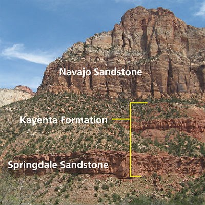
Kayenta Formation with Springdale Sandstone - outcrop
View of Kayenta Formation from the Human History Museum in Zion Canyon

NPS photo/Adrienne Fitzgerald

The Kayenta Formation is visible in lower Zion Canyon and Kolob Canyons as the steep reddish-brown slopes below the giant cliffs.

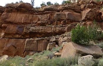
The Springdale Sandstone is considered to be a sub-unit or member of the Kayenta Formation, and was deposited by a main river channel associated with the same river system responsible for the deposition of the Moenave and Kayenta formations. The Springdale Sandstone is visible in lower Zion Canyon as the prominent reddish cliff band above the canyon floor, separating the lower Moenave layer from the rest of the Kayenta Formation.
 
Springdale Sandstone outcrop
Springdale Sandstone Member of the Kayenta as seen from the bottom of the Zion-Mt. Carmel Highway

NPS photo/Adrienne Fitzgerald

The Springdale Sandstone layer provides some of the most dramatic examples of the ongoing erosion occurring at Zion National Park, as the crumbly layers of the underlying Moenave Formation erode and undercut the Springdale Sandstone cliff. Boulders break off of the Springdale with some regularity, and some have even damaged buildings and roads in Zion.


Return to the main Rock Layers page

Last updated: July 6, 2015

Park footer

Contact Info

Mailing Address:

Zion National Park
1 Zion Park Blvd.

Springdale, UT 84767

Phone:

435-772-3256
If you have questions, please email zion_park_information@nps.gov. Listen to recorded information by calling anytime 24 hours a day. Rangers answer phone calls from 11:30 a.m. to 3 p.m. and 3:30 p.m. to 5 p.m. MT, but a ranger may not answer if they are already speaking with someone else.

Contact Us