An official website of the United States government
Here's how you know
Official websites use .gov A
.gov website belongs to an official government
organization in the United States.
Secure .gov websites use HTTPS A
lock (
) or https:// means you've safely connected to
the .gov website. Share sensitive information only on official,
secure websites.
The Zion-Mt. Carmel Highway and Tunnel provides direct access for travel between Bryce Canyon, Grand Canyon, and Zion Canyon. Due to the age of the highway, large vehicle restrictions are in place to protect drivers. Be sure to read up on current restrictions before visiting the park.
Perhaps the most remarkable part of the work is the engineering, and I take off my hat to the men who conceived this almost impossible project and carried it through to a successful conclusion.
Visitors look out from the west end of the Zion-Mt. Carmel Tunnel.
In 1909, President William Howard Taft designated Mukuntuweap National Monument at Zion Canyon using the power granted to him in the 1906 Antiquities Act. The canyon was so remote at this time that it required little protection. However, this also meant that the park lacked the infrastructure needed to support visitation.
In 1916, Congress established the National Park Service (NPS). The first director of the NPS, Stephen T. Mather, set out to improve visitor access to the natural wonders found across the national park system. By promoting road construction, national parks could bring visitors into previously inaccessible areas. Once in the parks, the NPS provided visitor facilities and hotel accommodations for a more comfortable stay. Across the western United States, increasing park development led to extensive visitor growth.
During this development, the NPS adopted a form of architecture meant to harmonize the built environment with the parks' spectacular natural landscapes. Known today as NPS Rustic, the agency constructed buildings such as visitor centers, park staff housing, roads, and trails with local materials that melded the built environment with the surrounding natural environment.
Also in 1916, Senator Reed Smoot of Utah successfully acquired federal appropriations to build roads through Mukuntuweap, the first such money appropriated directly to a park project. During this period, entrepreneurs W.W. Wylie and Gronway R. Parry initiated large scale concessionaire services to support visitation. These two, one-time competitors, joined forces to form the National Park Transportation and Camping Company. The newly established company ran tent camps in the canyon, in addition to providing bus transportation to the park from the railhead in Lund, Utah. Additionally, the concessionaire services provided a ten-day loop tour based out of Cedar City, Utah that visited Zion Canyon, Bryce Canyon, the North Rim of the Grand Canyon, and the Kaibab Plateau.
Mukuntuweap's popularity steadily grew through local promotion, park service backing, and concessionaire advertising. With the location's new reputation, President Woodrow Wilson issued an executive proclamation on March 18, 1918 enlarging the monument from 15,840 acres to 76,800 acres and changing its name to Zion National Monument. The following year, Senator Smoot introduced a bill to elevate Zion National Monument to a national park. On November 19, 1919, President Wilson signed the bill into law establishing Zion National Park as Utah's first national park.
With the designation of Zion as a national park, the park service formed an alliance with both the state of Utah and the Union Pacific Railroad to promote a "Grand Loop" reminiscent of the ten-day trek operated by concessionaires prior to National Park designation. Problems with the earlier loop focused on the route's time-consuming nature, as the route required a significant amount of doubling back. With new loop routes, NPS Director Mather hoped to create a series of national parks in southern Utah linked to the Grand Canyon and the rest of the nation by rail or highway to make the "Grand Loop" the center for American tourism.
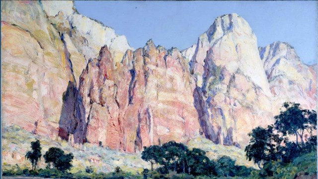
A part of realizing the "Grand Loop" was the construction and completion of the Zion-Mount Carmel Highway and Tunnel. The 25-mile road was a joint effort between the National Park Service, the state of Utah, and the Bureau of Public Roads. A road designed to go where no road had gone before, the Zion-Mount Carmel Highway and Tunnel went up Pine Creek Canyon, through the Navajo sandstone cliffs to the eastern plateau, then across slickrock country.
Over a three-year period, this improbable route presented unique logistical, engineering, and design challenges. Extensive effort and planning were required to incorporate natural materials and colors into a highly engineered, sophisticated, yet rustic construction to ensure that the road blended into the surrounding landscape. The galleries, or windows, within the 1.1-mile tunnel were placed to provide views of Zion Canyon's spectacular beauty. Numerous rustic masonry and wooden bridges, long lengths of expertly constructed rock walls with massive stones, beautiful arched-masonry culverts, and other features are visible along the road.
Scaffolding for placing steel and forms in the first gallery of the Zion-Mt. Carmel Tunnel. Zion Museum Catalog No. 15531-1.
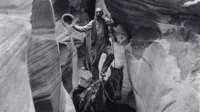
Four different crews from both Utah and Nevada began work on opposite ends of the planned road. On the western side, the Nevada Contracting Company of Fallon, Nevada began carving a series of seven switchbacks from the canyon floor up to the sandstone cliffs above. The soft rock beneath the Navajo sandstone cliffs sloughed away and rockslides were a continuous problem. Large boulders posed a regular threat to workers and had to be blasted into smaller rocks with dynamite to prevent catastrophes. However, accidents did occur. At one point, a rockslide caused a large boulder to roll down over the switchbacks and killed one of the men working below.
As the work from the canyon floor progressed from the west, two crews from companies based in Springville, Utah began cutting a road from the east toward the canyon from Mount Carmel Junction. Facing many challenges of their own, these crews had to continually blast their way through the sea of sandstone slickrock which covers six miles of the park's east side.
Despite the many challenges that the crews encountered, the most significant challenge of the project remained the construction of the 1.1-mile tunnel through the heart of the sandstone cliffs to connect the new road from the east with the switchbacks to the west. The arduous task of constructing the tunnel, undertaken by the men of the Nevada Contracting Company, along with crew bosses from around the country, began with blasting gallery windows into the cliff face above Pine Creek Canyon. From these windows the crews were able to then access the interior of the cliff and progressively bore their way through the rock, ever approaching opposite ends of the cliff where the tunnel would meet the new roads. The gallery windows also served as holes through which rock debris from carving the tunnel could be pushed out and cleared from the work area, as well as supplying much needed ventilation and lighting to crews working inside the tunnel. Once the small pilot tunnel shaft had been cut, work began on widening the tunnel to make it passable for automobiles. Using a combination of drilling and blasting, expanding the width of the tunnel was relatively quick work, although several collapses did occur, and additional structural supports had to be put in place.
Cars travel through the east end of the Zion-Mt. Carmel Tunnel. Zion Museum Catalog No. 10174.
Two years and ten months after the project began, the work was completed, and on July 3, 1930, the Zion-Mount Carmel Highway and Tunnel was officially dedicated and opened to the public. Visitors traveled along the new scenic route in the comfort of an automobile and enjoyed views of the high desert landscape along the way. The once imagined "Grand Circle Tour" of Zion, Bryce Canyon, and Grand Canyon National Parks was now a reality.
Because of the significant planning, skills, materials, and overall design and engineering, the Zion-Mount Carmel Highway and Tunnel is listed in the National Register of Historic Places. In May of 2012, it was designated as an Historic Civil Engineering Landmark by the American Society of Civil Engineers.
Frequently asked questions about the Zion-Mount Carmel Highway & Tunnel
The Zion-Mount Carmel Highway, including the tunnel, was constructed from 1927 to 1930 at a cost of $1,896,000.
The tunnel is 1.1 miles long.
The elevation gain is 800 feet, and the tunnel is approximately five miles from the Zion Canyon Visitor Center.
Today, the tunnel is very similar to how it was upon its completion over eighty years ago. Because the tunnel passes through soft sandstone, it has been reinforced throughout the years. Concrete ribs have been installed to give added support to the tunnel’s entire length.
In 1958, collapse of a sandstone pillar west of Gallery #3 broke the top out of that gallery and flushed tons of debris into the tunnel, causing it to close for several weeks. Because of that collapse, the tunnel is now monitored electronically twenty-four hours a day to warn park officials of potential rockfall danger.
Learn about vehicle size limits on the Zion-Mt. Carmel Highway.
Last updated: May 28, 2026
Park footer
Contact Info
Mailing Address:
Zion National Park
1 Zion Park Blvd.
Springdale,
UT
84767
Phone:
435-772-3256
If you have questions, please email zion_park_information@nps.gov.
Listen to recorded information by calling anytime 24 hours a day.
Rangers answer phone calls from 10 a.m. to 5 p.m. MT, but a ranger may not answer if they are already speaking with someone else.