There are multiple fires burning in Yosemite National Park Wilderness. Each fire is burning in a fire adapted ecosystem. There are currently no threats to infrastructure and all trails remain open. All fires may be visible from Tioga Road, Glacier Point, and from high country vistas. Smoke from each fire is settling locally at night and in the morning, then rising and dispersing to the north and northeast in the early afternoon. Park managers are working with the local Air Quality Districts and will be monitoring smoke impacts to the park and local communities. Smoke from regional wildfires in California is impacting the area reducing visibility.
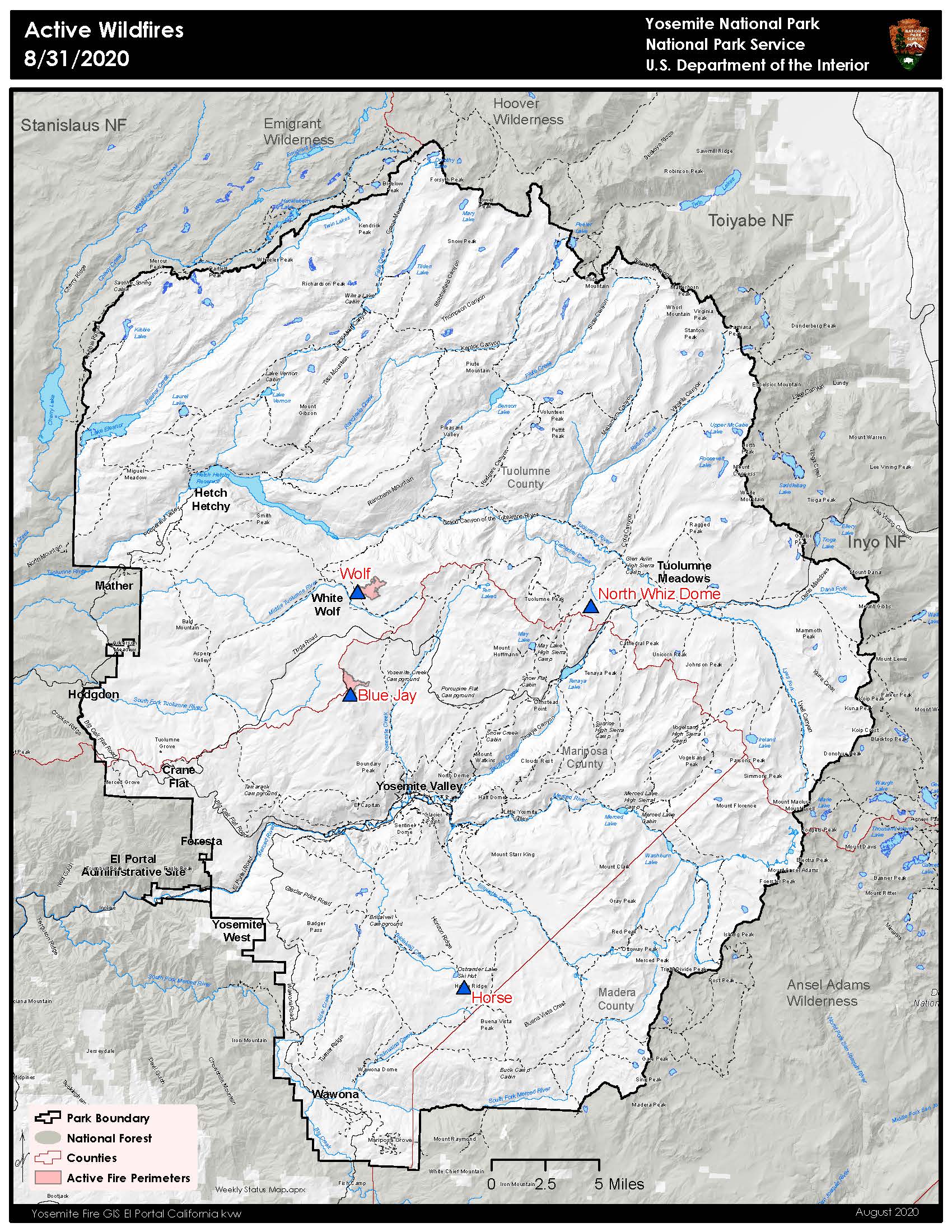
Blue Jay Fire
Location: 4 miles south of White Wolf campground and 1 mile west of Lukens Lake trail at approximately 9,000 feet elevation.
Discovery Date: July 24, 2020
Size: 508 acres
Containment: 15%
Strategy: Confine and Contain
Cause: Lightning
The fire has a 40% active perimeter burning in pockets of accumulated dead and down logs and is creeping and backing with some isolated single tree torching along the active perimeter. When conditions are favorable fire personnel are conducting firing operations to help bring the fire’s edge to natural containment lines.
inciweb.nwcg.gov/incident/6888/
Wolf Fire
Location: 1 mile north of White Wolf campground and 2 miles east of Lukens Lake trail at 9,000 feet elevation.
Discovery Date: August 11, 2020
Size: 494 acres
Containment: 0%
Strategy: Confine and Contain
Cause: Lightning
The fire has an 80% active perimeter primarily on the north and northwest edge. The fire is burning in dense pockets of vegetation and accumulated dead and down logs and is creeping along the forest floor with some isolated single tree torching and short range spotting along the active perimeter.
inciweb.nwcg.gov/incident/7134/
North Whiz Dome Fire
Location: 4/10 mile south of Cathedral Creek and 1 mile northwest of Tioga Road at 8,400 feet elevation.
Discovery Date: August 27, 2020
Size: 2-3 acres
Containment: 0%
Strategy: Monitor
Cause: Lightning
The North Whiz Dome Fire is not currently burning along any trails. The strategy for this fire is to monitor and utilize natural barriers for the fire to burn into, such as granite and bare ground. Fire behavior is actively burning in heavy fuels through ground litter on the forest floor and burning in pockets of accumulated dead and down logs with isolated single tree torching along the active perimeter.
Horse Fire
Location: 1 mile south of Ostrander Lake along Horse Ridge at 9,500 feet elevation.
Discovery Date: August 24, 2020
Size: 2-3 acres
Containment: 0%
Strategy: Confine and Contain
Cause: Lightning
The Horse Fire was ignited by lightning on Aug 24th.Fire is slightly active with low fire behavior. It is not currently burning along any trails and has shown little activity. This will be the last report unless conditions change.
For the most up-to-date fire information follow Inciweb: https://inciweb.nwcg.gov/