Crystal Creek Water Ditch

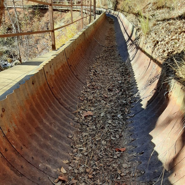
Metal flume and narrow boardwalk section of Crystal Creek Water Ditch and Trail.

Difficulty Level

Easy, Flat.
Dirt surface.
Trail width of 3 to 4 feet.
Hiking Only; No bicycles, horses, or pack animals.
Doges required to be on leash.

Length

1 mile one way

Elevation

1,400 to 1,420 feet.

Enter at your own risk

The Carr Fire burned through 97% of the park’s forested lands in the summer of 2018. Be aware of hazards created by the fire, including falling trees and limbs, burned out stump holes, abandoned mine features, and loose rocks.Watch the weather and do not hike if rain is forecast. Rainstorms present the possibility of flash flooding, landslides and debris flows in the fire area. Stay on established roads and trails and report hazards to park dispatch, (530) 242-3431.

Directions

From Highway 299, turn onto Crystal Creek Road. Follow the road just 100 meters up to the first gravel pullout on the left. This is the trailhead for Crystal Creek Water Ditch Trail. Be sure and lock your vehicle and take your valuables with you. Please display your entrance pass on your dashboard.

Trail Description

From the trailhead, take the short stairway down to the water ditch. The trail is flat and parallels this historic water ditch the entire rest of the way.
At the bottom of the stone stairway, you can view the remnants of the cleanout shed. While the wooden components of this structure were unfortunately burned in the Carr Fire in 2018, you can still see the cement foundations. Reconstruction of this structure and restoration of the mechanism is planned in the near future. Charles Camden’s daughter, Grace, had the cleanout shed built in 1913. It featured an ingenious water-powered rotary rake that removed pinecones, leaves and other debris from the flowing water before it entered what was a large wooden flume crossing Willow Creek.

About 200 yards from the cleanout shed is the first of seven drainage crossovers, or flumes, that allow seasonal runoff from small gullies to cross, but not flood, the ditch.

The tumbling of Crystal Creek can be heard and seen all along the trail since the Carr Fire burned most of the previously dense vegetation. Various stone retaining walls support the ditch along the way.

You come to a section of trail where the hillside is too steep to support a ditch, even with retaining walls, so a 250-foot long narrow boardwalk and flume was built (see photo at above right). The boardwalk rests about 25 feet above the creek and may be challenging to those who have a fear of heights.

The trail ends at the intake and coffer dam which historically channeled part of the creek’s flow into this historic waterway. When ready, turnaround and follow the trail back to the trailhead.

 
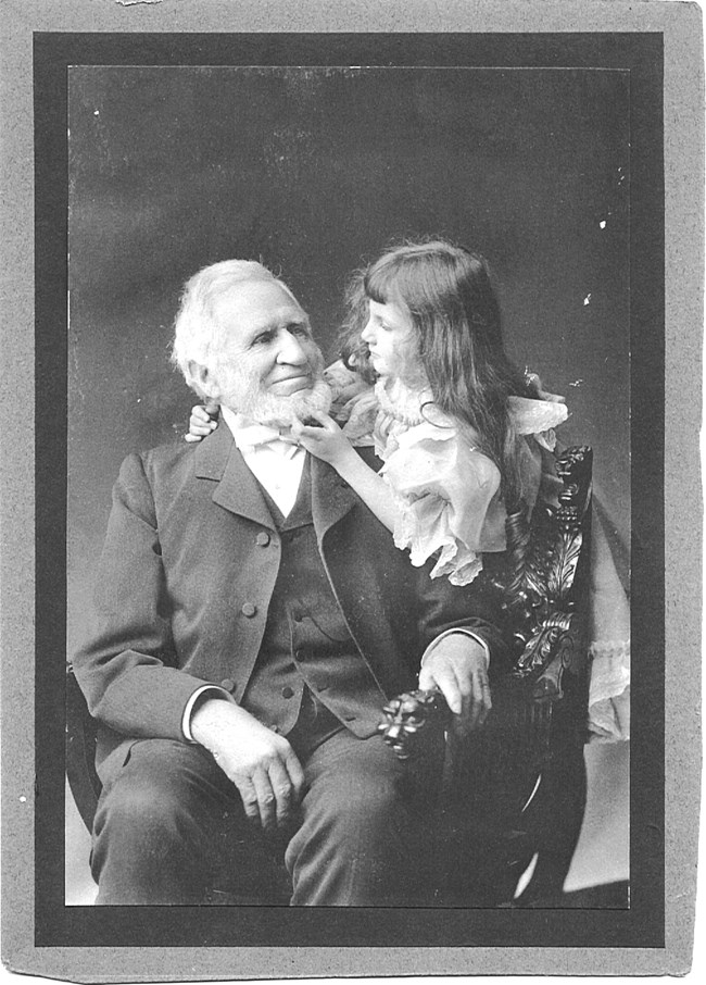
Charles Camden and grandaughter Philena Wetmore, circa 1905.
Charles Camden and granddaughter Philena Wetmore, circa 1905. Charles owned the land and had Crystal Creek Water Ditch built in the mid-1850s. He and his family lived just downstream in the Camden House for decades.

Historical Background

“Between 1855 and 1858 I made the upper ditch from Crystal Creek down to the Tower house…” wrote Charles Camden in his autobiography written in 1900. Then, as now, water was a precious resource in a land where generally no rain falls from June through October. Camden claimed water rights to Crystal Creek and Mill Creek. He hired laborers to construct ditches to supply water to his sawmill on Mill Creek and to his scattered mining claims nearby. Originally, the retaining walls, trestle and flume were made of timber, presumably milled at the sawmill, which was operating by 1853.

Operating entirely by gravity, the ditch system drops some 41 feet in elevation over a distance of approximately 2 miles. The ditch also provided water to the homes, orchard and fields of what we now call the Tower House Historic District. Camden sold the surplus water profitably to other miners. The trail follows only about the first third of the original ditch, from the cleanout shed to the coffer dam. The ditch continues past the cleanout shed, across the creek through a large, suspended pipe, called an inverted siphon, and underneath what is now Highway 299. The steel pipe and concrete abutments you see straddling Willow Creek were constructed around 1930. The force of the water propelled it up the hillside to a redwood tank, which was lost in the Carr Fire of 2018. Some of the water was stored in the tank for use in the yard of the Camden house and some was used to irrigate the fields along the French Gulch Road.


Ditch Engineering

Water is introduced into the ditch by means of a concrete diversion dam and intake across Crystal Creek, which you find at the end of the trail. The dam pooled water to an elevation where it spilled into the ditch inlet through a concrete gate structure. A wooden baffle could be raised or lowered in the slots for controlling the flow rate. Some 50 feet downstream of the inlet, the ditch widens into an elongated settling basin. The increased cross-sectional area decreased the velocity and allows silt, sand and small pebbles to settle. Farther on is a concrete sluice. The float at the end acted as a flow controller and diverted excess water through the overflow and back into Crystal Creek. The sluice discharged into a short tunnel carved through the steep stone hillside, a testament to the determination of the ditch makers. The final engineering element represents a hydropower generator. The concrete structure provided a housing for an undershot water wheel and water flow control. The power was transported to the French Gulch area to support mining operations in the 1930s and 40s.

Last updated: March 8, 2024

Park footer

Contact Info

Mailing Address:

P.O. Box 188
Whiskeytown, CA 96095

Phone:

530 242-3400

Contact Us