Image courtesy of George A. Smathers Library University of Florida 
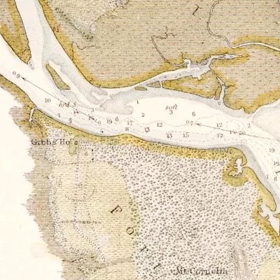
Image courtesy of the State Archives of Florida, Florida Memory Union Naval commanders had little firsthand knowledge of the St. Johns River when they arrived in March of 1862. Therefore the blockading fleet relied on three main sources to get their bearings; United States Coast Survey navigational maps, local pilots, and fugitive slaves. Although Kingsley Plantation was clearly listed on their navigational charts, a December 27, 1862 Union Naval report of an overland expedition on Fort George Island seemed to indicate surprise when they "discovered quite an extensive plantation." The unexpected locating of the plantation indicates that the Union ships had been busy in the eight months since their arrival with their primary duties of blockading, preventing Confederate attempts to establish control of the river, and aiding the increasing numbers of fugitive slaves that approached them for help. Had the Union Navy accessed the Fort George River to the north of island, the plantation would have been easily viewed from the water. However, the Union's lack of experience along the St. Johns often prevented them from being able to effectively negotiate the shallow waters around Fort George and Batton Island. Two Union ships ran aground at Sisters Creek, along the western border of Fort George and Batton Islands, while engaging Confederate forces entrenched at nearby Yellow Bluff in October 1862. Even with the use of local pilots these waterways could be dangerous. A Union soldier remarked in his memoirs of the "many wrecks" along Batton Island "which had been strewn upon the beach, victims of the most formidable of the Southern river-bars." Regardless of the treacherous waters surrounding Fort George Island, it is still curious that the plantation's location was not known to the Union due to the common practice of gathering local intelligence from fugitive slaves and even enlisting them into military service. For example, two local contraband helped in the establishment of the blockade in March of 1862 by informing the Union about the Confederate defenses near the mouth of the river. Considering that the impetus for the Union excursion on Fort George Island had been to ensure the safety of nearby contraband against Confederate attack, it is strange that the locating of Kingsley Plantation was unanticipated.
Whatever knowledge the Union possessed of Kingsley Plantation's existence was quickly lost. In early 1863, a joint Union Army-Navy operation with the purpose of raiding plantations along the St. Johns paused for several days at the river mouth. Although this expedition used local Jacksonville area contraband as soldiers and had men posted on Fort George and Batton Islands, Kingsley Plantation was not disturbed. Likely this was the result of the mission focus on plantations in areas to south of Jacksonville as well as the plantation being obscured from view along the St. Johns. From Mayport, a Union soldier described climbing the lighthouse "to see what there was about," revealing "a fine view out to sea, but there was little to be seen on land as the ground seemed to be higher on both shores of the river and was covered with forest."

Image courtesy of the Library of Congress The Union expedition that stumbled upon Kingsley Plantation in December 1862 had sought to prevent a Confederate attack originating from Fort George Island. The previous summer and fall had witnessed the construction of Confederate forts to contest Union control of the river at nearby Yellow Bluff and St. Johns Bluff. Confederate forces had also become distressed about the large number of fugitive slaves seeking Union protection around the river mouth, resulting in the formation of small guerilla units to serve as slave patrols. In addition to returning captured contraband, these guerilla units used violence and intimidation against loyal Unionist whites suspected of aiding fugitive slaves as well as joining with conventional Confederate forces to attack the Union base at Mayport. Though no existing Confederate records explicitly place these irregular units around Kingsley Plantation, the indirect evidence of their presence abounds. Concerned Unionist whites and contraband had abandoned or been removed from Fort George and Batton Island several times during the war and Union accounts on the island throughout 1862 record a near constant fear of "surprise attacks." In the two months before the mission on Fort George Island, a Union Naval commander echoed this anxiety reporting several times to superiors that "guerillas are still in numbers on each side of the river" and "they have even approached the vicinity of the entrance of the harbor." The exact amount of Confederates in the area would have been difficult for the Union to ascertain. The accurate firepower that Union gunboats could deliver often kept Confederate forces out of sight and operating just inland of the river, making an attack from the interior of Fort George Island a likely scenario.
|
Last updated: July 21, 2020