Last updated: January 11, 2024
Thing to Do
Under-the-Rim Trail
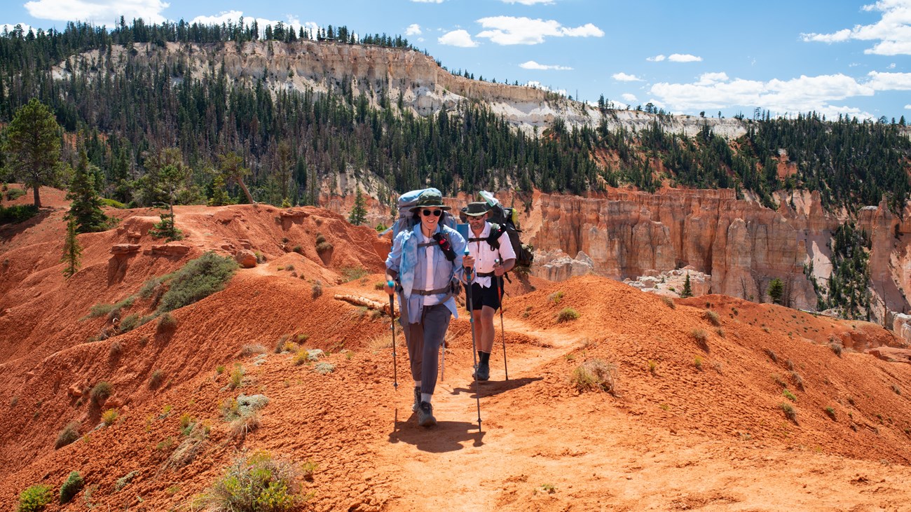
Bryce Canyon's backcountry trails offer forests and meadows, stunning views of distant cliffs, and solitude. However, hoodoos are best experienced along our frontcountry trails in the main amphitheater area. The Under-the-Rim trail connects Rainbow Point in the south to Bryce Point in the north. Three connecting trails intersect this trail at the Agua Canyon, Whiteman Bench, and Swamp Canyon trailheads. Permits are not required to hike this trail, but all overnight stays require a permit.
- Trailhead: Rainbow Point or Bryce Point.
- Parking: At trailheads; oversized vehicles permitted at Rainbow Point but are not permitted at Bryce Point when the shuttle is in operation
- Distance: 22.9 miles (36.9 km)
- Approximate Time: 2-3 days
- Elevation Gain: 5500 feet (1676 meters)
- Difficulty: Strenuous
- Services: None along the trail. Accessible restrooms can be found at Rainbow Point.
- Shuttle Service: Yes, to Bryce Point. No shuttle to Rainbow Point, although Private options may be available.
- This trail may be inaccessible during mid-winter due to snow depths ranging from 2-15 ft. (.7-5 m)
- Pets are not allowed on this trail. Service animals are allowed in national parks. What is a service animal?
- Backcountry camping is permitted only in designated backcountry campsites and all overnight backcountry stays require a permit.
Details
Duration
2-3 Days
Activity
Backcountry Hiking
Pets Allowed
No
Activity Fee
No
Entrance fees may apply, see Fees & Passes information.
Location
Rainbow Point
Typically this trail is hiked south-to-north (Rainbow Point to Bryce Point).
Reservations
Yes
Day-hiking this trail does not require a permit but all overnight backcountry stays require a permit.
For more information please visit our Backcountry Information page.
For more information please visit our Backcountry Information page.
Accessibility Information
This is a backcountry trail with natural terrain and is not considered an accessible trail.
- Surface Type: Firm Native Sediment
- Total Ascent: 5500 feet (1676 meters)
- Length: 22.9 mi (36.9 km) roundtrip