Last updated: December 28, 2025
Thing to Do
Hike Cathedral Valley

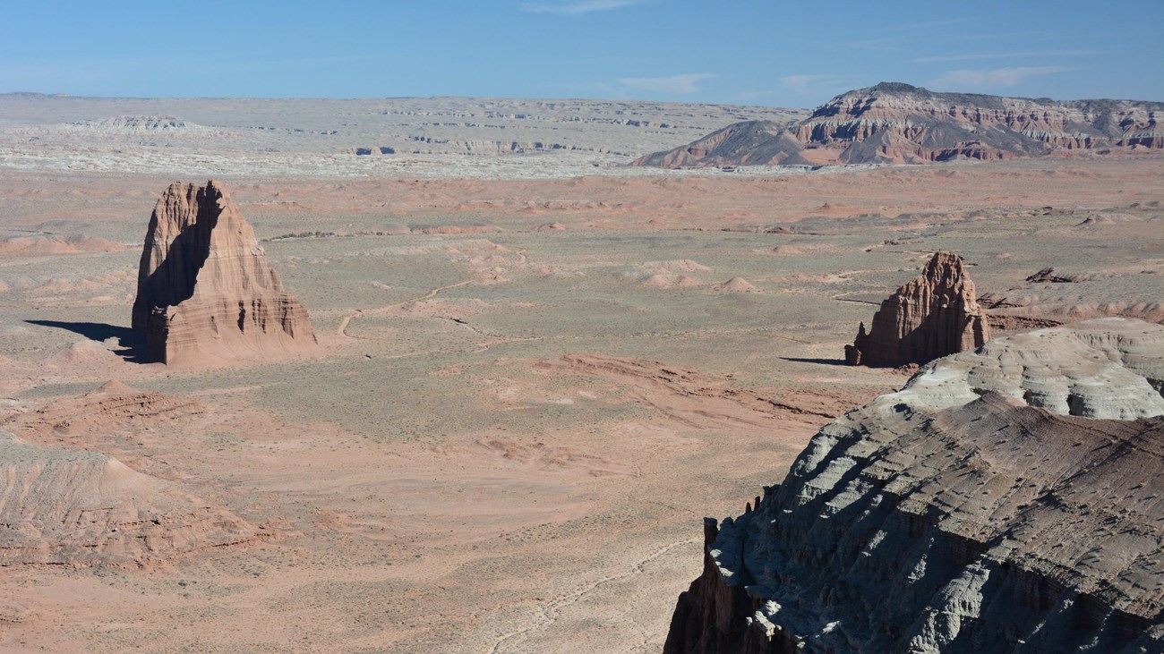
NPS/ C. Roundtree
These routes are not official, maintained trails. Route conditions including obstacles in canyons, change frequently due to weather, flash floods, rockfall, and other hazards. Routefinding, navagation, and map-reading skills are critical. Do not rely solely on unofficial route markers (rock cairns, etc.); they are not maintained by the National Park Service (NPS), may not indicate the actual route in this description, or may be absent. Leave no trace of your visit.
Roads in this area are maintained infrequently and are not plowed in winter. Some sections of road cross areas of bentonite clay, which becomes impassable when wet. Deep, soft sand may also exist on roads. Roads may occasionally require four-wheel drive, and may quickly become impassable due to wet weather. At the south end of the Hartnet Road near Highway 24, vehicles must ford the Fremont River; there is no bridge over the river. Do not attempt to cross the river during floods or other periods of high water. Ask at the visitor center about river ford conditions or call 435-425-3791. Press 1 for more information; press 4 for road conditions.
Check this weather forecast specifically for Cathedral Valley and road reports before departing. Be prepared for changing conditions. Let others know your travel plans, especially if exploring backcountry areas. Carry extra food, water, and appropriate clothing. Stay hydrated, and limit exposure to desert sun. Have a self-rescue plan. Beware of storms that may cause sudden flash floods, and avoid travel in narrow canyons if rain is approaching. Do not walk or drive across flooded roads or trails - play it safe and wait until floodwaters subside. You are responsible for your own safety.
A PDF version of this information can be downloaded and printed.
Route Descriptions
Jailhouse Rock and Temple Rock Route
4.5 miles (7.3 km) round trip
2-3 hours
Moderate
Starting at the Lower South Desert Overlook (15.2 miles [24.5 km] northwest of Highway 24 via the Hartnet Road), an old road leads to a viewpoint that overlooks Jailhouse Rock, a large promontory rising from the valley floor. To continue on to Temple Rock, follow the switchbacking track until it disappears along the valley floor. A faint single track then leads around the north side of Jailhouse Rock across the South Desert and rejoins the road before reaching a low passage between volcanic dikes. Ascending the dike on the left provides a vantage point for viewing Temple Rock, an eroded monolith of Entrada sandstone. It is roughly 2.3 miles (3.7 km) from this point back to the trailhead.
Lower Cathedral Valley Overlooks Route
1.5-2.5 miles (2.5-3.9 km) round trip
1-2 hours
Moderate
While most visitors look up at the Temples of the Sun and Moon from below, this hike offers a bird's eye view of the two monoliths. Access is from the Hartnet Road, 17.6 miles (28.3 km) from Highway 24. A wooden sign with a diagram of the ridge ahead marks the start of the route. Follow the faint path to the north across a brushy flat, then climb a short, steep pitch to the rim of a saddle that affords views of Lower Cathedral Valley to the north. A second saddle to the east can be accessed by returning to the base of the cliffs and turning east, following a sandy wash to a point level with the low pass to the north. While there is no reliable trail connecting the two saddles, there may be a faint track guiding hikers between the viewpoints. It is roughly 0.9 mile (1.4 km) between the two saddles. From here, traverse cross-country back to the trailhead, completing a 2.5 mile loop.
Upper South Desert Overlook
0.4 mile (0.6 km) round trip
<30 minutes
Moderate
This short path affords views of the upper reaches of South Desert, flanked on the north side by steep cliffs, and the Henry Mountains to the east. A short spur road leaving the Hartnet Road 27.1 miles (43.6 km) from Highway 24 provides access to the trailhead. After a short stretch across relatively level terrain, the footpath climbs steeply to the top of a rocky outcrop with a 360-degree panorama.
Upper Cathedral Valley Overlook
0.2 mile (0.3 km) round trip
<30 minutes
Easy
Approximately 27.4 miles (44.1 km) from Highway 24, a dirt track departs the Hartnet Road, heading north 0.3 mile (0.5 km) to the trailhead. A short, rolling trail leads to an excellent view of Upper Cathedral Valley. The panorama is highlighted by a line of monoliths in the valley below known as the Cathedrals.
Morrell Cabin Trail
0.4 mile (0.6 km) round trip
<30 minutes
Easy
This short hike begins 1.8 miles (2.9 km) north of the junction of the Hartnet and Cathedral Roads, at the base of a series of steep, rocky switchbacks, approximately 28.1 miles (45.2 km) from Highway 24 (via the Cathedral Road). Follow an old road 0.2 mile (0.3 km) to Lesley Morrell's historic cabin, used as a seasonal camp for local cowboys from the 1930s until 1970. The cabin is now listed on the National Register of Historic Places. Visitors may peer through the windows to see the interior. To the south are the remains of a small corral near the edge of a nearby wash.
Cathedrals Trail
2.4 miles (3.9 km) round trip
1-2 hours
Easy
This 2.4 mile (3.9 km) out-and-back hike follows a low ridgeline that parallels a line of monoliths known as the Cathedrals. The trailhead is on the Cathedral Road, 27.4 miles (44.1 km) from Highway 24, or 2.4 miles (3.9 km) north of the Hartnet Road junction. A small wooden sign marks the start of the trail, which begins with a short, steep ascent, followed by a relatively level walk along the gentle ridge to the west. A small hill at the trail's end provides a broad view of the Cathedrals and Upper Cathedral Valley.
Additional Information
Best Season:
Spring and fall.
Maps:
USGS 7.5-minute series: Cathedral Mountain, Fruita NW. Maps available at the visitor center.
For more information:
Call the Capitol Reef Visitor Center at 435-425-4111.

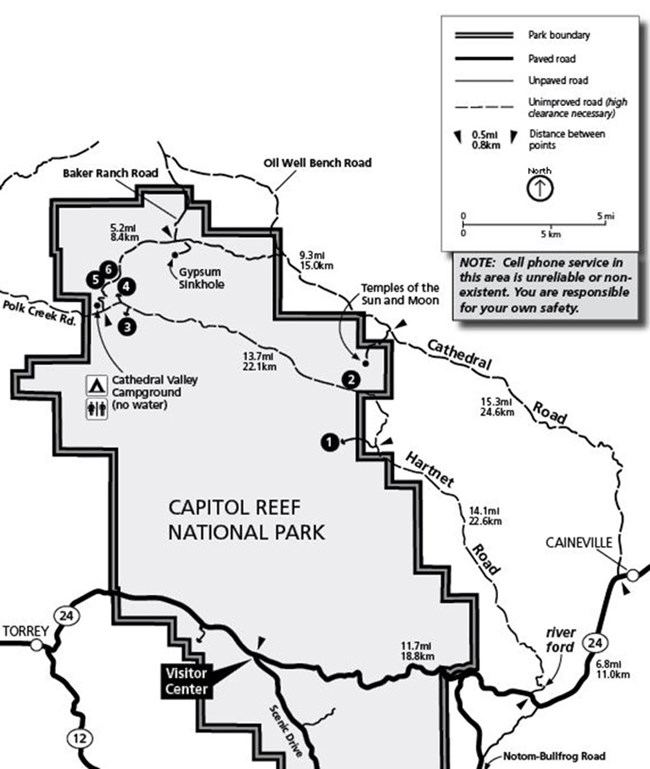
Trailhead Location Map
- Jailhouse Rock/ Temple Rock Route (Lower South Desert Overlook)
- Lower Cathedral Valley Overlook Route
- Upper South Desert Overlook
- Upper Cathedral Valley Overlook
- Morrell Cabin Trail
- Cathedrals Trail
Driving distances from Highway 24/ Hartnet Road junction
| Miles | Km | |
| Lower South Desert Overlook | 15.2 | 24.5 |
| Upper South Desert Overlook | 27.2 | 43.7 |
| Upper Cathedral Valley Overlook | 28.5 | 45.8 |
| Cathedral Valley Campground | 28.1 | 45.2 |
| Morrell Cabin trailhead | 29.5 | 47.5 |
| Cathedrals Trail | 30.2 | 48.6 |
| Gypsum Sinkhole | 33.0 | 53.3 |
| Temples of the Sun and Moon | 42.3 | 68.1 |
Driving distances from Highway 24/ Cathedral Road junction
| Miles | Km | |
| Temples of the Sun and Moon | 17.1 | 27.5 |
| Gypsum Sinkhole | 25.6 | 41.1 |
| Cathedrals Trail | 27.4 | 44.1 |
| Morrell Cabin trailhead | 28.1 | 45.2 |
| Cathedral Valley Campground | 29.5 | 47.5 |
| Upper Cathedral Valley Overlook | 30.6 | 49.1 |
| Upper South Desert Overlook | 31.0 | 49.8 |
| Lower South Desert Overlook | 45.2 | 72.6 |
