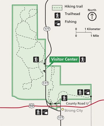
NPS Image CarThe preserve is in northern Chase County, Kansas, 2 miles north of intersection U.S. Hwy 50 and Flint Hills National Scenic Byway 177 (K-177) west of Strong City. Watch for brown attraction signs. Plan your trip with the Alternative Fueling Station Locator from the Department of Energy.
ParkingThe preserve has 4 parking lots and 5 hiking trailheads. Most parking lots are within a 5 minute drive of the Visitor Center. The Visitor Center accommodates the most vehicles with 5 accessible spaces during business hours and 3 spaces after hours. Buses and trailers can pull through at the Visitor Center parking lot. Other lots require turning around. Visitation peeks during major holiday weekends such as Memorial Day, July 4th, and Labor Day. Ample parking exists most of the year. The Visitor Center is off K-177. The 60 mph highway has no shoulder, sloped drainage, blind hills, and infrequent driveways. Visitors are discouraged from parking or walking along the highway. K-177 receives moderate semi traffic through the day and low traffic at night. AirplaneKansas City International AirportFrom the Kansas City / Overland Park area, travel southwest on I-35 to Emporia, KS. At Emporia travel 16 miles west on U.S. Hwy 50 and north for 2 miles on K-177. Wichita Dwight D. Eisenhower National AirportFrom airport, travel east U.S. Hwy 54 / U.S. Hwy 400 through Wichita. Travel northeast on I-35 (Kansas Turnpike) to Cassody (exit 92). Travel north on K-177 for 25 miles to Strong City. Travel slow and watch for the K-177 sign in downtown Strong City. Turn left and continue to follow K-177 west, curving north as it crosses over U.S. Hwy 50. Travel north 2 miles on K-177 and watch for the small brown attraction sign and buildings on the left side of the highway. If you miss the K-177 sign in Strong City, travel north through the town. All north/south streets run into U.S. Hwy 50. Turn west (left) on U.S. Hwy 50, travel approximately 1 mile, watching for large brown attraction sign. Take the exit (right turn) and travel north on K-177 for 2 miles. The preserve is on the west (left) side of the highway. 
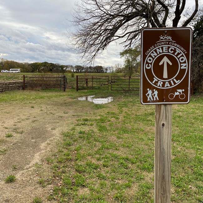
NPS Photo BicycleThere is no cycling allowed within the preserve. Bike racks are located at the Visitor Center and Bottomland Nature Trail parking areas. The Chase County Community Connection Trail runs from Chase County courthouse in Cottonwood Falls 2 miles into Strong City. Downtown Strong City is 1 mile from the Bottomland Nature Trail parking area. From the west end of Sixth Street and Pine Street, go north to the trail underpass. After crossing under the highway, turn left on country road 227. The parking area with comfort station is visible. The Visitor Center is 3 miles north via KS-177, a 60 mph highway with no shoulder. KS-177 commonly has semi-trucks and light to moderate traffic. On FootWalkers can travel from downtown Strong City 1/2 mile to Two Section Trail via the west end of Sixth Street and trail underpass. Bottomland Nature Trail is 1/2 west along country road 227. This gravel road has low, mostly local traffic. The Bottomland Nature Trail connects with the Fox Creek Trail system. The Visitor Center is 3 miles north along the Fox Creek Trail. Maps are posted along the trail. |
Last updated: July 29, 2024
