
Directions and Maps
Need directions to the Visitor Education Center or other areas of interest from the Home Front? 
Operating Hours
The Visitor Education Center hours and operations can be found here. 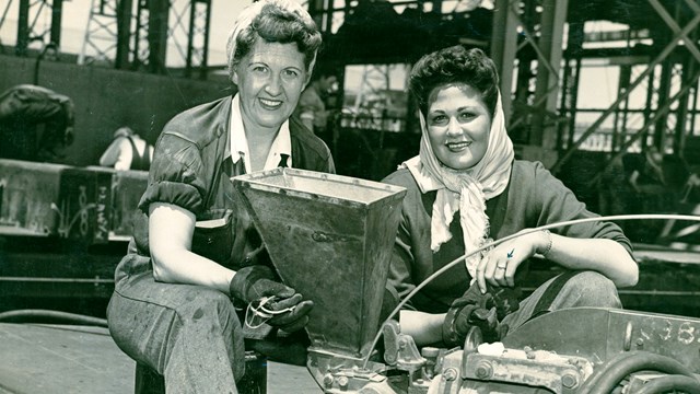
History and Culture
Looking to learn more about the WWII Home Front? Start by clicking here. Discover Richmond's WWII Heritage: Over 20 Sites to ExploreWhy WWII History Captivates UsWorld War II profoundly shaped the world we live in today. The era's stories of resilience, innovation, and diverse experiences offer timeless lessons that continue to resonate. Whether you're drawn to the social changes on the home front or the global impact of the war, there's always something compelling to uncover. As you explore Richmond's significant WWII sites, you'll gain a deeper appreciation for the city's rich history and its vital connection to this pivotal era. As you explore this page: You'll find a comprehensive list of WWII sites that hold historical significance in Richmond. We recommend beginning your journey at the park's visitor center, where you can pick up a printed map, get help with the NPS app, or ask questions about directions and specific locations. Take a self-guided tour at your own pace: Experience Richmond's historic WWII sites. Please be aware that not all sites are fully accessible; many can only be viewed from the outside due to their historic condition, locations, or private ownership. Some sites may require reservations, so please plan accordingly. These locations are crucial to understanding both Richmond's history and the broader WWII narrative. For inquiries about specific sites, contact the Visitor Education Center at 510-232-5050 ext. 0. 
NPS photo/Luther Bailey Rosie the Riveter Visitor Education CenterAccess:Free entrance. Explore exhibits, watch park films, and engage with rangers and docents. Visitor Center Address:1414 Harbour Way South, Days and Hours:Open daily from 10:00 AM to 5:00 PM. Directions to the Visitor Center:Housed in the "Oil House" - Park of the Historic Ford Assebmly PlantThe Historic Oil House, now the Visitor Education Center for the Rosie the Riveter/World War II Home Front National Historical Park, embodies a legacy of industrial and wartime transformation. Originally built to support the Ford Assembly Plant, the Oil House was essential for storing fuel that powered the production of Ford automobiles, a cornerstone of early 20th-century automotive innovation. During World War II, the plant shifted from automobile production to manufacturing jeeps and tanks, crucial for the Allied war effort. The Oil House continued its vital role, storing the fuel needed to maintain this critical production. Situated on the edge of San Francisco Bay, adjacent to the historic Craneway—once a loading dock for the Ford Assembly Plant—the Oil House reflects the architectural and industrial ingenuity of its era. The Craneway, now repurposed, stands as a striking feature of modern use. In 2012, the Oil House underwent a significant renovation to become the Visitor Education Center. This project preserved the building’s historical character while modernizing it to serve its new educational role. The renovation balanced the preservation of its historic integrity with the need for contemporary functionality. Today, the Visitor Education Center offers an immersive educational experience, showcasing the vital contributions of American civilians on the World War II home front. As the gateway to the Rosie the Riveter/World War II Home Front National Historical Park, the Oil House provides engaging exhibits, educational programs, and interpretive displays that bring to life the stories of resilience, innovation, and unity from this pivotal era. Short on Time? Start with these Four Significant Sites:For detailed information, click on each link

Ford Assembly Plant
The Ford Assembly Plant is part of the historic WWII Home Front. 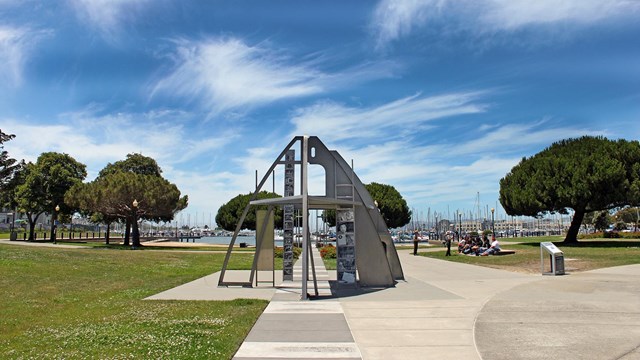
The Rosie the Riveter Memorial
Visit the Rosie the Riveter Memorial. Click for more information. 
SS Red Oak Victory Ship
Visit the SS Red Oak Victory Ship, which is docked in the Richmond Shipyard. 
Historic Richmond Shipards Overview
Learn more about the role that Richmond shipyards played in WWII. The Official NPS App Provides a Self-Guided TourFor those who wish to explore beyond the visitor center or engage with our audio programs, the official NPS app is an excellent resource. The app includes:
Step-By-Step NPS App GuideNew to the NPS app? Use our Detailed Access Guide to get started and make the most of your visit. Historic Kaiser Shipyard No. 3: What to See?Richmond's Kaiser Shipyard No. 3 offers visitors a chance to explore various historical sites that played a crucial role during World War II. Key attractions include the SS Red Oak Victory Ship, a preserved Victory ship that served in the Pacific Theater, and the Machine Shop, which highlights the advanced manufacturing techniques used during the war. Visitors can also see the General Warehouse, where essential ship supplies were stored and distributed, and the Whirley Crane, a massive structure used to lift heavy ship components. These sites collectively provide a comprehensive look into the shipyard's significant contributions to the war effort and the daily lives of the workers who supported it. At Kaiser Shipyard No. 3, you can see:
To learn more about the site, please select one of the graphic images below. Kaiser Shipyard No. 3 Information
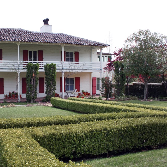
Historic Sites for WWII Housing, Childcare and EducationAtchison Village, Nystrom Village, Nystrom School, and Maritime Child Development Center During World War II, Richmond saw the creation of Atchison Village and Nystrom Village to accommodate the influx of shipyard workers, providing essential housing and community services. Atchison Village offered durable homes and amenities, while Nystrom Village addressed similar needs for comfortable living spaces. Nystrom School was established to educate the children of these workers, ensuring stability and normalcy for families during the war effort. Additionally, the Maritime Child Development Center provided childcare and early education, allowing parents to focus on their work while knowing their children were cared for. These initiatives reflect the comprehensive support systems developed to maintain workforce productivity and morale during a critical period.

Kaiser Permanente Heritage Resources. The Historic Kaiser Field Hospital: Pioneering Pre-Paid Medical CareAccess: This building is privately owned and uninhabited. It can be viewed from the outside, only. The Birth of Pre-Paid Medical CareHenry J. Kaiser's groundbreaking idea of providing pre-paid medical care was initially aimed at ensuring that his workforce could meet the rigorous demands of wartime production. This system quickly proved beneficial, extending beyond the workers to their families and setting a precedent for future healthcare models. For many workers, this innovative approach marked the first time they had access to regular medical care, fundamentally transforming their lives and well-being. Today, the concept of pre-paid medical care is a central pillar of American healthcare, a lasting legacy of the WWII Home Front. The Kaiser Field HospitalThe Kaiser Field Hospital played a crucial role in this pioneering healthcare system. Opening with only ten beds, the hospital rapidly expanded its capacity to 160 beds by 1944, reflecting the increasing demand for medical services as the war effort intensified. The Field Hospital served as the second tier of emergency treatment for those injured in the shipyards. Modern InfluenceThe Kaiser Field Hospital continued to operate as a vital part of the Kaiser Permanente healthcare system long after the war, providing medical services to countless individuals until its closure in 1995. The building, which still stands today, is privately owned, serving as a historical landmark that commemorates the innovative spirit and forward-thinking approach of Henry J. Kaiser. 
NPS photo/Luther Bailey Richmond Fire StationAcccess: Working fire station. View from outside only. 
Photo: Annamarie Morel Filice and Perrelli CanneryAccess: Currently an operating business. No inside tours. Visible from outside only. World War II and the Cannery BoomThe onset of World War II brought a dramatic shift in the fortunes of the Perrelli Cannery. The war effort created new demands for food supplies, and the cannery secured lucrative contracts to provide tomatoes and fruits to the military. This influx of government contracts not only ensured the survival of the cannery but also led to a period of significant growth. During the peak season, the cannery employed up to 1,200 workers, many of whom were essential to maintaining the high levels of production required to meet military needs. Impact on the Italian-American CommunityDespite this economic boom, the war also brought challenges, particularly for the Italian-American community that formed a large part of the cannery’s workforce. Many of these workers, including the founders, were of Italian descent and were deeply affected by wartime policies. In response to security concerns, Richmond was designated a “defense prohibited zone.” This designation imposed strict restrictions on non-citizens and those of Italian descent, many of whom lacked U.S. citizenship despite having lived in the country for years. The Resilient History of the Perrelli CanneryThe building that once housed the Perrelli Cannery still stands on Harbour Way, serving as a tangible reminder of Richmond’s industrial heritage and the rich history of its immigrant communities. This structure embodies the perseverance of the business and the people who worked there through some of the most challenging periods in American history. The story of the Perrelli Cannery is one of adaptation and resilience, highlighting the profound impact of historical events on local communities. Its ongoing presence in Richmond’s historical narrative underscores the vital contributions of immigrant workers to the city’s industrial success and the lasting effects of wartime policies on these communities. 
Photo: Ellen Gailing Macdonald AvenueAccess: Macdonald Avenue is the main business street of Richmond. There are multiple shops and businesses. Visitors may explore on their own. 
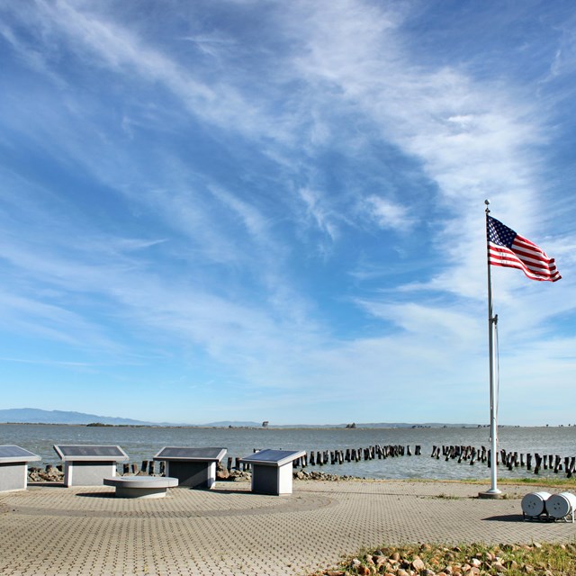
Annamarie Morel Lucretia Edwards Shoreline ParkAccess: Open park location. 
Photo: Annamarie Morel Barbara and Jay Vincent ParkAccess: Open park. Observe posted park hours. 
Annamarie Morel Shimada Friendship Park: A Symbol of Peace and International RelationsAccess: Open park. Observe posted park hours. Historical Context and EstablishmentThe sister city relationship between Richmond and Shimada was established in the early 1960s, a period marked by a global push for international cooperation and peace in the aftermath of World War II. The sister city program, initiated by President Dwight D. Eisenhower in 1956, aimed to foster global peace and mutual understanding through cultural and economic exchanges between U.S. cities and cities around the world. Features of Shimada Friendship ParkPeace Garden: At the heart of the park is a beautifully landscaped peace garden, designed to provide a tranquil space for reflection and relaxation. The garden features traditional Japanese landscaping elements, including meticulously maintained plants, a koi pond, and stone lanterns. These elements create a serene atmosphere that invites visitors to reflect on the values of peace and friendship. Historical SignificanceThe establishment of Shimada Friendship Park is a testament to the enduring commitment of Richmond and Shimada to promote peace and understanding through cultural exchange. The park not only commemorates the sister city relationship but also serves as a living reminder of the power of international friendship in fostering global harmony. Future AspirationsAs Shimada Friendship Park continues to evolve, it remains a focal point for promoting peace and cultural exchange. Future plans for the park include expanding the cultural exchange pavilion, adding more educational programs, and enhancing the peace garden with additional traditional Japanese elements. These improvements aim to further enrich the visitor experience and strengthen the cultural ties between Richmond and Shimada. Richmond Marina Bay TrailExploring the San Francisco Bay Trail on the Richmond Waterfront Interpretive Markers and Historical InsightsAs you travel along the Bay Trail, you will encounter eight interpretive markers shaped like ship’s prows. These markers are strategically placed along the trail and offer fascinating insights into the World War II home front. Each marker tells a different story, expanding on the histories presented at the Rosie the Riveter Memorial. These stories provide a deeper understanding of the contributions and experiences of those who worked on the home front during the war, making your journey both informative and engaging. Connecting Key SitesThe Bay Trail is an excellent way to enjoy a leisurely walk or bike ride between several notable sites: Enjoying the Bay TrailThe San Francisco Bay Trail extends for many miles around the Bay, offering numerous opportunities for outdoor recreation and exploration. Whether you’re looking for a short walk or a longer bike ride, the trail provides a beautiful and accessible way to experience the Richmond waterfront. The trail's flat, well-maintained paths are suitable for visitors of all ages and abilities, making it a popular choice for families, fitness enthusiasts, and history buffs alike. Sheridan Observation PointLooking across the channel from Sheridan Observation Point at the foot of Harbour Way South, you are presented with a unique vantage point of some of the historic buildings of Henry J. Kaiser's Richmond Shipyard Number Three. This location offers a fascinating glimpse into a critical site of American industrial and wartime history. A Place of ReflectionSheridan Observation Point is not only a prime viewing spot but also a place for reflection on the monumental achievements and sacrifices of those who worked at the shipyards. The view across the channel offers a tangible connection to the past, allowing visitors to appreciate the scale and impact of the shipyard’s contributions to the war effort. Richmond Museum of HistoryDiscover the Richmond Museum of History: An East Bay Treasure Historic Carnegie LibraryThe museum's home, a Carnegie Library, is a testament to early 20th-century architecture and philanthropy. Andrew Carnegie, a steel magnate and philanthropist, funded the construction of libraries across the United States to promote education and literacy. The Richmond Carnegie Library, with its stately architecture and inviting atmosphere, has been repurposed to house the museum, continuing its legacy of public service and education. Permanent Exhibit GalleryWithin this historic setting, the museum boasts a permanent exhibit gallery that showcases a wide array of artifacts, documents, and displays that chronicle the rich history of Richmond and the surrounding areas. Visitors can explore exhibits that cover significant periods and events, from the indigenous history and early settlers to the industrial boom and contributions during World War II. The carefully curated exhibits provide a comprehensive overview of the city’s evolution and its role in broader historical contexts. The Seaver GalleryIn addition to the permanent exhibits, the Richmond Museum of History features the Seaver Gallery, a dynamic space dedicated to temporary exhibits and special events. This gallery allows the museum to rotate displays and bring fresh, engaging content to visitors. The Seaver Gallery hosts traveling exhibits, community art shows, and thematic displays that delve into specific aspects of Richmond’s history or contemporary cultural topics. This flexibility ensures that there is always something new and exciting for repeat visitors to discover. Extensive Permanent CollectionThe museum draws from an extensive permanent collection of historically significant objects and documents. This collection includes photographs, personal letters, official documents, artifacts from daily life, and items related to Richmond’s industrial and wartime history. By leveraging this rich trove of materials, the museum is able to stage compelling exhibits that tell the story of Richmond's diverse community and its impact on the region and the nation. Educational Programs and Public EngagementBeyond its exhibits, the Richmond Museum of History is dedicated to education and public engagement. The museum hosts a variety of educational programs designed to benefit the community. These programs include school tours, lectures, workshops, and special events that cater to audiences of all ages. By offering these educational opportunities, the museum plays a vital role in fostering a deeper understanding and appreciation of local history among Richmond residents and visitors. Visiting the Richmond Museum of HistoryThe Richmond Museum of History is more than just a museum; it is a cultural hub that preserves and celebrates the unique heritage of the East Bay. Whether you are a history enthusiast, a student, or someone looking to connect with the past, the museum provides a rich, educational, and engaging experience. Plan your visit to explore the permanent collections, enjoy rotating exhibits in the Seaver Gallery, and participate in educational programs that bring history to life. For more information: Richmond Museum of History Japanese American Nurseries in Richmond: A Legacy of Resilience and CommunityFrom the 1910s until the forced relocation and incarceration of their community in 1942, over a dozen nurseries owned by Japanese American families flourished in Richmond, California. This area, roughly bounded by Cutting Boulevard, 45th Street, San Pablo Avenue, and the Santa Fe Railroad, was home to a vibrant concentration of Japanese American families. These families specialized in growing carnations, roses, and other cut flowers, primarily for the wholesale market. A Thriving CommunityThe nurseries in Richmond were more than just businesses; they were the heart of a tight-knit community. Japanese American families worked tirelessly to cultivate their nurseries, contributing significantly to the local economy and the floral industry. Their expertise in horticulture and dedication to quality made these nurseries well-known for their beautiful and high-quality flowers. Forced Relocation and Its AftermathThe onset of World War II brought drastic changes to this flourishing community. In 1942, Executive Order 9066 led to the forced relocation and incarceration of Japanese Americans. Families were uprooted from their homes and businesses and sent to internment camps across the country. As a result, many nurseries were left abandoned, vandalized, and fell into disrepair. Post-War Revival and ResilienceA remarkable aspect of Richmond’s Japanese American nurseries is the resilience demonstrated by their owners upon their return. After the war, a comparatively high percentage of original nursery owners managed to reclaim and revive their businesses. The Oishi and Sakai families, among others, returned to Richmond, resurrected their nurseries, and continued to operate them until the properties were sold around 2006. These nurseries not only became operational again but also thrived, standing as testaments to the enduring spirit and determination of the Japanese American community. Miraflores DevelopmentToday, the area that once held these nurseries has been redeveloped into a housing and park complex known as "Miraflores." This redevelopment includes the preservation and adaptive reuse of several historic nursery buildings. These structures have been relocated and restored, serving as tangible links to the past. Current Site and Community ImpactMiraflores stands as a living monument to the legacy of the Japanese American nurseries. The park and housing development provide a space for reflection and learning, ensuring that the history of the Japanese American community in Richmond is not forgotten. The interpretive displays offer insights into the challenges faced by these families during and after World War II, highlighting their resilience and contributions to the local culture and economy. Other Park Sites in the East BayExplore our other National Park sites in the East Bay. |


Last updated: January 9, 2025