|
summary of construction under phase I and II includes: 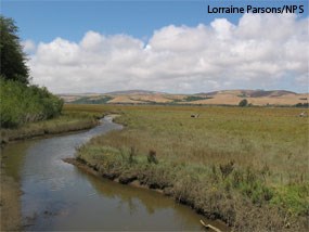
Most of the 600+ acres is expected to revegetate naturally. With levees removed, approximately 310 of the 550 acres of former Giacomini Ranch pastures will be subject to tidal influence under regular or higher high tides. These tides will kill off a considerable amount of the non-native grasses and herbs that dominated the pastures by increasing inundation or the amount of ponded water and salinities in the soils, although some of the species that had established in the Giacomini Ranch were tolerant of inundation and at least brackish salinity conditions. Brackish salinities represent a rather broad range of salinities (0.5 ppt to 29 ppt) between freshwater conditions (0 ppt) and marine salinities (34 ppt). An increase in soil and water salinities increases the likelihood that the species that replace these largely non-native grasses and herbs will be brackish or salt marsh plant species, most of which are native, although there are a few non-native or naturalized ones. The mechanisms of this conversion are discussed further in the Revegetation: Kick Starting Natural Community Development (177 KB PDF) and How Long Will It Take For Wetlands To Develop? (158 KB PDF) posters that were developed for the October 2008 breach event. Because of the proximity to undiked marshes with a healthy, diverse native salt marsh plant community, these areas are expected to rapidly revegetate as tides bring in seeds, root and rhizome fragments, and vegetative materials capable of propagating or establishing a new plant. 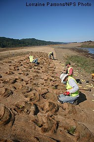
Where active revegetation is often necessary is in higher elevation upland areas. These areas are not exposed to tides and, so, therefore do not have the advantage of salt acting as a natural herbicide and decreasing cover of non-native and invasive plant species. In addition, many of these areas will not be as successful in naturally recruiting native species due to the lack of adjacent seed and propagative material sources or the poor dispersal mechanisms available (i.e., only infrequently flooded by waters potentially carrying seeds). In addition, in some areas, even if seeds are available and native plants germinate, conditions are such that they are unlikely to persist, because of the extreme depth of the groundwater table, competition with non-native or weedy species, and other factors. Active revegetation is also often necessary or advisable in cleared or excavated areas where non-native or invasive species are believed to be capable of rapidly establishing and precluding establishment of native plant species, such as areas where non-native species have been specifically eliminated as part of an invasives removal program. Active revegetation can also act to jumpstart or speed up establishment of native plant communities. This is particularly important if the constructed areas are intended to provide habitat for special status species and even mitigate impacts to existing habitat for these species. At Giacomini Ranch, active revegetation efforts specifically targeted the following habitats or areas: 1) freshwater marsh and pond areas created as habitat for the federally threatened California red-legged frog and adjacent upland perimeters (Tomasini Triangle Marsh and Olema Creek Frog Ponds under Phase I); 2) high tide refugia areas created for the state-threatened California black rail and federally endangered California clapper rail (East Pasture and West Pasture High Tide Refugias under Phase II); 3) riparian habitat along creek banks where higher elevations indicate that propagule deposition might be more infrequent and persistence of germinated seedlings, low due to the distance to the groundwater table (Lagunitas Creek in the southernmost portion of the East Pasture from former riprap area to White House Pool and upper Tomasini Creek and Tomasini Backwater Slough under Phase II); 4) riparian habitat in areas where the creek bank has been totally reworked or graded regardless of elevation (Lagunitas Creek in southernmost portion of the East Pasture in riprap area and floodplain terrace area and Tomasini Creek near realignment; Phase II); 5) higher elevation areas along graded marshplains (Marshplain Enhancement in East Pasture under Phase II); 6) the newly graded Dairy Mesa slopes, because proximity to town increases likelihood of establishment by non-native and even ornamental species and potential for dispersal of native plant species propagules to this area is relatively low (Phase II and later phases); and 7) areas where invasive species removal has been conducted once there have been a sufficient number of subsequent re-treatments to ensure that invasives have been successfully eradicated (Lagunitas Creek in southern portion of East Pasture; Dairy Mesa slope near Tomasini Triangle Marsh; upper Tomasini Creek and Tomasini Backwater Slough; and riparian habitat along Sir Francis Drake Boulevard as part of later phases). Download the Project Revegetation Areas Map (2,338 KB PDF) for more detail on active revegetation areas. These active revegetation efforts focused on five specific vegetation communities: 1) riparian habitat—both lower and upper floodplain terrace; 2) freshwater marsh; 3) salt marsh; 4) upland ecotone; and 5) mesic scrub. Many of the revegetation areas combined vegetation communities. For example, high tide refugia planting plans called for a Salt Marsh vegetation community on the lower slopes of the expanded levee or berm, transitioning into an Upland Ecotone community on the upper slopes and tops, where elevations exceed that even infrequently exposed to tides. The freshwater marsh and ponds focused on plantings of Freshwater Marsh plants in the marsh and ponds themselves, transitioning to Upland Ecotone species along the perimeter or on berms constructed specifically to prevent incursion by high tides such as was constructed at the Tomasini Triangle Marsh. Along Lagunitas Creek, creek banks that were graded often transitioned from a Low Floodplain Terrace Riparian community directly adjacent to the creek around Ordinary or Mean High Water to a High Floodplain Terrace Riparian community at higher elevations, with the uppermost perimeter being planted with Upland Ecotone species. A list of the species planted as part of Phase I and II can be found in Table 1. Photographs of many of the species planted can be found in the Revegetation: Kick Starting Natural Community Development (177 KB PDF) poster. Table 1. Giacomini Wetland Restoration Project Plant ListRiparian
Upland Ecotone
Mesic Scrub
Salt Marsh/Upland Ecotone
Freshwater Marsh/Vernal Meadow
KeyCONT = Container plant 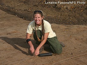
All of the container plant material installed was grown from seeds and vegetative, root, and rhizome materials collected by a local contractor (Carissa Brands and others) either on-site or directly adjacent to the Giacomini Ranch and Olema Marsh. The propagule materials were then delivered to a contractor for propagation. During Phase I and Phase II, Lu Restoration Nursery of Roseville, Calif., helped with propagule collection and directed most of the plant propagation efforts. The Park Service also received some assistance from students at West Marin Elementary School, who collected and grew 90 California buckeye plants, which they helped to plant along Lagunitas Creek in Fall 2008. 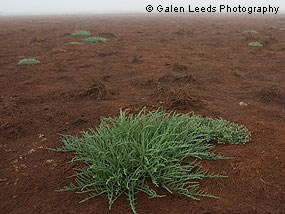
In addition to container plants, some areas were either directly seeded or sown with propagule sources such as branches, rhizomes, or even "sod." Seeds were either collected on-site by Park Service Staff and Ms. Brands or purchased from a reputable contractor that had collected the seed from Marin County or Bodega in Sonoma County. Sowing with propagule sources occurred mainly in the Marshplain Enhancement area and involved dispersal of seed-bearing pickleweed branches that are capable of germinating from the nodes, as well as saltgrass rhizomes and seeds of jaumea, California sea lavender, gumplant, and arrow-grass. 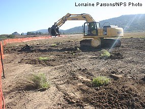
In addition, Hanford ARC worked with the Park Service to either preserve or, if preservation was not possible, to salvage as much of the wildrye and Santa Barbara sedge, as possible. With direction from the Park Service, Hanford later transplanted these sod mats out into the appropriate areas after construction was complete. In Phase I, approximately 14,427 container plants were planted in the fall of 2007 and spring 2008 for a total of 32,808 plants. For Phase I, most of the planting was conducted by members of the Marin Conservation Corps. In Phase II, most of the planting was conducted by Shelterbelt Builders of Berkeley, Calif., a company that specializes in revegetation and invasives removal. 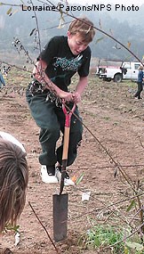
While these organizations were the backbone of plant installation efforts in 2007–2008, many volunteers from the community, general public, and local schools also helped with planting. In 2008, volunteers from the local community, general public, and local schools planted more than 1,500 plants! Local schools that generously donated students’ time included West Marin, Inverness, Tomales, Nicasio, and Pleasant Valley Elementary from Novato. In addition, employees of LSA Consulting (Richmond, Calif.) and WRA (San Rafael, Calif.) also donated their time to come out and help plant. Approximately 10–30 members of the public, including many local residents, joined the Park Service staff to help with planting, as well, during two open community planting dates. 

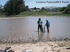
Because of the difficulty with finding freshwater sources for irrigating and installing irrigation and plant protection in flood-prone areas, maintenance of plants once installed will be minimal. Some post-installation irrigation may be conducted if prolonged drought conditions occur, however, in general, plant numbers and planting densities were designed to account for the fact that there would be mortality without irrigation during the first and subsequent summers. In some cases, protective fencing has been placed around plants to minimize browse damage or predation: the large green fencing around freshwater marsh plants in the Tomasini Triangle Marsh was installed specifically to eliminate browsing by Canada geese, which ate extensive numbers of plants installed in the marsh in fall 2008. In one instance, Canada geese ate 400 plants overnight. These fenced exclosures will be taken down once plants reach a large enough size enough size that they will not be as susceptible to predation. In general, the principal maintenance that will occur will be selective weeding of revegetation areas to remove thatch and increase light transmission to installed plants and to decrease competition for water and resources with weeds. summary of construction under phase I and II includes: |
Last updated: October 14, 2022
