Last updated: November 13, 2024
Place
Bailly Homestead, Chellberg Farm, Little Calumet River, Mnoké Prairie Trails
NPS Photo / K. George
Quick Facts
Location:
Porter, IN
Amenities
20 listed
Baby Changing Station, Benches/Seating, Bicycle - Rack, Cellular Signal, Historical/Interpretive Information/Exhibits, Information, Information Kiosk/Bulletin Board, Parking - Auto, Parking - Bus/RV, Picnic Shelter/Pavilion, Picnic Table, Restroom, Restroom - Accessible, Restroom - Seasonal, Scenic View/Photo Spot, Toilet - Flush, Trailhead, Trash/Litter Receptacles, Water - Bottle-Filling Station, Water - Drinking/Potable
Outer Loop Trail
3.4 miles, 120 feet of elevation gain, 1% average grade, 9% maximum grade
Hike time: 2.5 hours
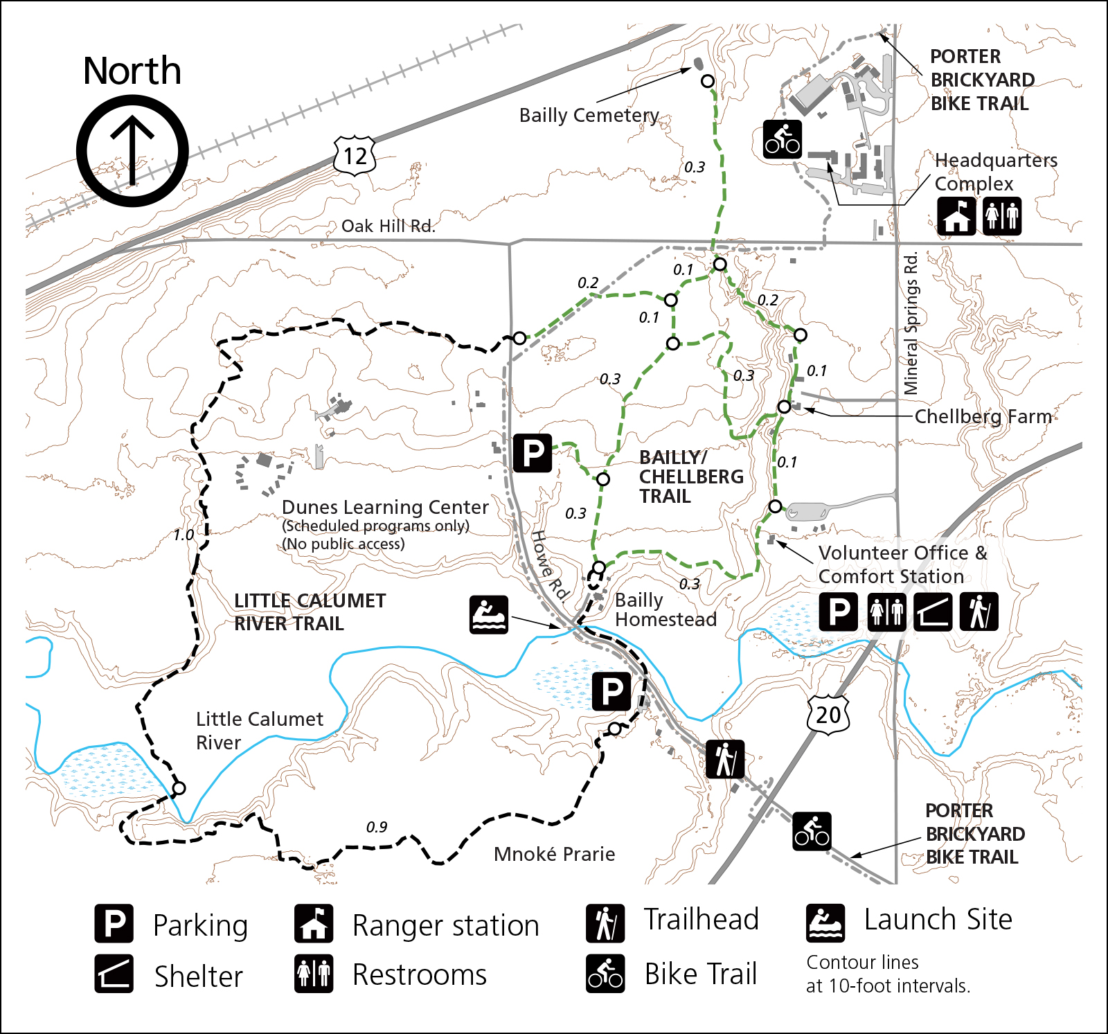
The Little Calumet River, Mnoké Prairie, Bailly Homestead, Chellberg Farm and Bailly Cemetery trail system reveals the rich natural diversity that has drawn people to this area for over 10,000 years. Hike through a forest dominated by maple, beech, basswood and oak trees. Follow a stretch of the Little Calumet River, once a critical transportation route for early regional travelers and explore the enchanting Mnoké Prairie for a glimmer of the vast stretches of pre-settlement grasslands. Explore the historic Bailly Homestead and Chellberg Farm.
This featured hike combines sections from several trails into a perimeter loop hike. Start the hike at the Bailly / Chellberg parking lot and head north on the Bailly Homestead / Chellberg Farm Trail. Just before the Chellberg farm buildings is a trail junction. Proceed straight (north) onto the Little Calumet River / Mnoké Prairie Trail. The Little Calumet Trail will wind through a small scenic ravine that has some sections of stairs. After a third of a mile, stay left at the junction with the Bailly Cemetery Trail. Note that a 0.6 mile round trip out and back extension can be added by hiking up to the Bailly Cemetery and back.
Shortly after the cemetery trail is a junction with a connector trail. Stay to the right. Next up, the trail will join the paved Porter Brickyard Trail. Follow the paved trail to the left until the hiking trail veers right off the paved trail. Take the hiking path. Cross Howe Road and follow the trail through mature forests. At roughly the 1.3 mile mark from the parking lot, stay right at an unmarked trail junction. The trail will make its way down to the Little Calumet River. Just before the river, avoid a closed trail by staying right. After crossing the boardwalk and bridge, the trail will open up into the Mnoké Prairie. After nearly a mile in the prairie, the trail pass by a closed trail on the left and end up in an alternate parking lot. Walk down the entrance road, pick up Howe Road north long enough to cross back over the river and up the driveway of the Bailly Homestead. Lastly, hike north through the homestead and pick up the trail to the northeast back to the parking lot.
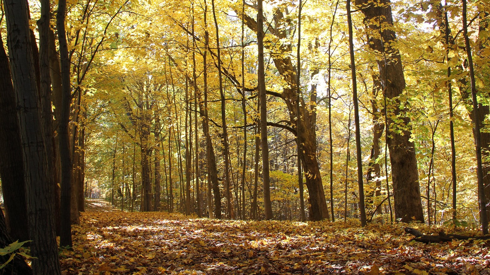
Trail Features: River Crossings, Historic Homes, Birding, Fall Colors, Wildflowers and Wildlife
Must See Gems: Bailly Homestead, Chellberg Farm, Mnoké Prairie, Bailly Cemetery, Bridge over the Little Calumet River
Area History & Background
The Bailly Homestead, declared a National Historic Landmark in 1962, was the home of Honore Gratien Joseph Bailly de Messein (1774 - 1835) who was one of the earliest settlers of northern Indiana. In 1822, Bailly set up his fur trading post at the crossroads of the Little Calumet River and several Indigenous trails. He was an independent trader in the extensive fur-trading network that spread from Montreal to Louisiana. The Bailly Homestead complex is the last remaining site of its nature in the Calumet Region.
In the 1870s, Swedish immigrants Anders and Johanna "Kjellberg" bought 80 acres to establish a modest family farm. They were the first of three generations of the Chellberg family to make their living here. In the 1930s, the Chellbergs started to tap the many maple trees on their property for the production of maple syrup.
The annual Maple Sugar Time event, which takes place the first two weekends in March, features the evolution of "maple sugaring" in northwest Indiana. A relatively short hike will interest people of all ages as they travel through time observing various methods of making maple syrup. Park rangers and volunteers demonstrate a range from an early American Indian method to the pioneer method of boiling sap in open iron kettles to a more modern commercial method of producing syrup. The Indiana Dunes National Park is the only national park that makes maple syrup.
Visitor Activities
- Hike to the Bailly Cemetery
- Explore the Bailly Homestead
- Stroll over to the Chellberg Farm
- Bike the Porter Brickyard Trail
Fun Facts
- Only national park that makes maple syrup
- Homestead of the first non-native Northwest Indiana resident
Getting There
Trailhead Parking Lot
North of U.S. Highway 20 on Mineral Springs Road, Porter, IN 46304
Trailhead GPS Coordinates
41.624679, -87.089502 (Decimal Degrees)
Need to Know
Hours & Information- Hours – Open daily from 6:00 am to 11:00 pm.
- Hike Length – Outer Loop: 3.4 miles, Bailly/Chellberg Inner Loop: 1.1 miles.
- Hike Time – 45 minutes to 2.5 hours.
- Difficulty – Easy to moderate with some changes in elevation and sets of stairs.
- Trail Surface – Packed soil with wood chips in places; several sets of stairs. Trail can be very wet and muddy.
- Facilites – Year-round restrooms and potable water at the parking lot.
- Pets – Permitted on a leash (6' or shorter).
- Prohibited – Littering, hunting, and removing plants.
- Prohibited – Bicycles and motorized vehicles.
- There are 3 covered picnic shelters near the parking lot that are wheelchair accessible. The shelters are reservable at www.recreation.gov starting six months in advance of the desired use date. The reservation is good for day use from 6:00 am to 11:00 pm.
- Cooking fires at the picnic shelters are permitted in the provided grills or an approved carry-in grill. An approved grill is a non-combustible container with an enclosed bottom and enclosed sides with a minimum depth of 2 inches. Charcoal must be cooled and safely disposed of in a non-combustible container or removed from the area.
- Parking lot is paved and large enough for buses.
Safety
- Please stay on the trail and respect closed area signs. Going off trail damages fragile habitat.
- Wear adequate footwear. The trail can be muddy and slippery. The morning dew can also be heavy in the prairie section of the trail.
- Ticks are present year-round. Take precautionary measures to prevent bites.
- Be prepared for changing weather conditions.
- In case of an emergency or to report a crime, call 1-800-PARK-TIP.
Accessibility
-
Trails are not wheelchair accessible. Restrooms and one picnic shelter are wheelchair accessible.
Trail Map
View detailed map of Bailly Homestead, Chellberg Farm, Little Calumet River, and Mnoké Prairie Trail.All hiking trail maps of the Indiana Dunes National Park are available online on our website or in paper at the trailhead kiosk or the Indiana Dunes Visitor Center.
Nearby Hikes
Cowles BogGlenwood Dunes
Tolleston Dunes
-
Pronunciation of Mnoké
Pronunciation of the Potawatomi word Mnoké which means good earth.