Management

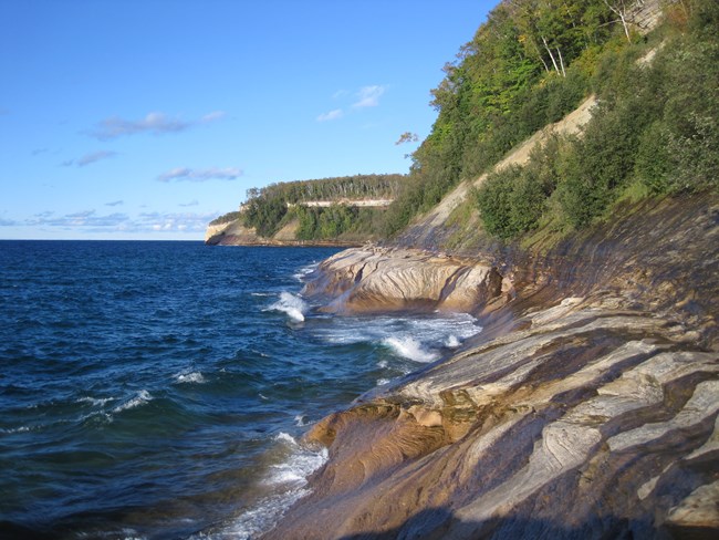
Waves crashing at cliff shoreline
Wild Beauty on the Lake Superior Shore

NPS photo


That, in order to preserve for the benefit, inspiration, education, recreational use, and enjoyment of the public a significant portion of the diminishing shoreline of the United States and its related geographic and scientific features, the Secretary of the Interior is authorized to take appropriate action, as herein provided, to establish in the State of Michigan the Pictured Rocks National Lakeshore.


Pictured Rocks was authorized by Congress as the first national lakeshore on October 15, 1966. The "diminishing shoreline" refers to public access to Great Lakes shores lost to private ownership. Formal establishment of the national lakeshore came on October 6, 1972. The 71,397 acres of the park are divided approximately equally by the enabling legislation into two distinct ownership and management zones. The federally-owned Shoreline Zone was established for the traditional national park reasons of preserving natural and cultural resources and providing for recreation.

The non-federal Inland Buffer Zone (IBZ) was created "to stabilize and protect the existing character and uses of the land, waters, and other properties within such zone." Congress intended that the buffer zone serve to preserve the setting of the Lake Superior shoreline and inland lakes, and protect the watersheds and streams. Sustained yield timber harvesting and other resource management activities compatible with preservation and recreational use were permitted in the IBZ.

Consumptive resource use, however, was intended to be subordinate to public recreation and the protection of "the usefulness and attractiveness of the lakeshore." The IBZ is comprised of national and state forest land, extensive private commercial forest, and small private parcels.

The park boundary extends one-quarter mile out over the surface of Lake Superior along the length of the park. National Park Service authority is limited to the surface waters within this one-quarter mile.
 

MISSION - Pictured Rocks National Lakeshore is dedicated to:

  • Preserving a nationally significant portion of the Great Lakes shoreline.
  • Allowing public access to its geologic, scientific, scenic and historic features.
  • Offering opportunities for recreation, education, inspiration, and enjoyment.
 

The PURPOSE of Pictured Rocks National Lakeshore is to:

  • Preserve a portion of the Great Lakes shoreline for its geographic, scientific, scenic, and historic features.
  • Provide opportunities for public benefit in recreation, education, enjoyment, and inspiration.
  • Protect the character and use of the shoreline zone while allowing economic utilization of the inland buffer zone renewable resources.
 

The Lakeshore’s SIGNIFICANCE:

  • Pictured Rocks National Lakeshore affords public access to a spectacular and diverse segment of the Lake Superior shoreline.
  • Unmatched in their scenic value, the 200-foot high Pictured Rocks cliffs rise perpendicular from Lake Superior creating a mosaic of rock form, color and texture, enhanced by cascading waterfalls.
  • Five square miles of pristine sand dunes and their unique plant communities, perched atop 300-foot sand banks, rise abruptly at the shore of Lake Superior.
  • Twelve miles of unspoiled and undeveloped Lake Superior beach contrast the Pictured Rocks cliffs and Grand Sable Dunes.
  • Bedrock geology and glacial landforms create a tapestry of topography marked by streams, inland lakes and a diversity of associated vegetation.
  • The shoreline offers extraordinary and inspirational scenic vistas of Lake Superior, the largest body of fresh water on earth.
  • Pictured Rocks National Lakeshore offers a variety of affordable year round recreational opportunities for appropriate public use.
  • Within a distinct area, the national lakeshore contains a spectrum of cultural resources focused on the human use of Lake Superior and the shoreline.
  • Lying in a transition zone between boreal and eastern hardwood forest, the lakeshore's scientifically recognized collection of flora and fauna is found nowhere else with the Lake Superior Basin.
  • Pictured Rocks is the only NPS area with a legislated buffer zone.

Last updated: June 16, 2019

Park footer

Contact Info

Mailing Address:

P.O. Box 40
Munising, MI 49862

Phone:

906-387-3700
Munising Falls Visitor Center

Contact Us