
Be Geohazard Aware!Recent research has improved our understanding of Mount Rainier, an active volcano. Active steam vents, periodic earth tremors, and reported historical eruptions provide evidence that Mount Rainier is sleeping, not dead. Seismic monitoring stations around the mountain should provide days or weeks of advance warning of impending eruptions. However, other geologic hazards like debris flows, glacial outburst floods, and rockfall can occur with little warning. Detailed geohazard information is available at park visitor centers and from scientists at the USGS Cascades Volcano Observatory. The more time you spend in an area where there are geologic hazards, the greater the chances that you could be involved in a geohazard event. While the chances of observing a geologic event are relatively low, you must decide if you will assume the personal risk of visiting these potentially dangerous locations. When you arrive in the park, be sure to review posted geologic hazard, evacuation, and escape information. Longmire, Carbon, and the campgrounds at Cougar Rock, Ohanapecosh, and White River are all vulnerable to geologic hazards. Many trails pass through geohazard areas. Remember, ANY glacially-sourced river in the park is at risk of a debris flow. Rising water level, shaking ground and a rumbling noise may signal a debris flow or lahar. If you are near a river and notice:
Then move quickly to higher ground! A location 160 feet (50 m) or more above river level should be safe. Geohazard Warning SirensGeohazard sirens are located at high visitor concentration locations along the Nisqually river including Cougar Rock Campground, Longmire, and Nisqually Entrance. If you hear the siren during your visit, head uphill, away from rivers. 
NPS/Daniel Keebler Geohazards & Trails: Tahoma Creek TrailThe former Tahoma Creek Trail has a long history of hazardous and life-threatening conditions. In the late 1980s, a very large debris flow destroyed several sections of the trail and a large section of the Westside Road, leaving visitors, staff, and vehicles stranded. Since that time the Westside Road has been closed to public vehicle access at Dry Creek and Tahoma Creek Trail was no longer maintained. Tahoma Creek continues to have floods and debris flow events, with around 35 debris flows and glacial outburst floods recorded from 1967 to 2023 (a 2015 debris flow was filmed by visitors hiking the Westside Road). Each event has impacted the road and degraded existing sections of the trail, making it difficult and sometimes impossible to navigate Tahoma Creek Trail. 
NPS/Daniel Keebler Hiking Tahoma Creek Trail is not recommended. Debris flows contain large volumes of water, mud, boulders, trees, and anything else picked up along the way. They almost always occur suddenly and move rapidly downstream. If you are in the debris flow corridor you may have no avenue of escape.
Visit our keyboard shortcuts docs for details
Video of the August 13, 2015 debris flow at Mount Rainier NP. Zachary Jones & Caroline Pedro were walking up Westside Road to the Tahoma Creek Trail when they heard a loud rumbling. Zachary asked Carol what the sound was, she thought it might be a passing train. They kept walking to a clearing where they had a full view of Tahoma Creek. In the distance, they saw huge mounds of tree debris and boulders raging down the creek. Zachary said if we're gonna die, we might we might as well film it! (Both are fine.) 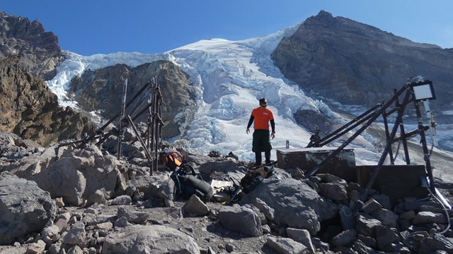
Seismicity
Seismicity is the study of earthquakes. Earthquakes are monitored on Mount Rainier as one way to track volcanic activity. 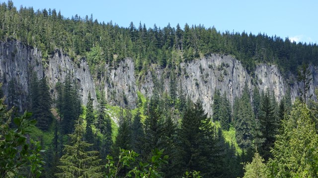
Geologic Formations
Explore Mount Rainier's geologic history through this selection of geologic formations. 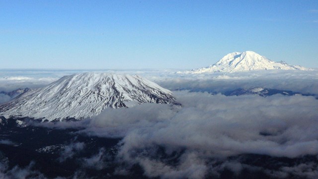
Volcanoes
Mount Rainier is a active volcano. Lava flows and eruptions have shaped the landscape in the past, and evidence can still be seen today. |
Last updated: August 12, 2024