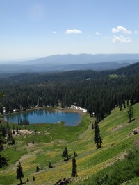
Start: Kings Creek Picnic Area
Trail to Cold Boiling and Crumbaugh LakesThe trail is fairly level to Cold Boiling Lake, and then descends to Crumbaugh Lake. From Crumbaugh Lake the trail passes through several meadows along the base of Mt. Conard. The trail then descends a steep grade to Mill Creek Falls. From Mill Creek Falls, the trail follows a steady incline to the Kohm Yah-mah-nee Visitor Center. The trail provides excellent opportunities to spot birds, wildflowers, and deer. The meadow along the shore of Crumbaugh Lake has a variety of wildflowers and the meadows past Crumbaugh Lake are ideal for wildlife viewing. Cold Boiling Lake is a "dying" hydrothermal area that continues to emit small amounts of gas bubbles at some points near the shore. Cold Boiling Lake to Bumpass Hell BasinFrom Cold Boiling lake, a 1.9 mile one-way trail segment climbs steadily (750 feet) to the eastern end of Bumpass Hell Basin. The entire route from Kings Creek Picnic Area Trailhead to Bumpass Hell Basin is 5.2 miles round-trip. This narrow route passes along a steep hillside and is not recommended for stock animals. | ||||||||||||
Last updated: December 23, 2022
