News Release

|
Subscribe
|
Contact: Megan Richotte, Public Information Officer, (907) 717-8858
Anchorage, AK – On September 16, 2020 Lake Clark National Park and Preserve will release the Environmental Assessment (EA) for the North Johnson Tract Right-of-Way Certificate of Access (RWCA). The EA will be available for review and public comment for 30 days through https://parkplanning.nps.gov/JohnsonRWCA.
A virtual public information session will be held by Lake Clark National Park and Preserve on Thursday, September 24, 2020 at 11:00 am AKDT to provide information on this RWCA and answer questions. There will not be public testimony at this event. All formal comments on the EA should be submitted through https://parkplanning.nps.gov/JohnsonRWCA.
Cook Inlet Region, Inc (CIRI) obtained the 20,942-acre North and South Johnson Tracts as part of the Cook Inlet Land Exchange in 1976, before Lake Clark National Park and Preserve was created under ANILCA. The Johnson Tract, a known mineral prospect, is situated in the headwaters of the Johnson River on the west side of Cook Inlet, 125 miles southwest of Anchorage. CIRI and its mineral exploration lessee, HighGold, requested a RWCA under section 1110(b) of ANILCA. The subsurface rights to the North Johnson Tract are owned by CIRI while the surface rights are managed by the NPS as part of Lake Clark National Park and Preserve. RWCAs are permits issued by the NPS to private land holders to cross NPS lands to access private lands within parks and preserves established by ANILCA. Access to inholdings is guaranteed by law.
The proposed action and preferred alternative described in the EA would issue a RWCA to HighGold to provide access across the park’s North Johnson Tract lands for purposes of subsurface mineral exploration of CIRI-owned subsurface rights. The proposed eight-year seasonal permit would allow helicopter access and exploratory drilling with a maximum season including 150 days of drilling between June 1st and October 31st annually.
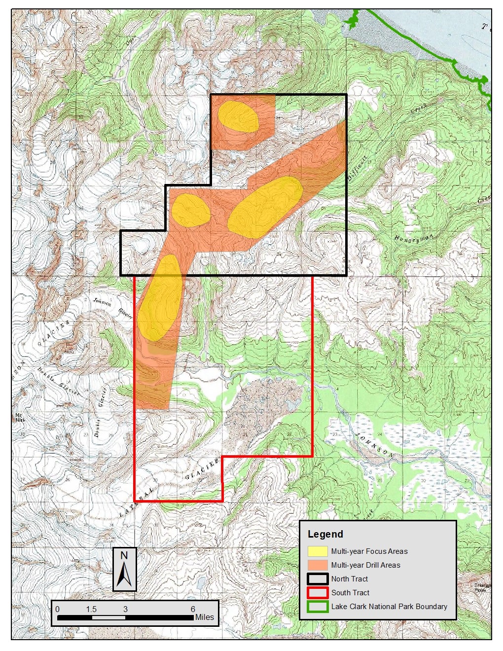
The EA addresses water quality, fish, soils, vegetation and wildlife impacts of the proposed RWCA. The project is expected to develop between 20 and 150 drill pads primarily in four focus areas deemed by HighGold to have the highest potential for minerals (see map). The EA highlights potential environmental impacts such as the use of surface water to lubricate drilling, potential acid generation from mineral exposure to the environment, and noise and dust generation from helicopter use, among other impacts. Proposed permit stipulations included in the proposed action and preferred alternative are intended to address identified environmental concerns.
How to Attend the Public Information Session:
When: Thursday, September 24, 2020 at 11:00 am Alaska Time.
Where: https://bit.ly/35CZbXh. This is a Teams Live event and can be viewed through a web browser or a Teams app. Teams is compatible with the Chrome, Microsoft Edge or Firefox web browsers. Live captioning will be provided.An opportunity will be available to submit written questions.
—NPS—
Last updated: September 16, 2020
