NPS / Brad Sutton Some sources define a desert as an area receiving no more than ten inches of precipitation annually. However, many areas receiving this amount of precipitation are not deserts. This definition is not complete. Both the timing and type of precipitation determine the environment established. In a desert, rain isn’t evenly distributed throughout the year. Weather patterns often create short, violent downpours that produce flash floods. Much of the water runs off before it can soak into the soil. A lot of moisture is also lost to evaporation. Many deserts lie in areas of high pressure systems where there is little cloud cover. At least 90 percent of the sun’s rays reaches Earth’s surface, producing seasonal hot temperatures. (For comparison, the surface of more humid lands, covered with more vegetation, receives only 40 percent of possible solar radiation.) The hot, dry air causes any available water to evaporate quickly. When temperatures are extremely hot, rain can evaporate before it reaches Earth. The conditions producing high daytime temperatures reverse the process after sundown. Approximately 90 percent of the day’s accumulated heat radiates back toward the sky. (In moister climates only about 50 percent of this heat is lost.) These conditions produce the wide range of daily temperatures characteristic of deserts. This range is often 50 degrees or more. The rapid heating and cooling of air create another characteristic of most deserts: strong winds. These winds, circulating air that is often hot and dry, increase the already high rate of evaporation. Evaporation in American deserts ranges from 70 to 160 inches per year. A desert then is not so simply defined. Several characteristics: seasonal, high temperatures; low, sporadic rainfall; a high rate of evaporation; wide temperature ranges; and strong winds are part of the definition. 
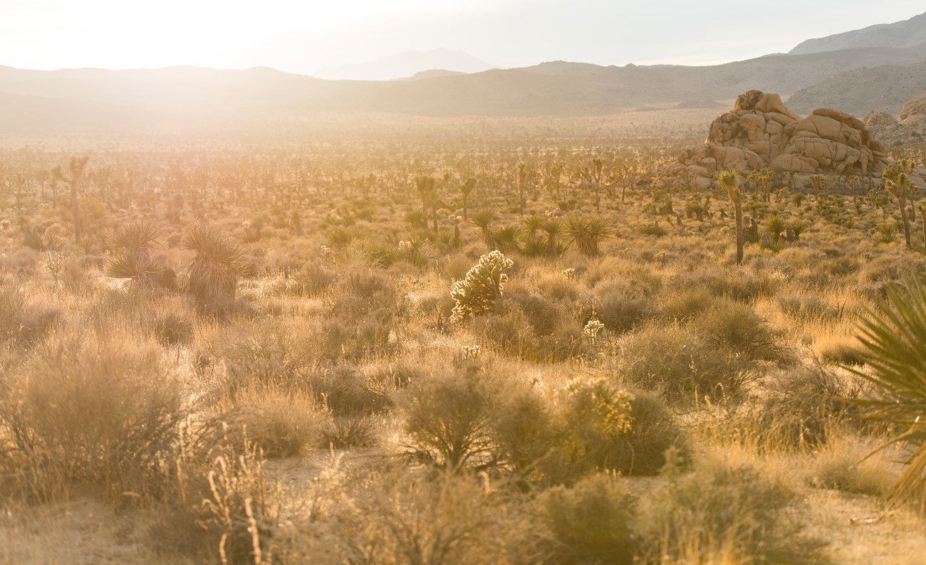
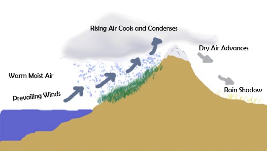
Public domain image Rain Shadow DesertThe area of southeastern California is a rain shadow desert. The rain shadow effect is produced by the high mountains on the west, which block the movement of wet winter storms. As coastal storms move in from the west they collide with Mount San Jacinto (10,804 ft.) and Mount San Gorgonio (11,502 ft.). The air rises, cools, and precipitation falls on the mountains. By the time the air moves over the mountains to the desert, there is little moisture left. Learn more in our Rain Shadow episode of the Granite Desk series.During late August or September occasional tropical storms move into Southern California from the south. These storms end up on the east side of the Peninsular Ranges and can dump a considerable amount of water in a short time. Some five to 10 inches of rain may fall in a few hours, representing a large portion of Joshua Tree’s annual precipitation. Horse LatitudesThe Horse Latitudes lie around 30 degrees in latitude, north and south. To understand why 30 degrees latitude is so dry, we have to start at the equator. Hot, humid air at the equator rises, cools, and loses much of its water vapor to condensation and precipitation. By the time this air moves 30 degrees to the north or south it is dry. Joshua Tree is situated between 33 and 35 degrees north, an ideal latitude for a desert. Mojave DesertSituated between the Great Basin Desert to the north and the Sonoran to the south (mainy between 34 and 38°N latitudes), the Mojave, a rainshadow desert, is defined by a combintation of latitude, elevation, geology, and indicator plants. ElevationsElevations are generally between three and six thousand feet, although Death Valley National Park includes both 11,049-foot Telescope Peak and the lowest point in the United States 282 feet below sea level at Badwater. TemperaturesTemperatures are a function of both latitude and altitude. Although the Mojave Desert has the lowest absolute elevation and the highest maximum temperature (134°F in Death Valley), it is north of the Sonoran Desert and its average elevations are higher. As a result, its average temperatures are lower than those of the Sonoran. GeologyThe Mojave is in what some geographers call the Basin and Range Province, a landscape of alternating mountain ranges and their adjacent basins. Common rock substrates include Precambrian gneisses and granites. Slopes are often composed of metamorphic rocks, such as gneisses. VegetationMojave Desert vegetation is dominated by low, widely spaced shrubs. Vegetation in the desert’s northern half closely resembles that of the Great Basin Desert, as that in the southern half does the Sonoran. However, nearly one quarter of all Mojave Desert plants are endemics. Synonymous with the Mojave Desert is the Joshua tree. Other endemics are Parry saltbush and Mojave sage. A more widely distributed plant, the creosote bush, dominates much of the land surface, often in close association with white bursage. |
Last updated: February 28, 2022
