NPS Photo
Upland vegetation ecosystems are important throughout the West. These woodland, grassland, and shrubland (including sagebrush steppe) habitats offer vital ecosystem services. They help conserve soil, sequester carbon, and cycle nutrients, energy, and water. They also provide a variety of wildlife habitat. Special crust-like soils found in these areas prevent soil erosion and help plants grow by fixing nitrogen. Known as cryptobiotic soil, the crust is a living collection of blue-green algae, lichens, mosses, liverworts, microfungi, and bacteria that is very fragile when dry.
In Bighorn Canyon National Recreation Area (Bighorn Canyon), woodland and sagebrush steppe communities cover approximately 60% of the land area. Plants in these communities provide food and habitat for bighorn sheep (Ovis canadensis canadensis), other ungulates, and wild horses. Sagebrush (Artemisia spp.), in particular, is important nesting habitat for several bird species.
Rangeland health is determined in part by measuring the abundance of key upland plants and soil properties. Given their generally dry climate, rangelands are easily damaged and slow to recover. Disturbances, such as drought, wildfire, livestock grazing, invasive plants, and human-caused damage can alter their composition and ability to create forage for grazers, as well as cycle energy and nutrients. These changes may in turn be exacerbated by climate change. Drought-influenced wildfire proliferates the spread of weeds, such as cheatgrass (Bromus tectorum), that choke out native species. Swaths of cheatgrass also help to fuel wildfires. In addition to promoting weeds, high intensity and frequent wildfire can damage cryptobiotic soil and leave patches of bare ground, increasing soil erosion. Warmer air temperature can cause cryptobiotic soils to grow more slowly, reducing their ability to recover after disturbance. This, in turn, reduces their ability to protect surface soils and nourish surrounding vegetation.
Humans have influenced Bighorn Canyon’s upland vegetation. Some of these changes are particularly concerning to park managers. By monitoring targeted species within these communities, we can determine the status (current condition) and detect trends (change over time) in ecosystem health. This can help inform resource decisions regarding land use, restoration, and weed management.
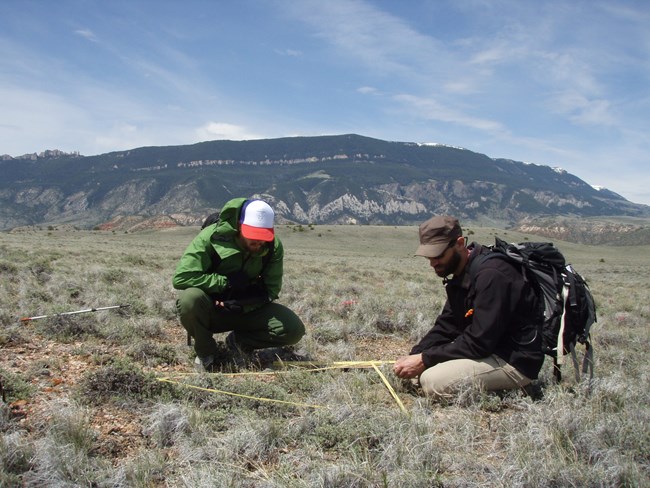
Since 2011, the Greater Yellowstone Network has been monitoring three different upland communities in Bighorn Canyon. We track select plant species in sagebrush, juniper (Juniperus spp.), and juniper-mountain mahogany (Cercocarpus ledifolius) habitats that indicate plant community health. We have also been assisting Grand Teton National Park’s sagebrush habitat monitoring program since 2012 following a similar protocol.
We Ask:
-
What is the current condition of sagebrush, juniper, and juniper–mountain mahogany communities in Bighorn Canyon?
- Are sagebrush, juniper, and juniper–mountain mahogany communities changing in Bighorn Canyon?
We Measure:
-
variety of native plant species and their abundance (percent cover)
-
variety of invasive plant species and their abundance
-
percent of exposed soil, which indicates soil stability
- percent of cryptobiotic soil crust (living soils composed of blue-green algae, lichens, mosses, liverworts, microfungi, and bacteria)
We monitor upland vegetation following this protocol:
Publications
Source: NPS DataStore Collection 9308. To search for additional information, visit the NPS DataStore.
Source: NPS DataStore Collection 4107. To search for additional information, visit the NPS DataStore.
Source: NPS DataStore Collection 9309. To search for additional information, visit the NPS DataStore.
Source: NPS DataStore Collection 9177. To search for additional information, visit the NPS DataStore.
Datasets
Source: NPS DataStore Collection 4059. To search for additional information, visit the NPS DataStore.
Data Visualizers
Explore VegViz.org for graphs, tables, and maps of the abundance of select native and nonnative vegetation in the Columbia Basin and Greater Yellowstone Region.Did you know...
We also monitor climate because of its significant influence across park natural resources.
Last updated: March 21, 2023
