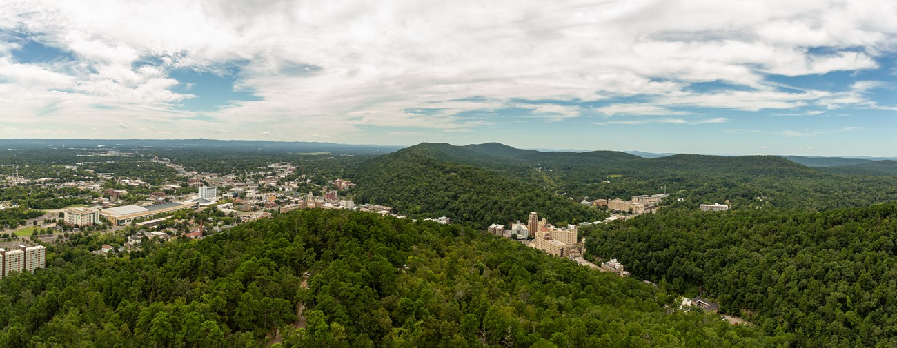
Hot Springs Mountain Lookout Point
NPS Photo/Mitch Smith
Located on this overlook is the historic Hot Springs Mountain Pagoda, designed by architect J.G. Horn in 1911 and dedicated to superintendent Harry H. Myers. Looking out from the pagoda is the city of Hot Springs with the Ouachita Mountains out in the distance.
Hot Springs Mountain Goat Rock Overlook
NPS Photo/Mitch Smith
This overlook is located on top of North Mountain overlooking the Zig Zag Mountains with a view of Indian Mountain to the right, also know as Silver Mountain. Although there is no silver found on the mountain, Indian Mountain is rich in Novaculite which was highly valued by the Native Americans for making tools. Since this stone breaks with a predictable cone-shaped fracture, they could easily carve tools into whatever shape and thickness they desired, commonly carving the rock into arrowheads, blades, drills, and other various tool. All Arkansas Novaculite is found within a 50-mile radius of Hot Springs, drawing Native Americans from all over to this location. Additionally, the Zig Zag Mountains is the area known as the recharge zone for the thermal springs. The thermal water we have today originated as rain water that fell over 4,000 years ago, soaking into these mountains and funneling back up at high speeds and hot temperatures. West Mountain Lower Overlook
NPS Photo/Mitch Smith
From this overlook is a great aerial view of Bathhouse row and downtown Hot Springs. Additionally, Hot Springs Mountain Tower can be seen standing tall on top of Hot Springs Mountin along with the Army-Navy Hospital standing tall below.
West Mountain Picnic Overlook
NPS Photo/Mitch Smith
One of the best places to picnic in Hot Springs, this overlook hangs higher up on West Mountain over looking the city of Hot Springs. In addition to picnic tables is a historic mountain shelter located on the left side of the overlook. Shelter houses like the one found here were built to provide visitors with a place to relax and enjoy the view. This shelter was built in 1924 making it one of the oldest mountain shelters still in use today at Hot Springs National Park.
West Moutain Loop Overlook
NPS Photo/Mitch Smith
At the summit of West Mountain is an overlook south to the Trap Mountains with Lake Hamilton visible far in the distance. You'll also find an outcrop of Arkansas Novaculite at the top which was used by the Caddo Indians for making tools and weapons and later by European settlers for whetstones.
Sugarloaf Mountain Balanced Rock Overlook
NPS Photo/Mitch Smith
Located along the ridge of Sugarloaf Mountain is an outcrop of novaculite, now known as Balanced Rock Overlook. Being part of Sunset Trail, Hot Spring's longest and most remote hiking trail, you can expect to see a variety of wildlife hidden from other parts of the park like wild turkey, white-tailed deer, and vultures.
Hot Springs Mountain Tower Overlook
NPS Photo/Mitch Smith
216 feet above Hot Springs Mountain and 1,256 feet above Sea level is the breathtaking panoramic view of the park and its surrounding countryside. Originally being made of wood in 1877, the tower was rebuilt with steel and an elevator in 1982 with both open and enclosed observation decks.
|
Last updated: September 1, 2020
