
Hurricanes Irma and Maria:
Selected Damage and Ongoing Threats to Cultural Resources
Hurricanes Irma and Maria:
Selected Damage and Ongoing Threats to Cultural Resources
The 2017 Atlantic hurricane season saw a total of 17 named storms, 7 tropical storms and 10 hurricanes. Three of those hurricanes, Harvey, Irma, and Maria, made landfall on the mainland U.S. or U.S. territories. In addition to causing tremendous destruction, the storms highlighted the likelihood that similar storms and damage will occur again. Recovery continues, and preparedness for future storms and sea level rise will take many forms. The Heritage Documentation Programs' work focuses on documenting the physical places—especially those related to architecture, engineering, and cultural landscapes—that illustrate American history. Because of their geographic location, resources in Florida, Puerto Rico, and the U.S. Virgin Islands are especially vulnerable to damage from wind and storm surge. This map includes a selection of damaged or threatened cultural resources in those three places.
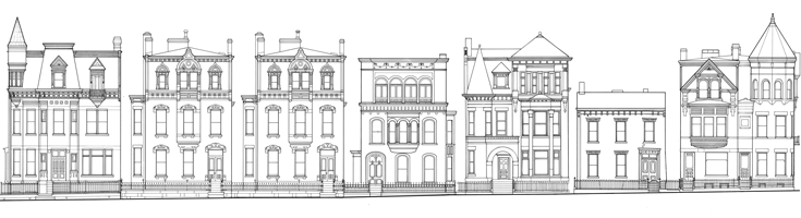
The resources highlighted in this story map were documented by the Historic American Buildings Survey, Historic American Engineering Record, and Historic American Landscapes Survey. Since the establishment of HABS in the 1930s, the programs have been tasked with the responsibility to produce a record of important historic places, ranging from nationally signficant sites to places valued by local communities. Documentation includes historical narratives, measured drawings, and large-format photography. Surveys are archived at the Library of Congress, which makes the documentation accessible online today and preserves it for future generations.
This story map was created by the National Park Service's Cultural Resources GIS Program.
To use this map: Click on the image below to launch the map. Within the sections and captions, you will see highlighted text. Clicking on this text will either take you to another view or link you to an external web page that is either the source of the information or will give you more in-depth additional resources. You can zoom in or out and pan on any of the maps interactively or by clicking on a link. If you wish to get back to the original extent just click on the 'Home' button (the little house). There is a drop-down legend in the upper-right corner of the map. You can open and the legend and scroll down to see the symbology. The legend can then be closed. There are overview sections for both Hurricane Irma and Hurricane Maria and more specific sections for each documented and threatened resource. Under the overview sections there are link to each of the specific sections for each resource. When you are in a section for a specific resource you can return to the overview section by clicking the link at the bottom. To get more in depth information about the resource you can click on the symbol on the maps for links to HABS/HAER/HALS survey information (navigates to the external Library of Congress site).
Explore the map


