|
Grand Canyon itself influences weather. Tremendous changes in elevation cause large differences in temperature and precipitation. The coolest, wettest weather station in the region (North Rim - 8,297 feet/2,529 m) is less than eight miles from the hottest, and one of the driest stations (Phantom Ranch - 2,460 feet/750 m). The coldest temperature recorded was –22 °F on the North Rim on February 1, 1985. The warmest was 120°F at Phantom Ranch on several dates during summer months. The North Rim is also the wettest location, with an average of 25.8” of moisture a year (45.03” in 1978). Lees Ferry is the driest, averaging only 6.1” of yearly precipitation (and only 2.7” in 1955). 
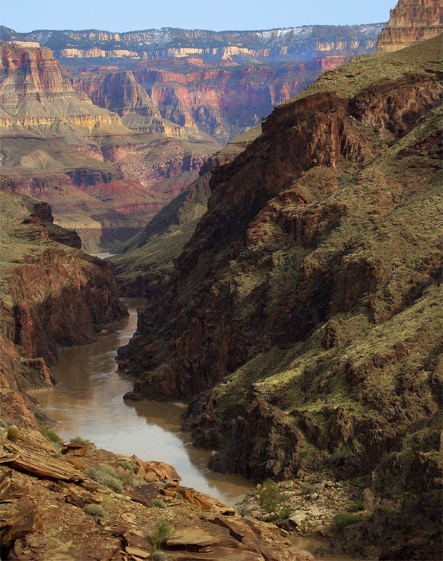
Deep canyons and rough terrain strongly influence solar heating and air circulation. Consequently, many different microclimates are found throughout the canyon.
During the dry early summer, average monthly highs are more than 30 degrees warmer than average lows at all stations except Pearce Ferry. Individual days may show even greater swings. 
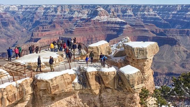
The North Rim receives the heaviest snowfall, averaging 142” per year, with a record snowfall of 272.8” (almost 23 feet) in 1978. The South Rim averages 58” of snow, and Phantom Ranch less than 1”. Moisture for these winter storms generally comes from the North Pacific.
Late spring and early summer are the driest times of the year, with relative humidity often falling below 10% during the day.

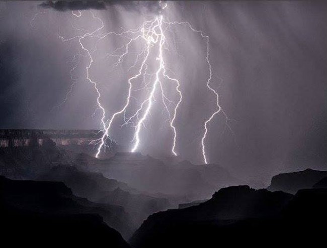
Moisture generally approaches the Grand Canyon region from the south or southeast to produce the late summer “monsoon” season. Days often begin clear, but clouds build by mid-morning. Strong ground-level heating creates updrafts of warm air, which climb tens of thousands of feet producing powerful thunderstorms whenever there is sufficient atmospheric moisture. At times rain falling from these thunderheads evaporates before it can reach the ground, appearing as veil-like virga trailing from the cloud base. 
Other thunderstorms produce localized but intense downpours, triggering flash floods in canyon tributaries. Such floods can arrive in the canyon bottom without warning. The rushing floodwaters may be the first indication of heavy rains at rim level. Average Temperatures on the South Rim (by month)
Average Temperatures in the Inner Canyon (by month)
Average Temperatures on the North Rim (by month)
Average Precipitation in Inches at Grand Canyon (by month)
Grand Canyon Climate Links.
Climate Overview for the Grand Canyon RegionWith an elevation spanning from around 2000 feet to over 8000 feet (760-2440m), the Grand Canyon area experiences a variety of weather conditions. This weather variety includes cold winters and mild pleasant summers, moderate humidity, and considerable diurnal temperature changes at the higher elevations, with hot and drier summers at the bottom of the Grand Canyon along with cool damp winters. Summer thunderstorms and winter snowfall adds to the weather variety in this region. SummerSummer temperatures on the South Rim, at 7000 feet (2135 m), are relatively pleasant with high temperatures generally in the 80s (27-32°C) (with temperatures typically warming to over 100 degrees (>38°C) at the river near Phantom Ranch (2400 feet/762m). North Rim summer high temperatures are typically cooler than the South Rim due to increased elevation (8000 feet/2440 m), with highs typically ranging in the 70s (21-26°C). Overnight lows can still drop near to below freezing occasionally on the North Rim, although typically low temperatures range from the 40s and 50s (4-15°C) at the South Rim to the 60s and 70s (16-26°C) at Phantom Ranch. Summer thunderstorms frequently occur during July, August, and early September with the potential for torrential rains, frequent lightning, and sudden flash floods. These thunderstorms are extremely variable in intensity and location and occur mainly between the hours of 11 a.m. and 6 p.m. Some of these storms can reach severe levels, with large hail, damaging winds, and occasionally even a tornado. FallThe summer heat gives way to a cooler but nonetheless pleasant fall period with average high temperatures gradually falling from the 60s (16-21°C) in September through the 50s (10-15°C) by November along the Rim, and from the 90s (32-37°C) in September to near 70 (21°C) by November along the river. Low temperatures will typically fall below freezing on the Rim, but still remain in the warm 50s and 60s (10-21°C) along the river. The summer rains typically diminish in mid September with a drier fall period the norm with fewer days of precipitation. However, late summer thunderstorms or early winter snow storms have been known to take place during this transition season, making for sudden changes to the weather. WinterWinter conditions on the South Rim can be extreme. Be prepared for snow, icy roads and trails, and possible road closures. Winter weather typically begins by November and becomes well entrenched by December and January, with frequent light to moderate snows and increasingly colder weather. Low temperatures are generally in the teens along the Rim; however afternoon high temperatures still average in the 40s (4-9°C), due to the amount of sunshine the area receives. Along the river, cold air typically becomes trapped in the canyon leading to high temperatures only in the 40s and 50s (4-15°C) and low temperatures in the 30s and 40s (-1C-+9°C). Even with all of the winter sunshine, significant snowfall can be expected during the winter with an average snowfall of 50 to over 100 inches (1.3-2.5m) per year on the Rim, and occasionally snow will make it even to the river. Between storms, when dry high pressure builds in, winds become light, and fresh snow cover is on the ground, minimum temperatures can plummet, especially on the Rim, with sub-zero temperatures likely. Snow continues to be possible at the higher elevations through April. During the winter and early spring months, fog occasionally forms due to radiational cooling from snow cover on the ground. However, this fog usually breaks up quickly by morning. Learn more about winter visits... SpringBy mid-April, winter weather usually begins to break, and although snow is not uncommon in May, warm spells become more frequent. The winter cold gives way to a warming and pleasant spring period with average high temperatures gradually rising from the 50s and 60s (10-21°C) in April through the 70s to 80s (21-32°C) by June along the Rim, and from the 80s (27-32°C) in April to near 105 (41°C) by June along the river. Low temperatures will typically fall below freezing on the Rim in April and May and warm into the 40s (4-9°C) by June, with low temperatures from the 50s (10-15°C) in April to the 70s (21-26°C) by June along the river. Spring is typically breezy to windy with winds occasionally gusting over 40 mph (18 m/s) and dry with little precipitation occurring in May and early June. Due to the very dry airmass typical of the late spring months, late season frosts and freezes are still a possibility, with sub freezing temperatures being recorded as late as July at the North Rim. Snowfall has been reported as late as the middle of June. |
Last updated: February 18, 2025
