News Release

NPS photo
|
Subscribe
|
Contact: Wendy Bredow, 907-697-2230
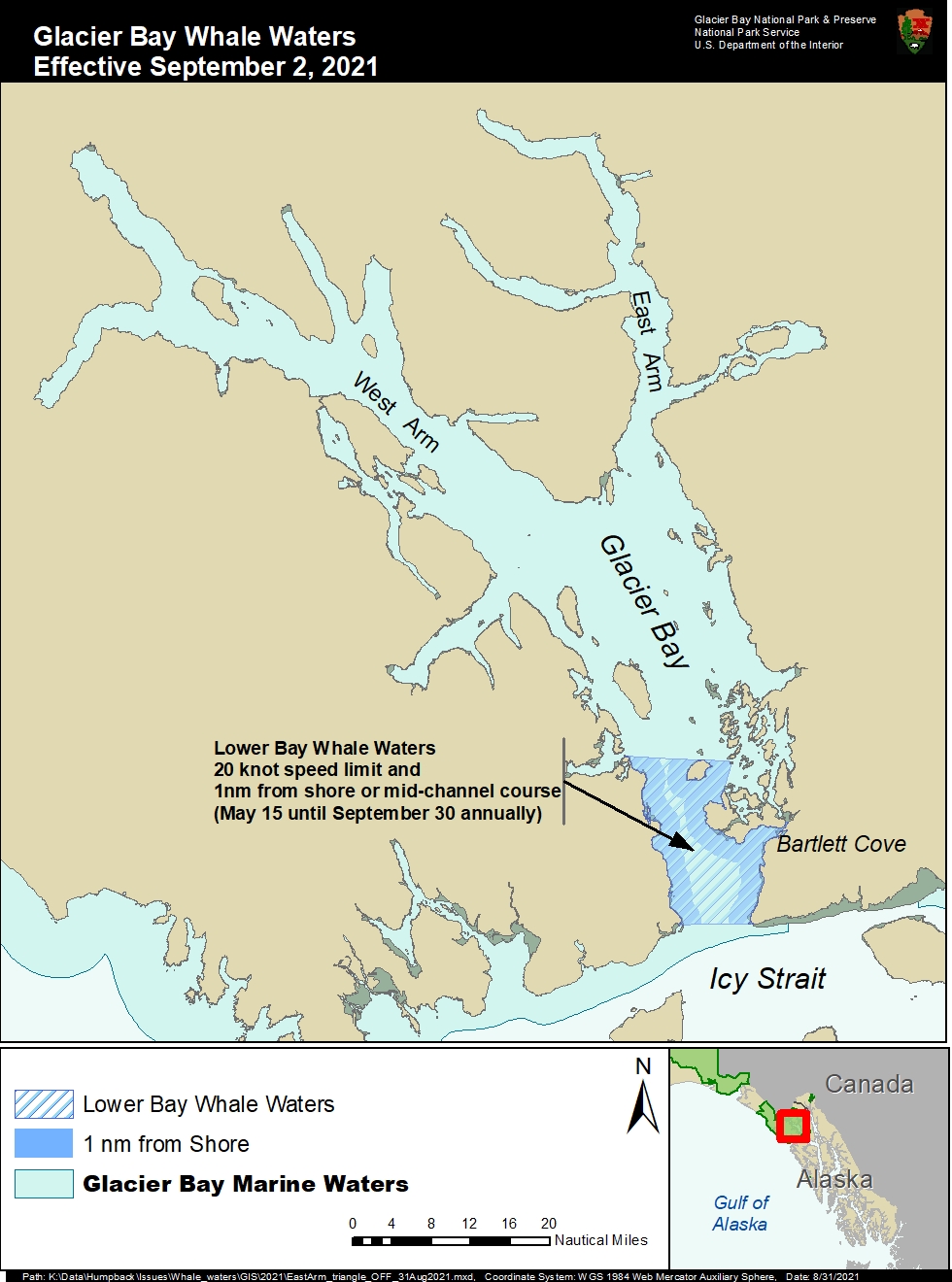
BARTLETT COVE, ALASKA – Today Glacier Bay National Park and Preserve Superintendent Philip Hooge lifted the 13-knot speed limit in the mouth of the East Arm that had been implemented on July 10, 2021, to protect numerous feeding humpback whales. Whale observations over the past week indicate that few whales are now using that area. This change will go into effect at 5:00 am Thursday, September 2. As shown on the map, current whale waters are defined as follows:
Lower Glacier Bay – 20-knot speed limit and mid-channel course restriction (or one nautical mile offshore): All waters between the mouth of Glacier Bay and a line drawn between the northern tip of Strawberry Island and the northern tip of Lars Island will remain in effect through September 30. This boundary is shown on NOAA nautical charts of Glacier Bay.
There are still several whales scattered throughout Glacier Bay. Vessel operators should keep a sharp lookout and reduce speed when necessary. Vessels are prohibited from operating within ¼ nautical mile of a humpback whale in park waters and are required to reduce speed if they find themselves within ¼ nautical mile of a whale. Speed and course restrictions in whale waters are intended to reduce whale disturbance and lower the risk of whale/vessel collisions, as authorized by Title 36 of the Code of Federal Regulations, Subpart N, 13.1174. Mariners are advised to verify whale waters designations prior to entering Glacier Bay by calling (907) 697-2627 or by contacting KWM20 Bartlett Cove on marine VHF radio.
Last updated: September 1, 2021
