



News Release
You are viewing ARCHIVED content
This content was published online before January 20, 2025. Please note that this content is NOT UPDATED, and links may not work. For current information, visit https://www.nps.gov/aboutus/news/index.htm.
News Release Date: June 25, 2019
Contact:
Wendy Bredow, 907-697-2230
Contact:
Chris Gabriele, 907-697-2664
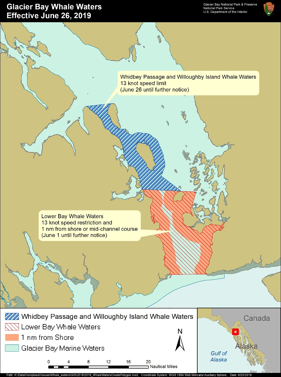
As shown on the attached map, the new whale waters area in Whidbey Passage and surrounding Willoughby Island is defined as follows:
- Willoughby Island: All waters within 1 nautical mile of Willoughby Island.
- Whidbey Passage Northern Boundary: a line from the northern tip of Drake Island to the mouth of Geikie Inlet;
- Whidbey Passage Western Boundary: the western shore of Whidbey Passage, excluding Fingers Bay and Berg Bay;
- Whidbey Passage Southern Boundary: is continguous with the northern boundary of Lower Glacier Bay whale waters;
- WhidbeyPassage Southeastern Boundary: extends from the northern tip of Strawberry Island to the southern tip of Willoughby Island.
Speed and course restrictions in whale waters are intended to reduce the disruption of feeding humpback whales and to lower the risk of whale/vessel collisions, as authorized by Title 36 of the Code of Federal Regulations, Subpart N, 13.1174. Vessels are prohibited from operating within ¼ nautical mile of a humpback whale in Park waters, including those Park waters outside Glacier Bay proper. Vessels positioned within ½ nautical mile of a humpback whale are prohibited from altering their course or speed in a manner that results in decreasing the distance between the whale and the vessel. Boaters should proceed cautiously in all areas where whales may be present because whales may surface in unexpected locations, posing a hazard to both the vessel and the whale. Boaters are advised to verify whale waters designations prior to entering Glacier Bay by telephoning (907) 697-2627 or by contacting KWM20 Bartlett Cove on marine VHF radio.
Last updated: June 25, 2019