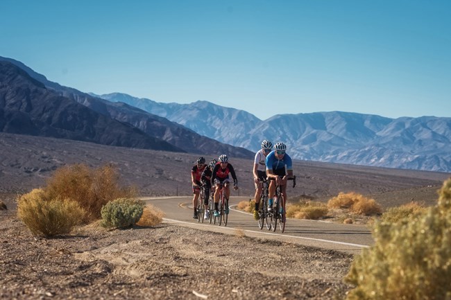
NPS - Kurt Moses Bicycles can be used on all park roads that are open to public vehicular traffic. They can also be used on routes that have been designated for bicycle use in developed areas such as the path between the visitor center and the Harmony Borax Works. They are not allowed on service roads, off roadways, in the wilderness, or on any trails. Riding a bicycle abreast of another bicycle on the park's narrow roads is dangerous and is also prohibited. Death Valley has more than 785 miles of roads including hundreds of miles suitable for Mountain Biking. Suggested RoutesEasy RoadsBicycle PathStart: Furnace Creek Visitor Center Distance: 1 mile to Harmony Borax Works; 1 mile one-way through Mustard Canyon Road type: paved and flat to borax works; gravel through canyon Level of use: moderate Salt Creek Road Start: 13.5 miles west of Furnace Creek on Hwy.190. Distance: 1.2 miles Road type: graded dirt road Level of use: moderate 20-Mule Team Canyon Road Start: 4.5 miles east of Furnace Creek on Hwy.190 Distance: 3 miles, one-way loop Road type: graded dirt road Level of use: medium Moderate RoadsHole-in-the-Wall RoadStart: 6.5 mile east of Furnace Creek on Hwy.190 Distance: 4 miles Road type: loose gravel Level of use: low Skidoo Road Start: 9.5 miles south of Hwy.190 on Emigrant Canyon Road Distance: 7 miles Road type: wash-board gravel Level of use: low Aguereberry Point Road Start: 12 miles south of Hwy.190 on Emigrant Canyon Road. Distance: 6 miles Road type: gravel, some rocky areas Level of use: low Lake Hill Road Start: 3 miles east of Panamint Springs on Hwy.190 Distance: 5 miles Road type: rutted gravel Level of use: low More Difficult RoadsArtist’s DriveStart: 9 miles south of Hwy.190 on Badwater Road Distance: 9 miles, one-way Road type: paved with hills Level of use: high West Side Road Start: 6 miles south of Hwy.190 on Badwater Road Distance: 40 miles Road type: level but wash-board gravel road Level of use: medium Trail Canyon Road Start: West Side Road Distance: 8 miles Road type: rough uphill into canyon with rocky spots Level of use: low Greenwater Valley Road Start: 7.5 miles south of Hwy.190 on Dante’s View Road Distance: 30 miles Road type: slightly uphill gravel road Level of use: low Cottonwood Canyon Road Start: west of Stovepipe Wells Distance: 18 miles Road type: gentle grade, sometimes deep sand at start, rocky in canyon Level of use: low Racetrack Road Start: Ubehebe Crater Road Distance: 27 miles Road type: washboard first 10 miles Level of use: medium Hidden Valley Road Start: Teakettle Junction, on the Racetrack Road Distance: 10 miles Road type: gravel Level of use: low |
Last updated: January 24, 2025
