News Release
You are viewing ARCHIVED content published online before January 20, 2025.
Please note that this content is NOT UPDATED, and links may not work. For current information,
visit https://www.nps.gov/aboutus/news/index.htm.
NPS
|
Subscribe
|
Contact: Jennette Jurado
Contact: Abby Wines
Contact: Nichole Andler
DEATH VALLEY, Calif. – Death Valley National Park is still closed due to major flash flood damage. The park had its rainiest day ever on August 20, receiving more rain than it normally does in an entire year.
National Park Service (NPS) and Caltrans road crews opened an exit lane on CA-190 by late on August 21. This provided an exit route for the 400 residents, employees, and travelers that sheltered in place for about 24 hours.
The National Weather Service rain gauge at Furnace Creek measured 2.2 inches of rain on August 20, 2023. This exceeds the park’s annual average rainfall of 2.15 inches. This set a new single-day rainfall record for Death Valley, breaking the previous record of 1.70 inches set on August 5, 2022. The National Weather Service radar indicates some parts of the park may have received around 5 inches of rain that day. This unprecedented rainfall was due to the remnants of Hurricane Hilary.
Flash floods form when rainfall exceeds the land’s ability to absorb water. Even small amounts of rain can cause dangerous flash floods in Death Valley National Park. In other places, plants stabilize the soil and reduce runoff. In other places, the terrain is less steep.
Park ranger Abby Wines describes flash floods this way: “Picture the mountains in Death Valley as being a steep building roof. Just like a roof, the rocky slopes don’t absorb much water. The canyons function like a rain spout, channeling that runoff. However, in Death Valley that runoff is a fast-moving muddy soup carrying rocks.”
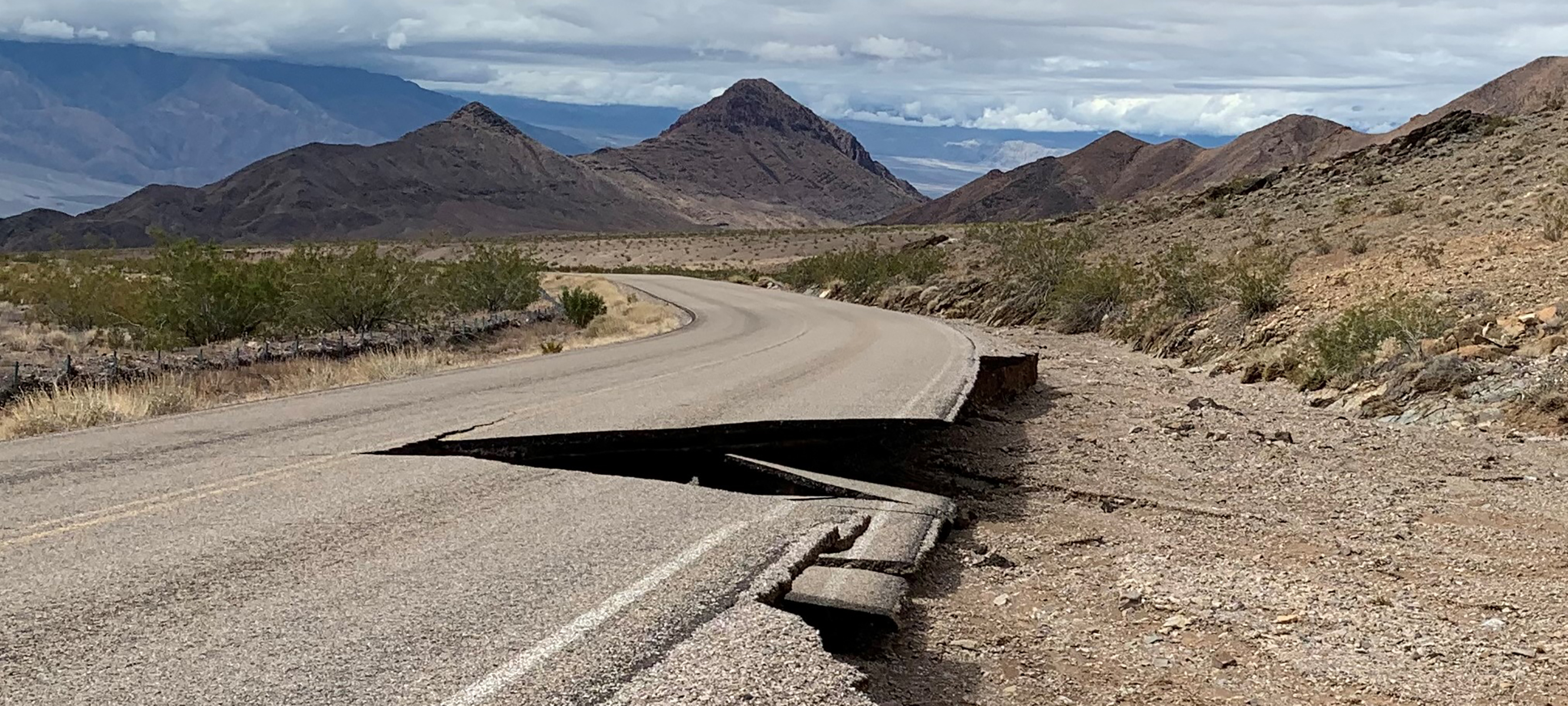
All paved and unpaved roads in Death Valley have been damaged and are closed. Undercutting of pavement and pavement loss make travel conditions unsafe. Additionally four utility systems were compromised by debris that moved during the flash flooding, dislodging water and wastewater pipes and impacting a well. The full extent of the damage across the park will not be known for a period of weeks, as roads make overland travel challenging in order for park crews to identify additional storm damage impacts, however aerial surveys indicated extensive parkwide flooding impacts.
Park officials say the park will likely reopen in stages. It may be weeks before Furnace Creek and Stovepipe Wells open. Secondary roads in the park may take months to open. Utility systems also need to be stabilized prior to reopening.
“Safety is the most important thing coming out of this storm. Making sure crews can work safely and efficiently without interruptions from visitor traffic will help us achieve that” said Superintendent Mike Reynolds. “We ask the public for patience and to honor the closures so we can do the work needed to get Death Valley open as quickly as possible and safe for everyone to visit.”
Death Valley National Park is the homeland of the Timbisha Shoshone and preserves natural resources, cultural resources, exceptional wilderness, scenery, and learning experiences within the nation’s largest conserved desert landscape and some of the most extreme climate and topographic conditions on the planet. Learn more at www.nps.gov/deva.
Video and more images are posted here: Hurricane Hilary in Death Valley National Park

NPS

NPS
August 2023 Flooding
Photos, Videos and News ReleasesLast updated: September 13, 2023