



News Release
You are viewing ARCHIVED content
This content was published online before January 20, 2025. Please note that this content is NOT UPDATED, and links may not work. For current information, visit https://www.nps.gov/aboutus/news/index.htm.
NPS Photo
News Release Date: June 18, 2020
Contact:
G.W. Hitchcock, (907) 683-9583
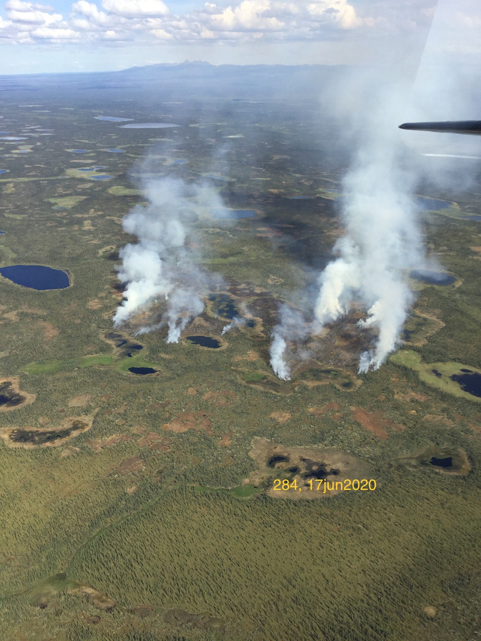
NPS and BLM AFS fire personnel will monitor the fire and allow it to continue burning to achieve land management objectives. Fire teams will enact Point/Zone Protection tactics for nearby structures. The closest NPS structure to the fire that is designated for protection is 8.9 miles to the west. The closest private structure is 3.5 miles to the east of the fire; NPS fire crews staged structure-protection resources at this site earlier today.
The fire is located within a Fire Management Option Area designated for Limited Protection. Wildfires occurring within the Limited Management Option will be allowed to burn within predetermined areas. Periodic surveillance will be conducted to evaluate the need for action to protect human life or site-specific values. By allowing fire to spread naturally, a natural mosaic of fire footprint and intensity can be maintained. This option reduces both long-term risks and costs while sustaining a natural range of variation in plant composition and structure. (Alaska Interagency Wildland Fire Management Plan, p. 24)
This is the same general area where the first fire of Denali's 2020 wildfire season, the Bearpaw River Fire (#145), was found on June 1. This fire was monitored by the NPS and declared out on June 10.
The satellite that found the heat detection is part of the National Oceanic and Atmospheric Association’s (NOAA) Visible Infrared Imaging Radiometer Suite (VIIRS). VIIRS is one of the key instruments onboard the Suomi National Polar-Orbiting Partnership (Suomi NPP) spacecraft, which was successfully launched on October 28, 2011. The VIIRS empowers operational environmental monitoring and numerical weather forecasting by providing sensor readings for more than twenty environmental data records; including clouds, sea surface temperature, ocean color, polar wind, vegetation fraction, aerosol, fire, snow and ice, vegetation, and other applications.
Fire in Alaska’s boreal forest is an essential process that restores ecosystem health and helps maintain species diversity. The NPS works closely with its interagency partners, neighboring communities, and other stakeholders to balance the risks and benefits of wildland fire when making decisions on fire management. Landowners can assist in these efforts, and decrease the potential risk to their property, by taking steps to make cabins and other structures more defensible against wildfire. The public can find more information about defensible space and being ready for wildfire by visiting the Alaska FireWise website or reading this Alaska Firewise pamphlet
For the most up-to-date information about wildfires in Alaska, the public is encouraged to visit the Alaska Wildland Fire Information Map
Tags:
wildland fire
Last updated: June 18, 2020