
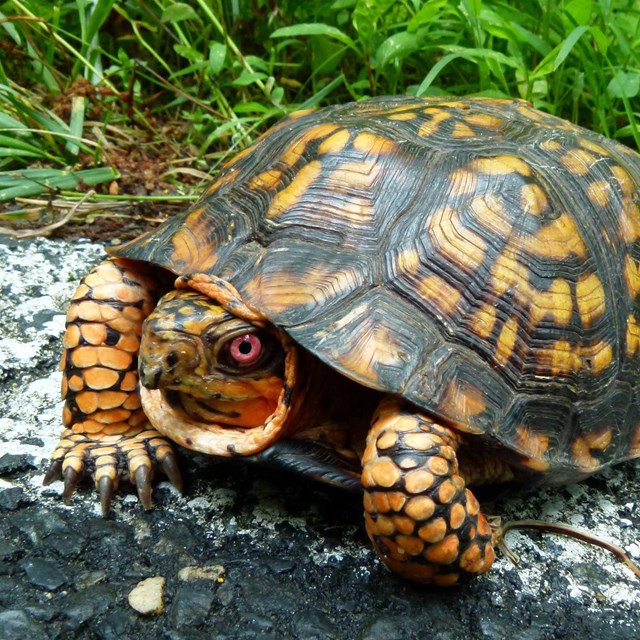
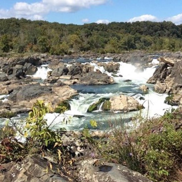
NPS Photo C&O Canal Natural ResourcesAlthough the Chesapeake and Ohio Canal never achieved its goal of linking Chesapeake Bay with the Ohio River, it provides for us today a window into the North American continent's geologic past and a pathway through the rich natural system of the "Nation's River." The Chesapeake and Ohio Canal National Historical Park includes 19,236 acres paralleling the Potomac River from the densely urbanized Washington, DC, upriver for 184.5 miles through pastoral farm country and forest to Cumberland, MD. Many of the park's three million annual visitors come here to enjoy the outdoors, access the river, hike and bike, jog, ride horses, and observe wildlife. The C&O Canal begins in the Atlantic Coastal Plain and crosses through portions of the Piedmont, Blue Ridge, and Valley and Ridge physiographic provinces. This diverse landscape, with the influences of the Potomac River, results in the rich geological, ecological, and biological diversity found within the Park's boundaries. Over 1,500 different species of plants, including a significant number of state and nationally rare plant species, take refuge in the many habitats that the C&O Canal provides. Interesting geologic formations exist in the park such as Great Falls and limestone caves. 
NPS Photo
Researching Nature at C&O CanalC&O Canal is a natural oasis for visitors and for scientific researchers because of its protected natural landscape. The research done here provides the accurate and current natural resource information we need to provide to best care for the park. Scientists look at what key resources are present in the park, if they are stable or changing, how ecosystems are changing over time, and how much change is normal. Like a physician monitoring a patient's heartbeat and blood pressure, National Park Service ecologists with the National Capital Region Inventory & Monitoring Network collect long-term data on forest vegetation, bird and amphibian communities, water quality, and other key resources at C&O Canal, analyze the monitoring results, and share them with the park. |

Last updated: September 5, 2025