|
Chickasaw National Recreation Area is an ecotone, or meeting place, where two different ecosystems overlap - the eastern deciduous forest and the mixed-grass prairie. Hikers, birdwatchers, and wildflower enthusiasts enjoy the variety this diverse ecosystem has to offer. Trail descriptions will help you choose your route. The trails vary in length, difficulty, and scenery. Sturdy tennis shoes are satisfactory on most trails. 
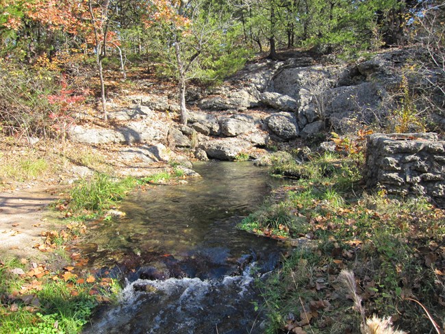
NPS Photo Springs TrailsFrom the Travertine Nature Center, the Antelope Spring Trail forms the basis of the trails to the east. Additional loops stem from this trail.
Travertine Creek TrailThe Travertine Creek Trail connects the Travertine Nature Center and Pavilion Springs. Parking is available on both ends. This trail is a mostly level gravel trail with some bridges, long gentle slopes, and a set of stone stairs near Pavilion Springs. Width and surface type varies and the trail is not wheelchair friendly. Strollers with larger wheels will be able to travel on the trail surface, but wider models will not have sufficient space in places. Pets are allowed on this trail, provided they are on a leash no more than 6 feet long or are fastened into a carrier or stroller. Veterans TrailThe Veterans Trail connects Pavilion Springs to the Oklahoma Veterans Center just outside of the park boundaries. Parking is available at Pavilion Springs. This trail is a wide, mostly level gravel trail. Most wheelchair tires are too narrow to travel well on the gravel, but most mobility scooters can cover the length of the trail. Strollers with good tires will also be able to travel the entire trail. Pets are allowed on this trail, provided they are on a leash no more than 6 feet long or are fastened into a carrier or stroller. 
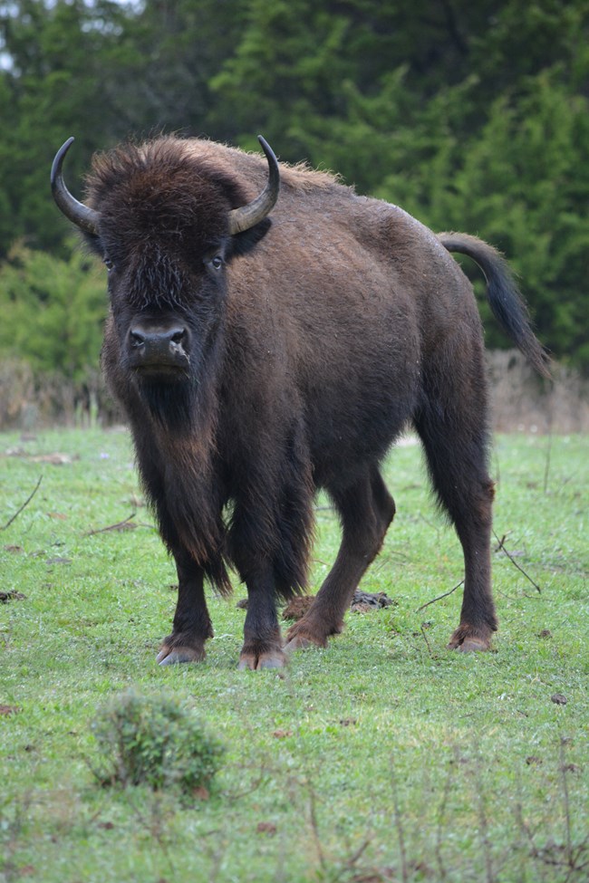
NPS Photo West Bison Pasture LoopThe West Bison Pasture Loop Trail travels around the West Bison Pasture. The trail can be accessed from the Lincoln Bridge, Pavilion Springs, Hillside Springs, Bison Overlook, and Bromide Pavilion parking lots, or via the trail system from Pavilion Springs, Flower Park, Bromide Hill, or Rock Creek Campground. The gravel trail varies in width, with some elevation gain (or loss depending on direction travelled) near the junction to the Bromide Hill spur trail. Trail width and surface are not wheelchair or scooter friendly due to a number of stairs, narrow spots, and short but steep grades. Some strollers can be used, but they will need good tires, be on the narrow side, and will have to be picked up and carried in places. Pets are allowed on this trail, provided they are on a leash no more than 6 feet long or are fastened into a carrier or stroller. Spur to Bromide Hill: add 0.5 mile (one way, fairly steep switchbacks, trail narrows) Flower Park TrailsA small network of gravel paths connect Vendome Well and Lincoln Bridge. Parking is available on both ends. Most wheelchair tires are too narrow to travel well on the gravel, but most mobility scooters do well. Strollers with good tires should also be able to travel the trails. Pets are allowed on these trails, provided they are on a leash no more than 6 feet long or are fastened into a carrier or stroller. Veterans Lake TrailThe Veterans Lake Trail is a wide concrete path that loops around Veterans Lake. There are two parking areas available, one near the dam and at the eastern end of the lake. While some visitors who use wheelchairs are able to complete this trail, it does not fully meet accessibilty standards due to long grades. Some moderate to steep inclines are scattered along trail. Those using mobility scooters should check their battery levels before starting the trail due to length and inclines. Surface is stroller friendly. Pets are allowed on this trail, provided they are on a leash no more than 6 feet long or are fastened into a carrier or stroller. Inkana TrailThe Inkana Trail is a wide paved path that connects the Veterans Lake to the Chickasaw Cultural Center. Some wheelchair users may be able to navigate the trail, but it does not fully meet accessibility standards due to long grades. Most mobility scooters should be able to travel the length of the trail. Parking is available at the Chickasaw Cultural Center (check website for days and hours) and at the park 24 hours a day. NPS parking areas are at the end of Cat's Eye Road near Inkana Bridge (gravel) and at Veterans Lake Dam (paved). Pets are allowed on this trail, provided they are on a leash no more than 6 feet long or are fastened into a carrier or stroller. Rock Creek Multi-Use TrailsThe Rock Creek Multi-Use Trails are the only trails the visitors may ride horses on. These rustic trails travel mostly through prairie areas, and the trails can be a bit difficult to see in the spring as new grass grows. These trails also pass through one of the park's hunting areas. If hiking in hunting season, be sure to wear brightly colored clothing. Trails can be accessed via the northern trailhead off of Cat's Eye Road, near Veterans Lake, or via the southern trailhead off of Cedar Blue Road, near Buckhorn Campground. These trails are not accessible and are not navigible with strollers. Pets are allowed on these trails, provided they are on a leash no more than 6 feet long or are fastened into a carrier. End-to-end trails:Trail 1: 4.3 mile (one way) Loop trails:North Trailhead Short Loop (Trail 1 to 2 to 3): 2.2 mile loop Lakeside Trails at The PointBoth the Lakeview Trail and the Fishing Rock Trail leave from Cooper Memorial Road, just north of the picnic area at the end of the road. Parking is available along the road and at the picnic area. Both trails are dirt paths with some up and down. Trails are not wheelchair accessible, and most mobility scooters will not be able to navigate the trails due to uneven surfaces. Some strollers with sturdy wheels and suspensions may be able to make both trails. The Fishing Rock Trail is closest to the lakeshore and is often partially underwater in spring, but may still able to be followed by those willing to wade. Pets are allowed on these trails, provided they are on a leash no more than 6 feet long or are fastened into a carrier. |
Last updated: December 19, 2023
