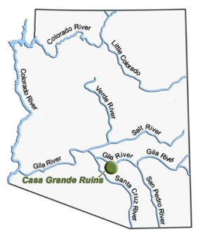
Look at a map of Arizona rivers. All the rivers in southern Arizona eventually drain into the Gila River. The Hohokam constructed canals that brought water from the rivers to their fields. We use the same technique today to water our crops. In the late 1920’s the Gila River was dammed, forming the San Carlos Reservoir. The Coolidge Dam allowed extra water to be stored for use by farmers and towns. Later, a diversion dam was put in a few miles upriver of Florence, Arizona. This dam moved all the river water out of the riverbed and into a series of canals, making the riverbed downstream of the dam completely dry. Eventually the river returns to its bed, after some of the water has been used for irrigation. |
Last updated: February 24, 2015
