|
The local water table 
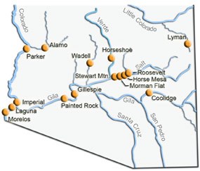
When the dams were built and the river stopped flowing, an interesting side effect occurred at Casa Grande Ruins National Monument. The mesquite trees died. Mesquite trees can have roots over 75 feet deep, but because the damming of the river occurred so rapidly, the trees couldn’t grow their roots fast enough to reach water. If the lack of water didn’t kill them outright, it made them susceptible to diseases and bugs. At the beginning of the 20th century, the water table was only about 15-20 feet below the level of the ground. That means if a person dug a 20 foot hole, there would be water in the bottom. Now in the 21st century in the Phoenix and Tucson areas of Arizona, the level of the ground water is much deeper. In some places over 700 hundred feet! |
Last updated: February 24, 2015

